Adventure, Asia, National Parks
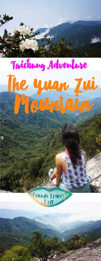
Things to do in Taichung- An adventure up the Yuan Zui Mountain

Aug
Taichung is situated in the middle of Taiwan island; with mountains just to the east of the city, one of the top things to do in Taichung is hiking. Now hiking in Taiwan is a lot of fun: Taiwan’s position on the plate boundary gives rise to beautiful mountainous landscape that makes it a hot spot for hiking.
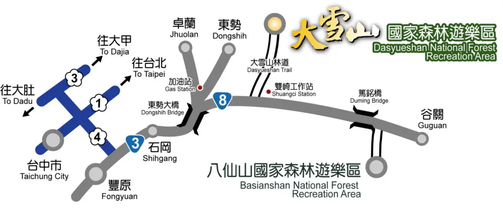
Situated within Dasyueshan National Forest Recreational Area (aka Big Snow Mountain), the hike to Yuan Zui Mountain is known as Yuanzuei Mountain trail, and only an hour and a half drive one way from Taichung city. Now if you like Angel’s Landing (my favourite hike at Zion Canyon), you will love this one: it is certainly one of the most thrilling hike I had done.
The best way to go up is by car– you can either rent a car to drive up or try to liaise with your hotel or hostel to get a ride up. I was doing help exchange at one of the hostels nearby and they arranged for someone to drop us off at the start point, and we hitchhike our way back (more information at the end). There are buses up but the timetable is inconvenient with only 3 buses per day, with not enough time in between for hiking at all
Before you go
Makes sure you have:
- Insects repellent
- Pair of gloves (not the keeping warm one but
- Long trousers (I wore shorts and it was a big mistakes)
- Cap/ sunhat and sunscreen (for sunny days)
- Plenty of water and a pack lunch
- Raincoat/ waterproof jacket (if weather forecast is unfavorable)
- Good hiking boots with grips (Trainers doesn’t count- it’s doable but much more slippery)
The hike should take around 4-6 hours, depending on your level of fitness and whether you are scared of height or not.
This hike is very popular with the locals, and there will be people on the trail every day of the week. I went during Wednesday and there was around 50 people along the trail. From the other hikers I learned that during weekends, the trail will be packed to the brim and there will be human traffic. If you want to do the trail, weekdays are your best bet
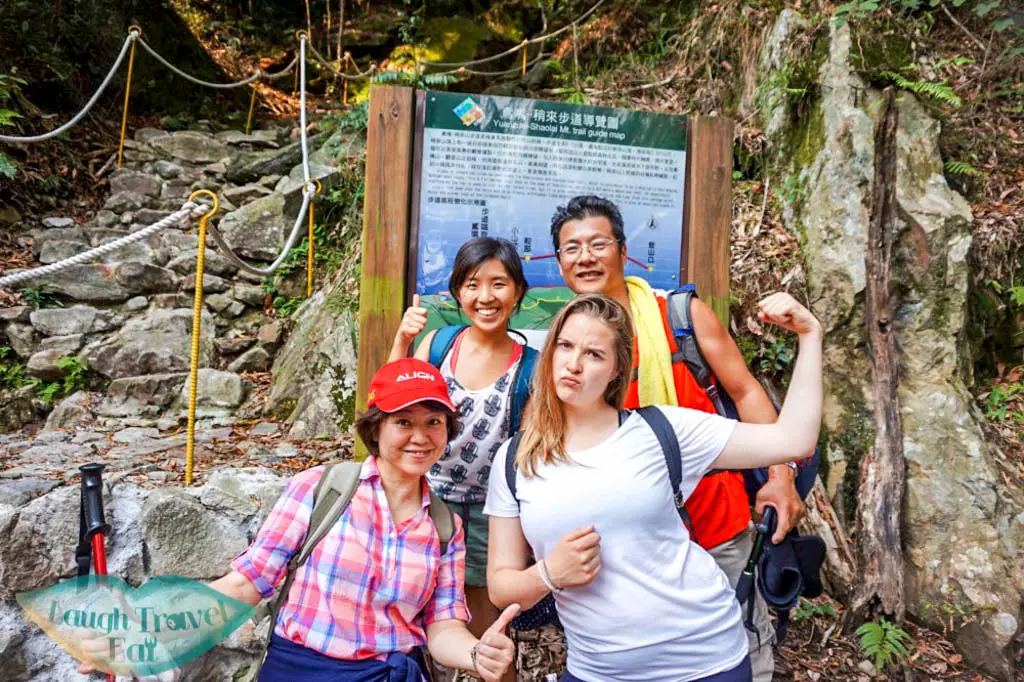
Start point
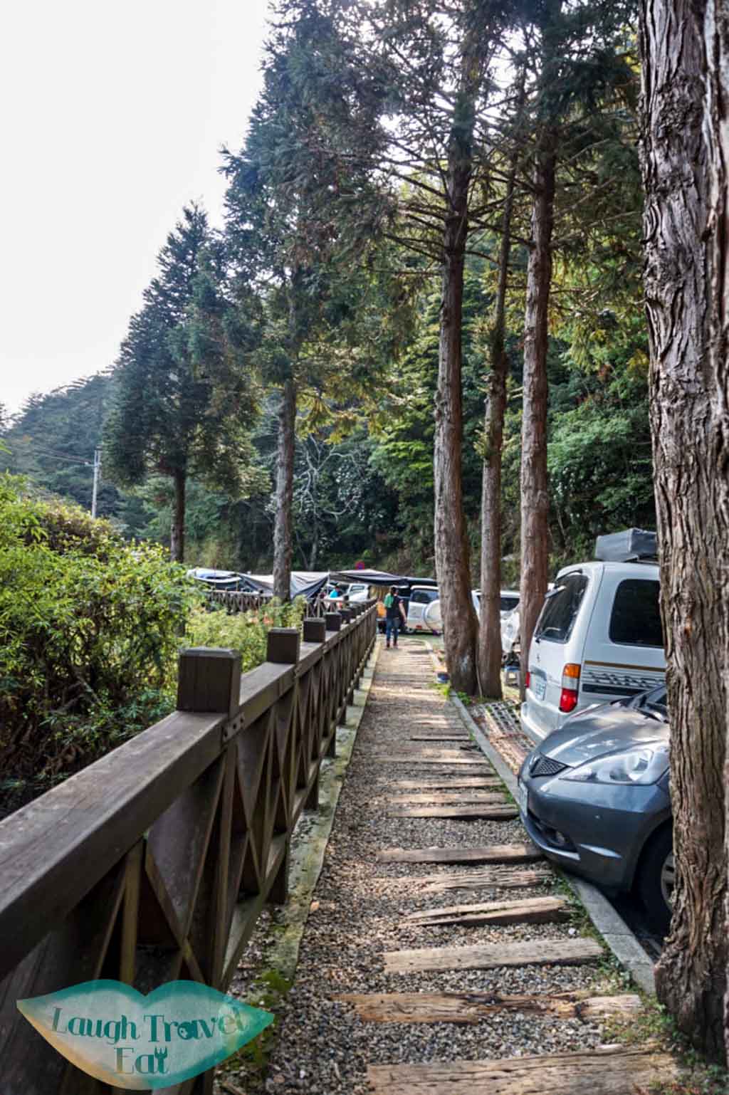
 Set your GPS to Dasyueshan Trail and drive to the 27k point. There should be parking before the sign (should be easy to see!). If there’s no space there, drive up further and find a safe spot along the road side to park (I have seen people done that and it’s fine!). There’s also a toilet facility as well.
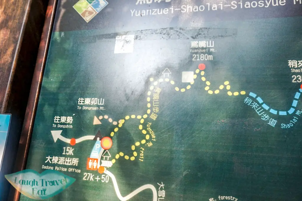
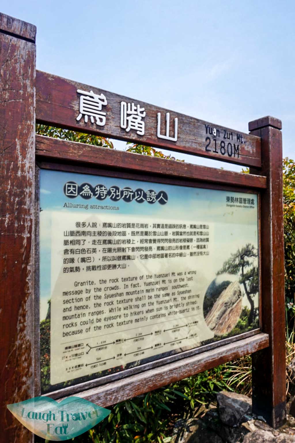
The route we are taking is from the toilet red dot up the yellow trail to the top of Yuan Zui Mountain (or Yuanzuei- there seems to be two spellings on the internet) at 2180m and down again before coming back down to Dasyueshan Trail at around 27.5K; this is just 500m walk back to the car park, a nice loop up the mountain and back!
 Heading uphill- Part 1
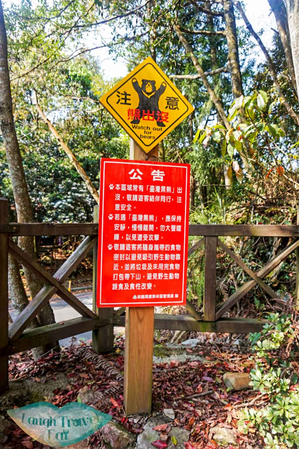
Now don’t be scared (or get excited) by the sign: whilst there are wild bears in this part of Taiwan, they live deeper and higher up in the mountains, well away from this popular trail frequent by human!
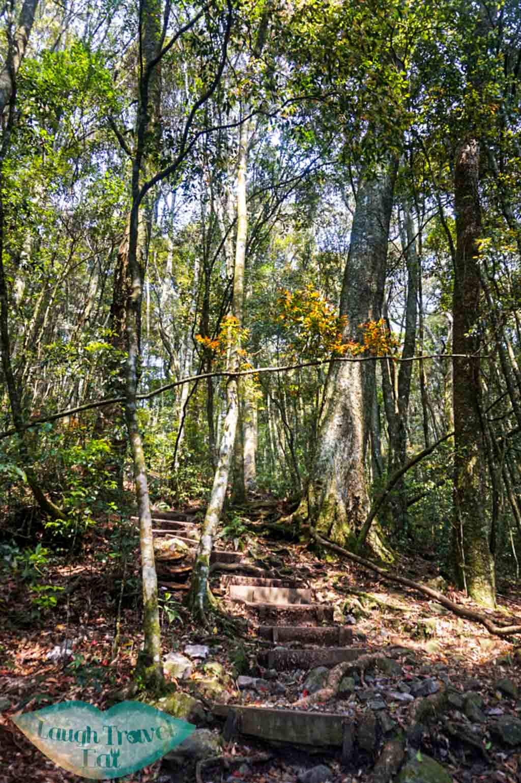
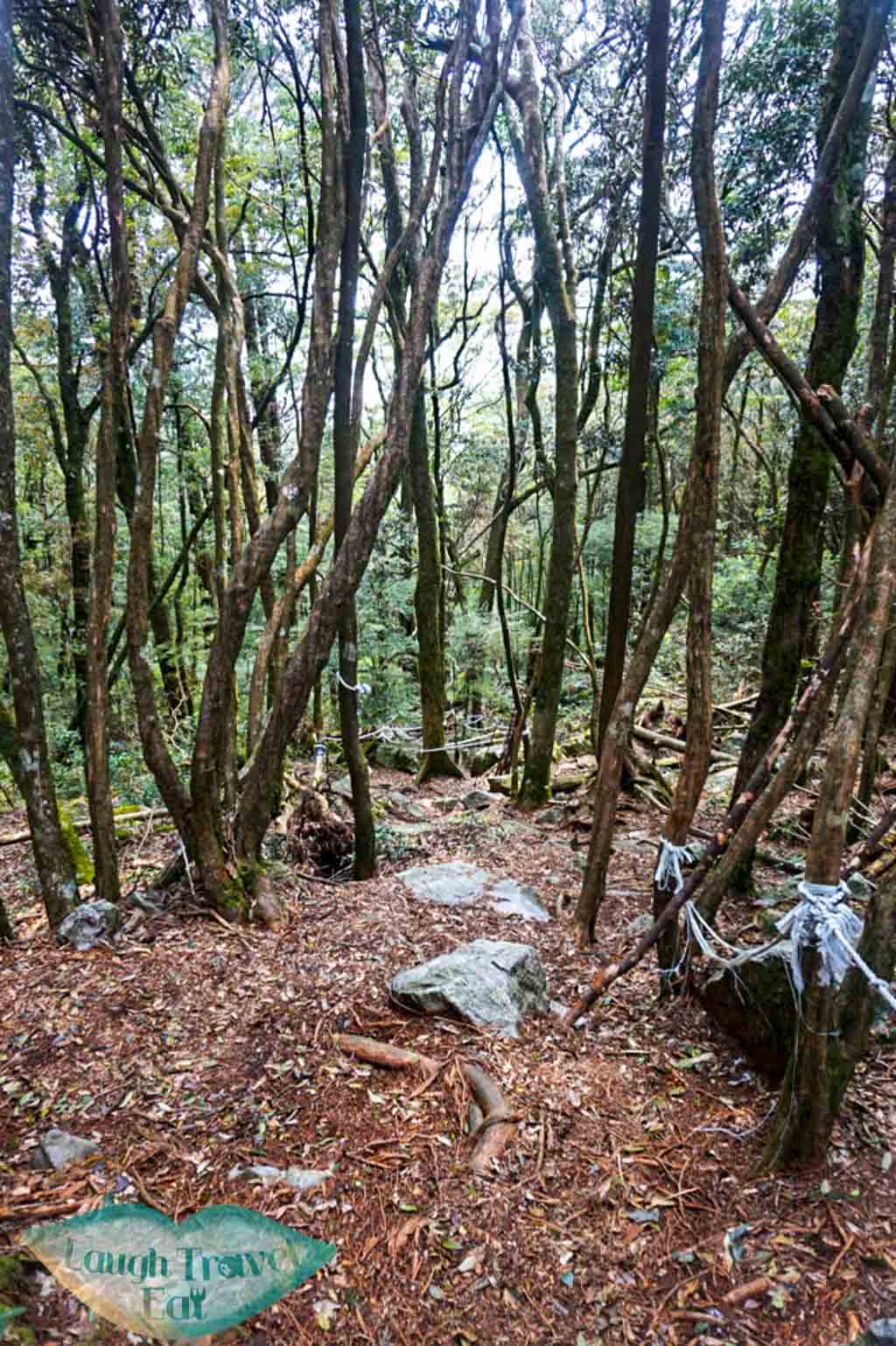
This first part of the route mostly consists of stairs going up and it can be quite tiring. The good thing is that the trail runs in between the forests, so it’s cool and nicely shaded.
There’s little marker post along the trail so you won’t get lost!
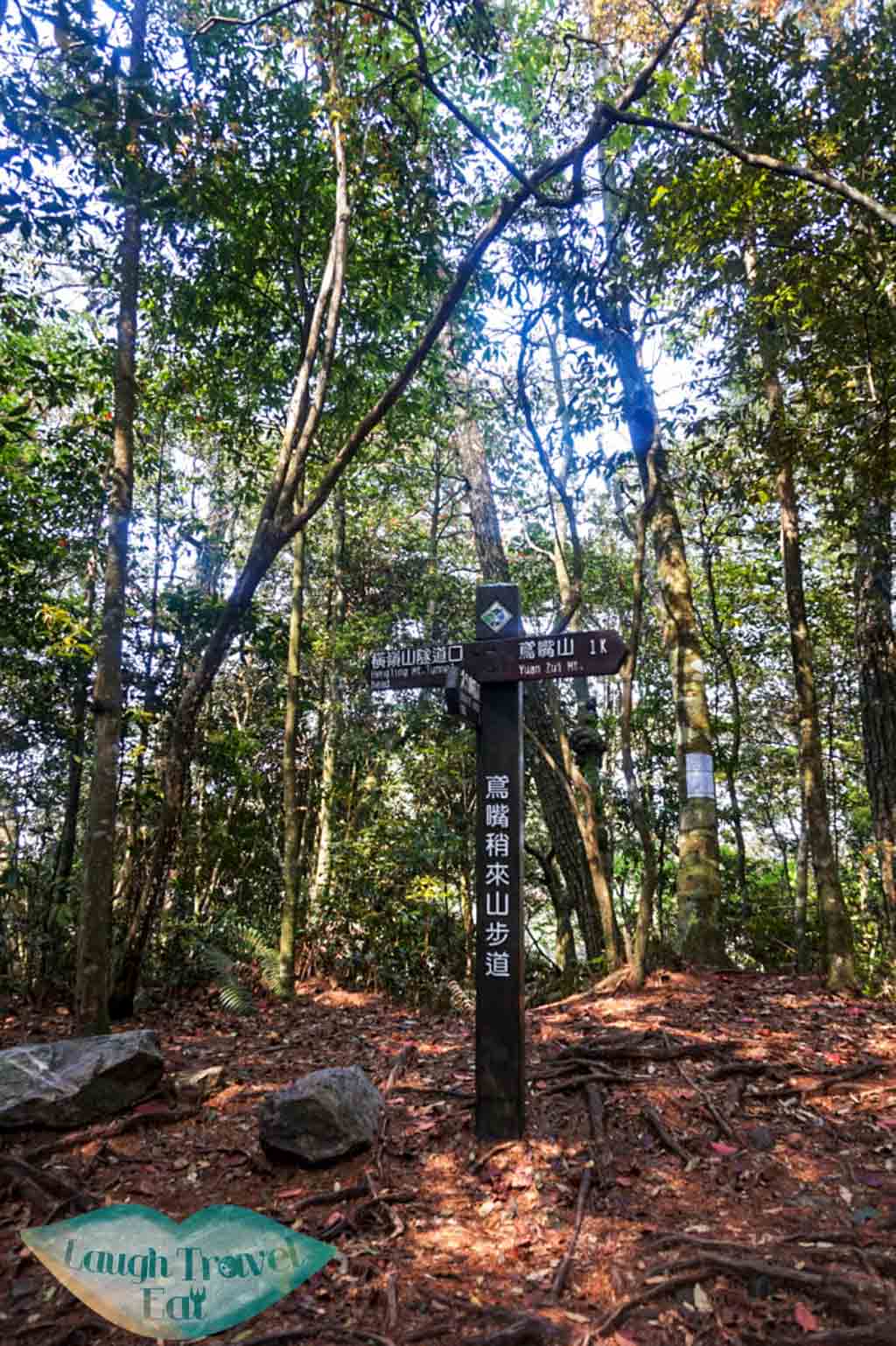
The trail will merge with another one coming up from beside the tunnel at around 25k (that one is even more strenuous so NOT recommended). Follow the sign to the right towards Yuan zui Mountain (1km to go!).

Heading uphill- Part 2
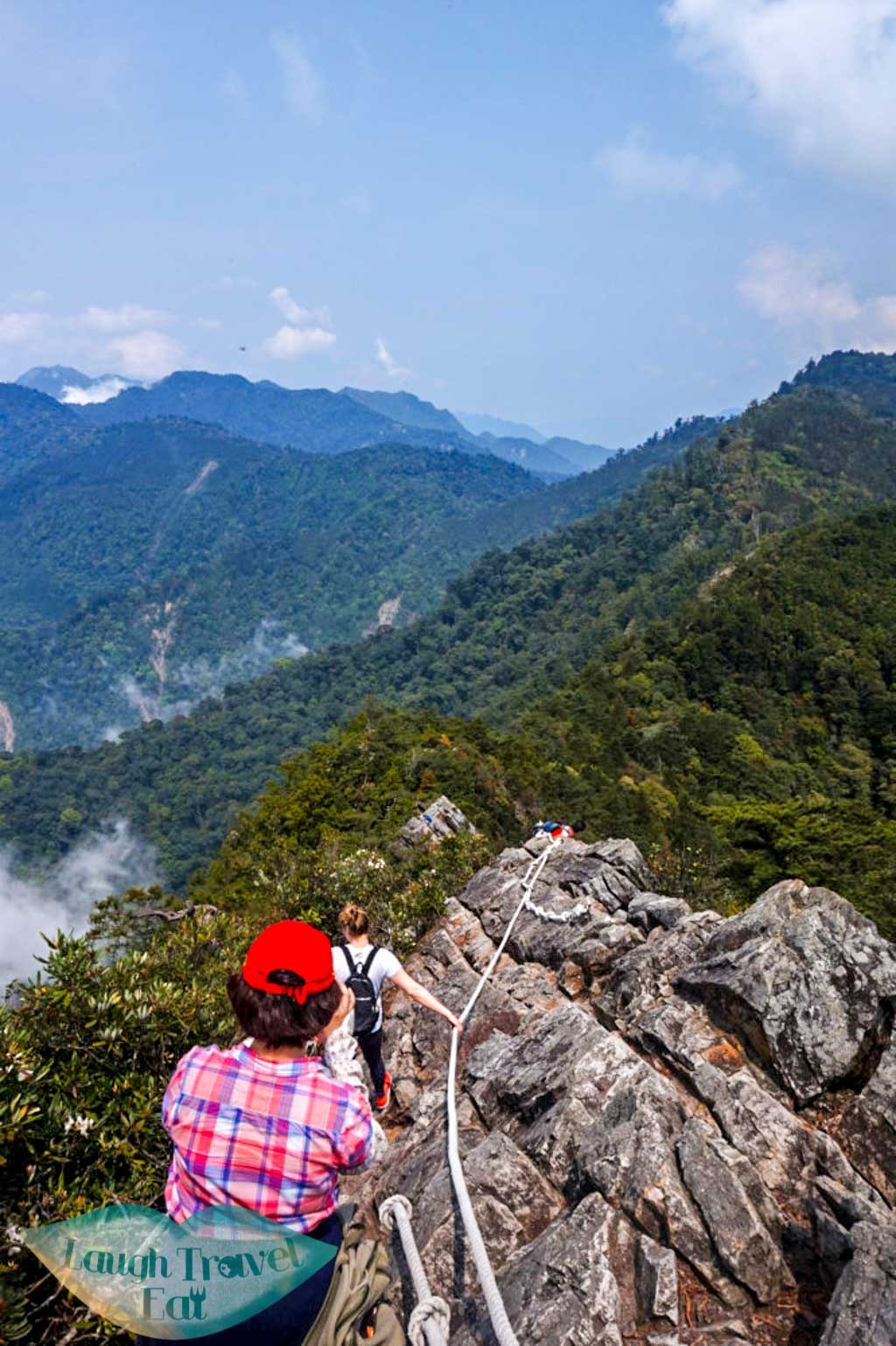
Continue walking up the trail, you will pass by a platform and a hut for rest. After reaching the hut you will exit the forest and encounter the next part of the hike! This is also a good time to put on your gloves as you will be hanging on to the rope from now on, and rope burn ain’t pretty.
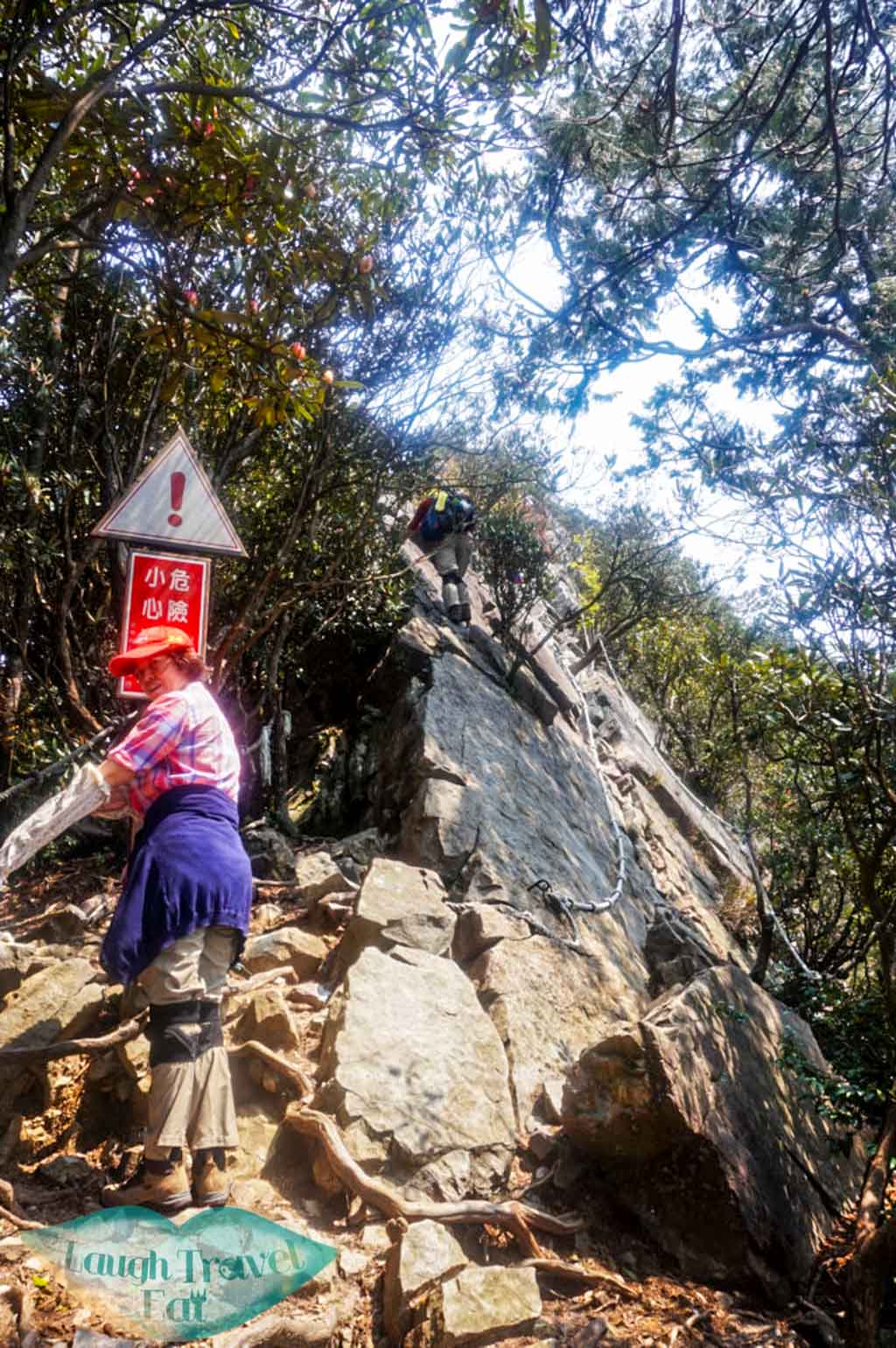
This part of the trail varies in steepness and scariness, but most of the time is very safe and exhilarating. One thing to keep in mind is when in doubt, hold on to the rope and find a foothold; move your foot one at a time, and only when you are 100% sure you are secured of the move do you move the other one.
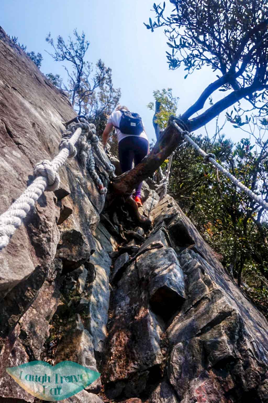
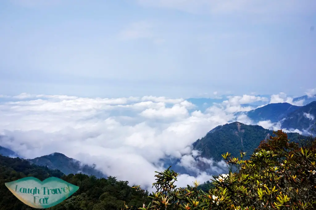
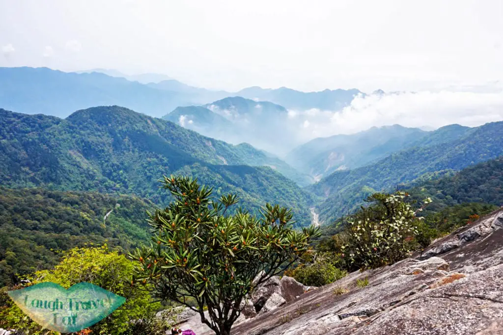
There are some stunning scenery along the way and you can find a spot to soak it in (but make sure you don’t block the trail!).
Sometimes, the trail seems impossible to climb up, but somehow everyone finds their way.
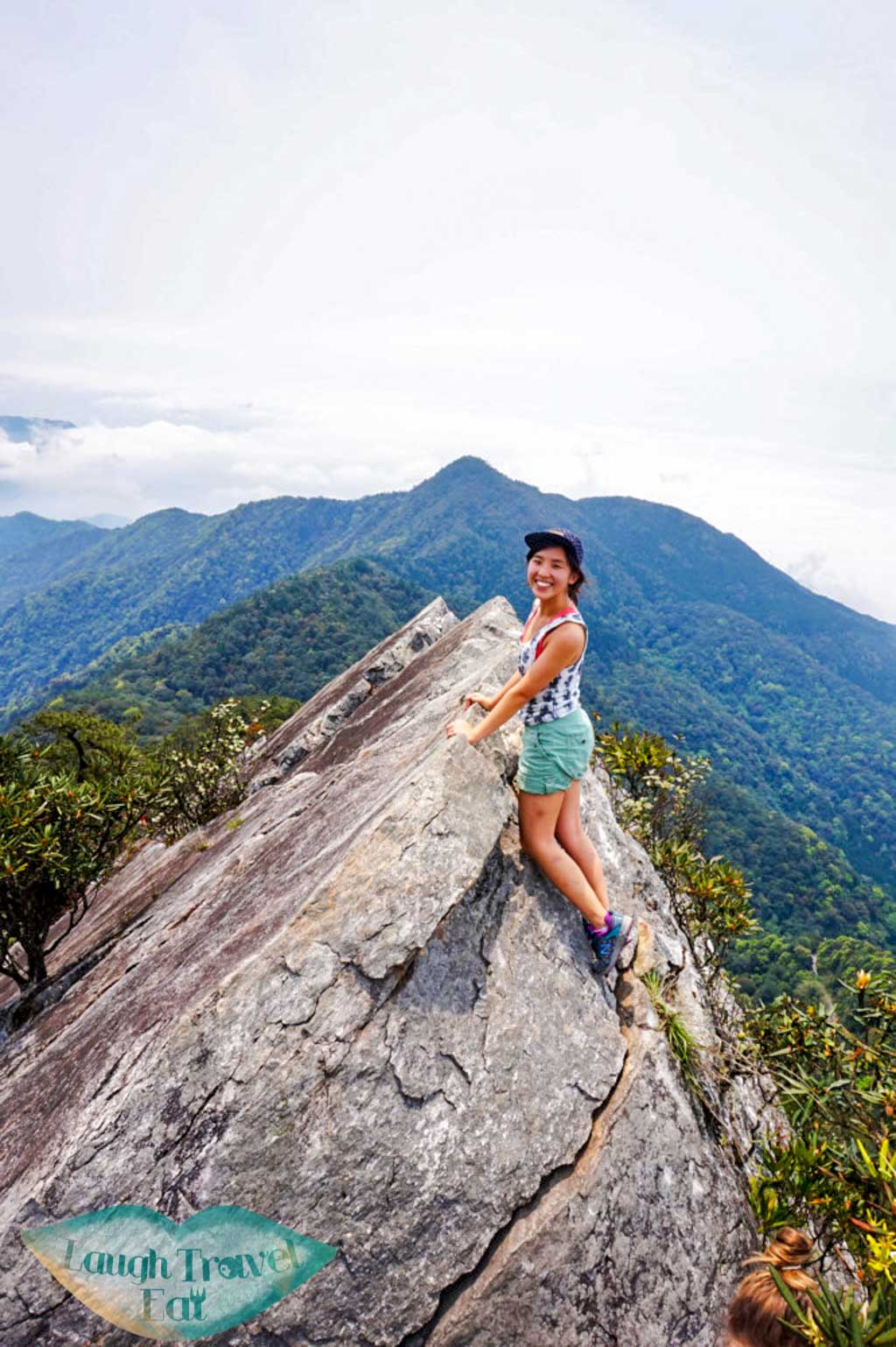
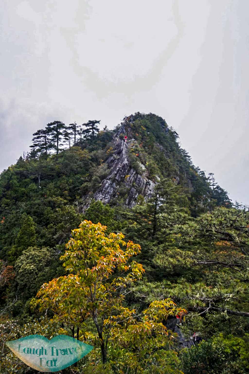
Yuan Zui Mountain Peak
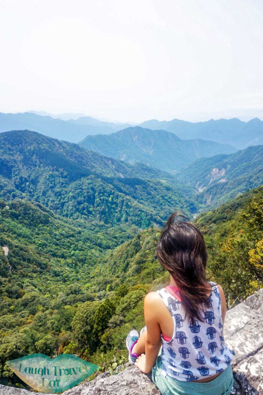
After what seems like forever, you will have made it to the top!
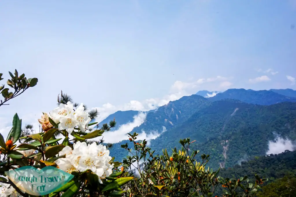
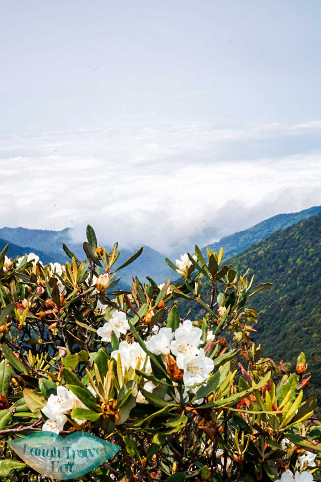
The view from the top is stunning! You will be able to catch a view on either side of the mountain.
 There is a good spot for photos to the left of the notice board (facing the board). There’s a path to the right along the edge of the peak that allows you to get to the second boulder, whilst the photographer climber on the first one.
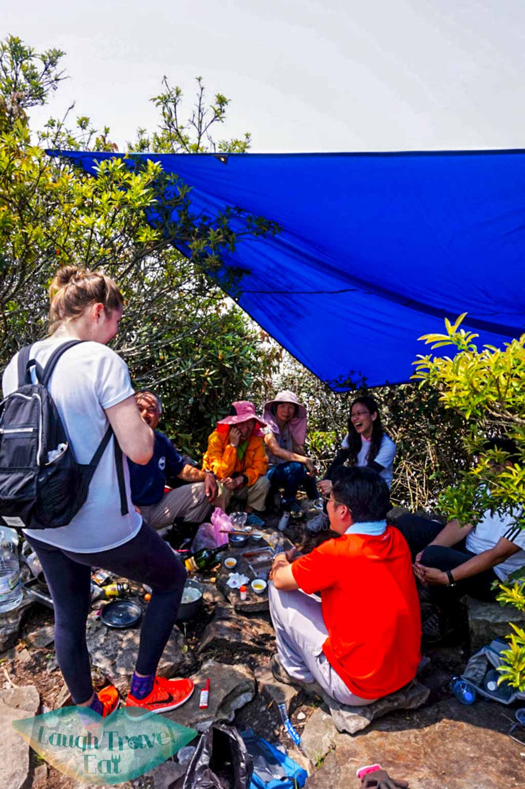
People usually eat their lunch at the peak, and one thing Taiwanese hikers do is that they will cook their lunch at the peak, as well as drink alcohol. They are very friendly and invited my friend Sophie for a drink.
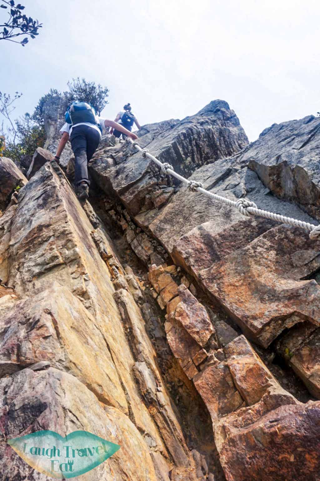
Descend- Part 1
This part is the hardest part of the hike (in my opinion). The hike down isn’t dangerous– but it sure scares me out of my mind for part of the way down. Fortunately, a Taiwanese couple ‘adopted’ my friend Sophie and I, and guided us the whole way down.
Some part of the descend is very steep, and it’s best to go down facing the rock and remember: one step at a time, only move your feet one at a time.
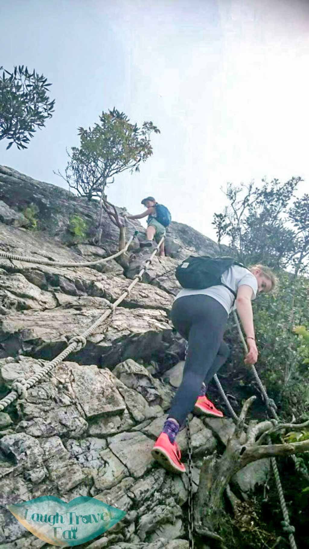
Side note: keep your elbows and knees away from the rock surface. I know it’s easy to use your knees as leverage but this can easily injure your knees.
Remembered to look back occasionally: there’s a spot that gives you a clear view of the path you just took downhill.
Carry on for a while longer and you will reach the end of the rocky part.
Descend- Part 2
The non-rocky part of the descend is pretty straightforward with a well-defined path. There should be a sign when you reached the junction for heading back down to the car trail.
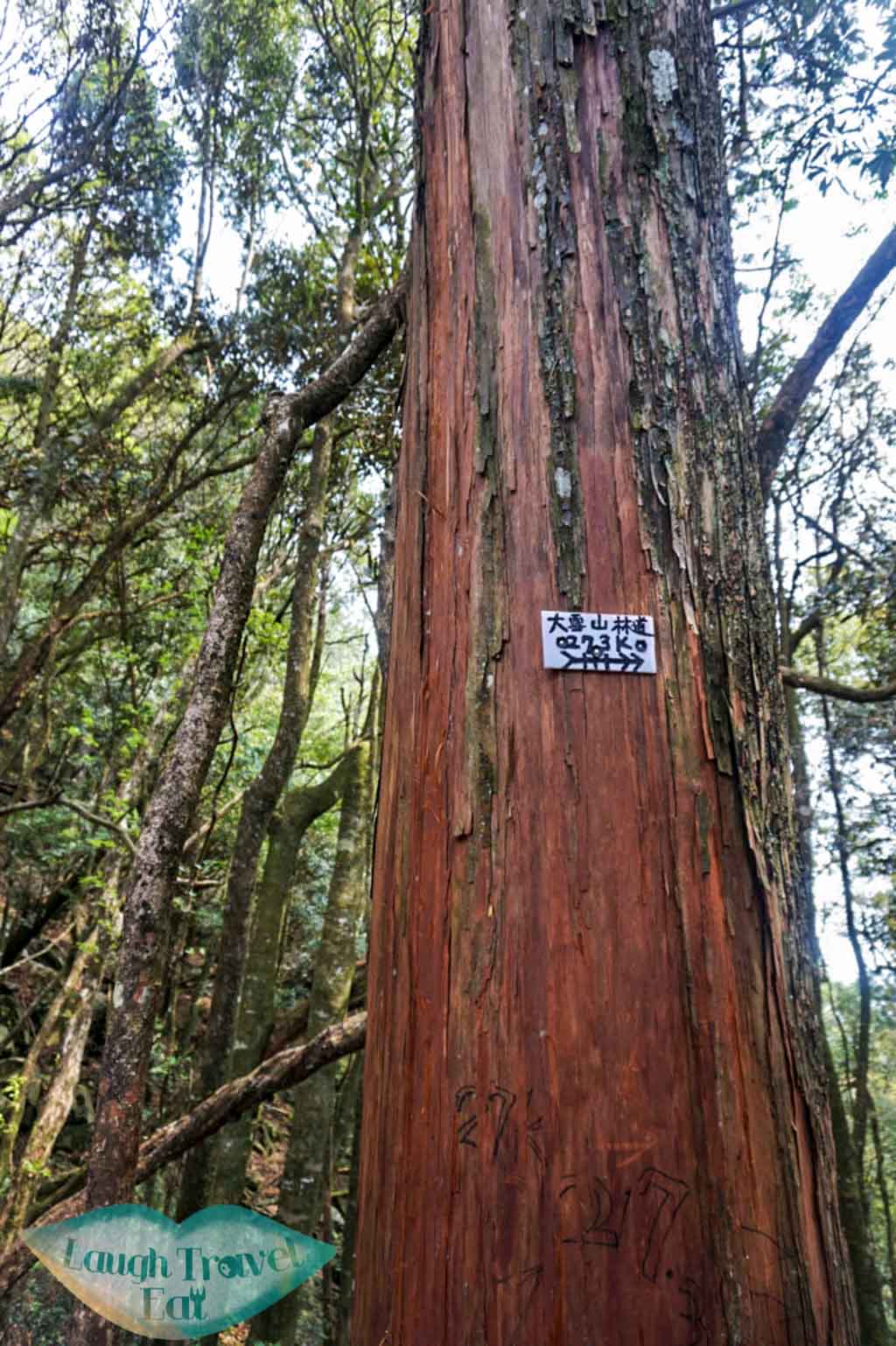
The path down is clearly marked, with ropes lining the 2 sides. The path mainly consists of rocks and some of them have moss growing on, so the ropes will come into handy.
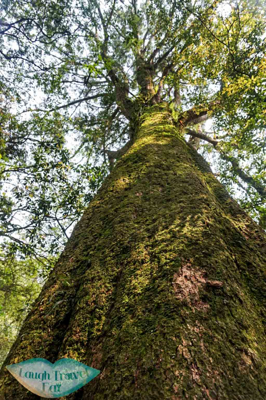
There are some ancient trees along the side of the path, and well worth the deviation from the path to get a picture.
And WE ARE DONE!!!!
Getting Back
As I say before: it’s easy to hitchhike back down to the city. We met quite a lot of friendly hikers along the way and more than one offered to drive us back down.
Side note: if you like bird watching, or by the time you make it back to your car it’s almost dawn, consider stopping at 23K: you might get a chance to see some of the wild birds in the area!
Verdict
This is a great hike to go for: but not for those with vertigo or people who don’t hike regularly. The hiking trail is very safe with regular hikers who are keen to help first timers on the hike- it’s definitely a worthwhile day trip to take if you are in the area!
The scenery is beautiful and according to the regular hikers we met, it changes every time they go up. On the day of our hike it was sunny with good visibility, and some of the Rhododendron were already blooming, adding colour to the landscape. However, mists and clouds can add a mystic air to the landscape as well, and it’s all up to the weather.
 Side note: from the map at the start of the article, you would have noticed that the trail stretches all the way across Dasyueshan recreational area. Please don’t try to take the whole trail all at once unless you have thoroughly research and prepare for it. There’s no way down after the 27.5K break for a while, and if by the time you get to the junction it’s already 2pm, head down instead of continuing. To make the whole trail in one day requires an early start, good physical condition and equipment as well as fast pace (i.e. less photo taking time).
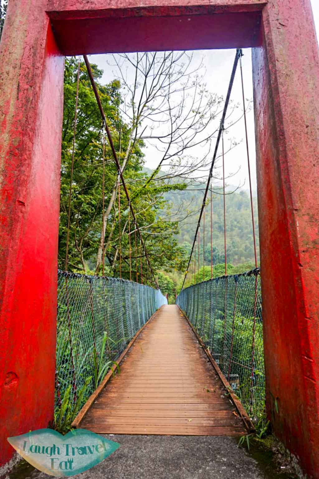
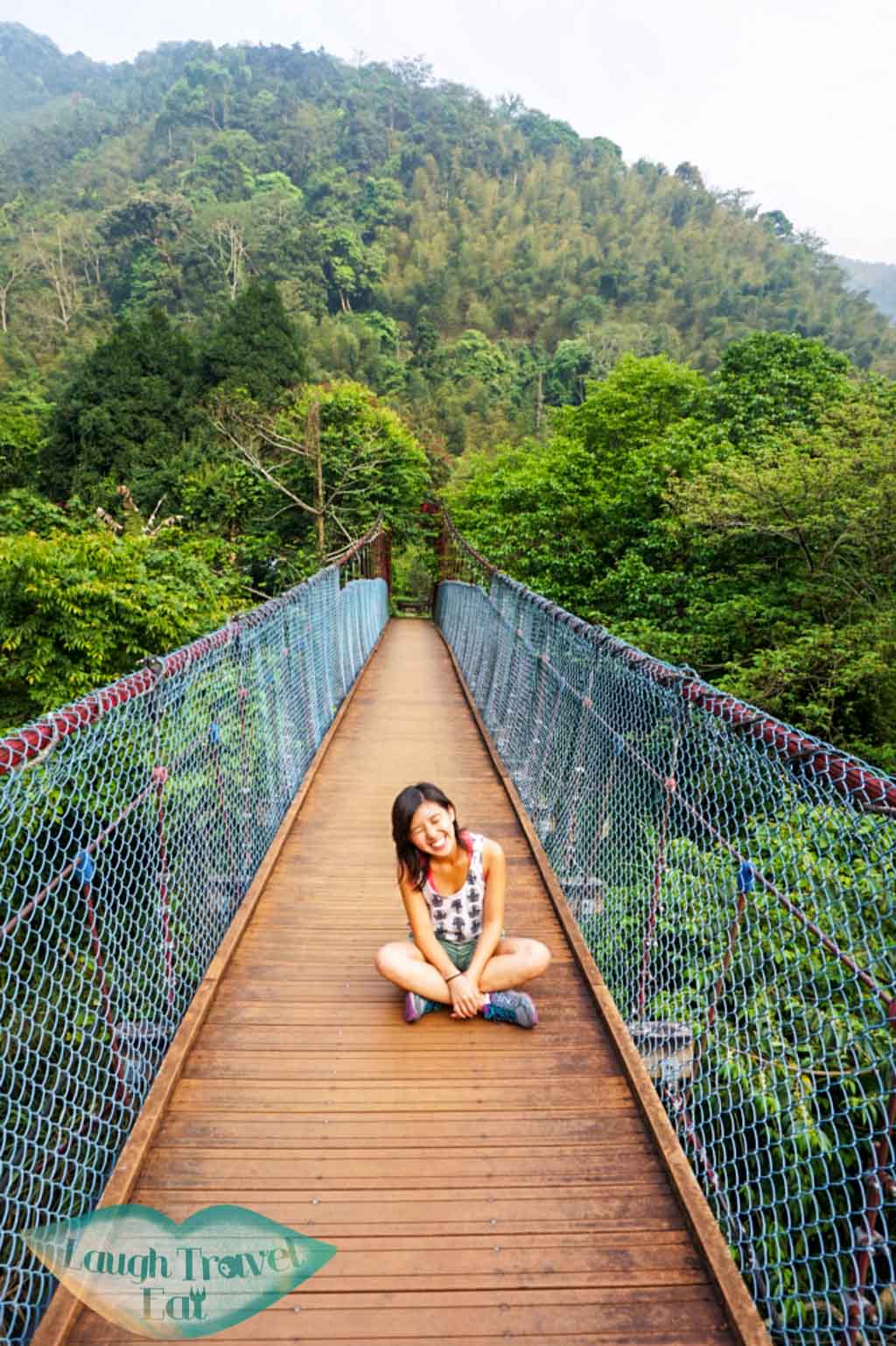
Extra Photo Stop- for those who love bridges
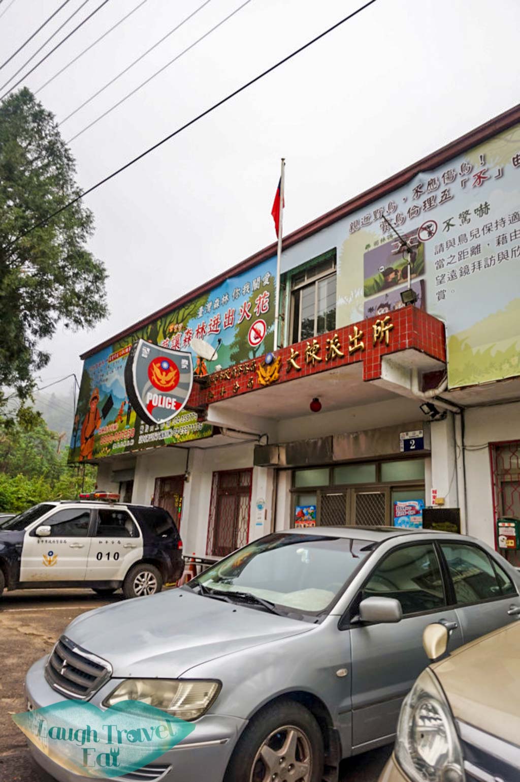
There’s more sights around the area if you are not too tired from the hike. My friend and I were dropped off at the Tai Tung Police station (it’s along the road back to city center!), and we decided to head down to the hanging bridge for some photos (well, I wanted to and Sophie reluctantly agreed). There are parking spaces around the bridge as well

The red bridge is very pretty and there was no one there when we went, which provided us a photoshoot opportunity.
Thank you all for reading! Hope this is helpful to you.


Hi Nam,
Is it required to get a mountain access permit before i go to mt. Yuan zui for a day hike?
Hi Larrie,
You don’t need a permit to hike this mountain!
Hi Nam,
I’m planning to head there in a few weeks time.
Is there public transport during the weekday? If not, what would be other alternatives aside from renting a car?
Lastly, have you been to Aowanda National Forest Recreational Area during your trip to Taiwan?
Hi Aaron,
Unfortunately there is no public transportation up there at all. You can take a taxi, however, it would be costly and you will face the problem of finding one on your way out. I haven’t been to Aowanda National Forest Recreational Area 🙂 but I hope you would have a nice trip!
Can you do this hike after rain? And can you do this hike in light rain?
I wouldn’t recommend it at all – the surface would be too slippery to climb!
Great article! I will be doing this hike with a group on Monday. I had planned to wear shorts but after reading your advisory against it I am having second thoughts. 😛 Will I surely regret it if I opt for shorts? They’re the only fitness bottoms I packed so it’s that or sweatpants..haha!