Europe
Tre Cime di Lavaredo: how to hike the classic three peaks in Dolomite Italy
Nov
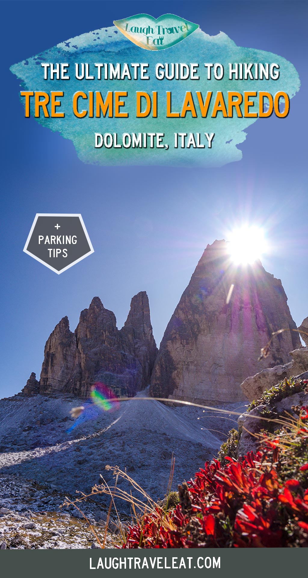
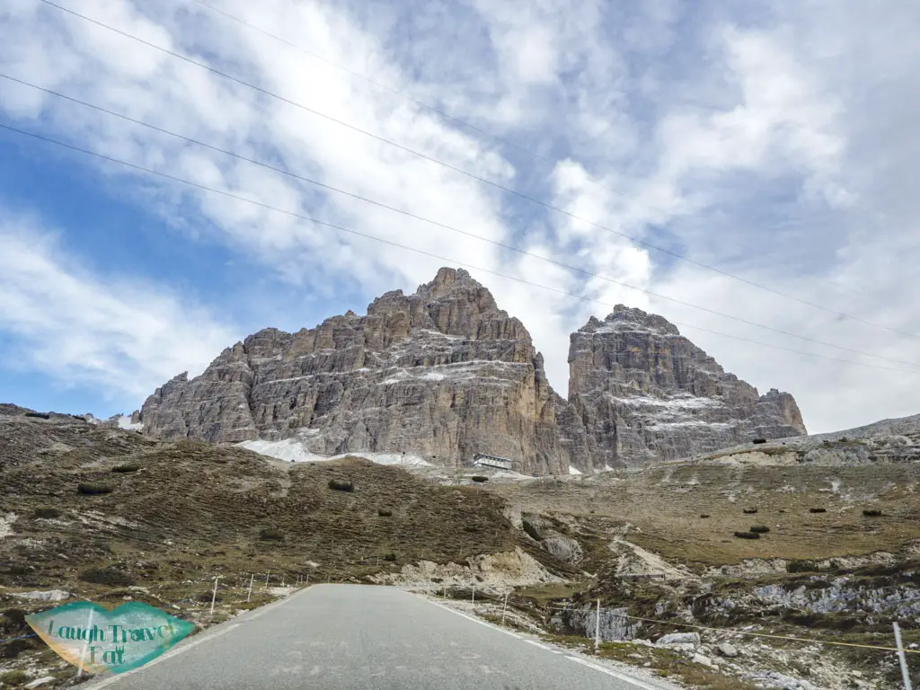
Tre Cime di Lavaredo is an iconic mountain with three peaks in the Dolomite and a popular day hike. Located on the border of the Veneto and South Tyrol region, it attracts a lot of hikers. There are a lot of hiking trails in the area but the classic trail takes you around the Tre Cime and back to the car park. Here’s how to hike it:
- See my Dolomites itinerary or full Italy series and itineraries here
Contents
Tre Cime hike summary
Time taken: 5 – 6 hours, but depending on which route you take
Pro: car park at the start and end of the trail, a circular route with spectacular view, easily one of my favourite hikes
Con: it’s rather popular, and the circular route branch off a little making it difficult to follow. It also costs 30 euros to drive up to the parking lot
Gear required: layers, especially fleece and windbreaker, gloves as well as hat as it get both cold and sunny. Hiking poles is also highly encouraged. Waterproof depending on the weather.
Here is a vlog on our hike to Tre Cime di Lavaredo:
How to get to Tre Cime
As a famous trek, the road to Tre Cime is well signposted, and our base in Cortina d’Ampezzo means it’s only about an hour’s drive away. It is situated on the S49, heading northeast from Lago di Misurina pass Lago Antorno.
Parking in Tre Cime
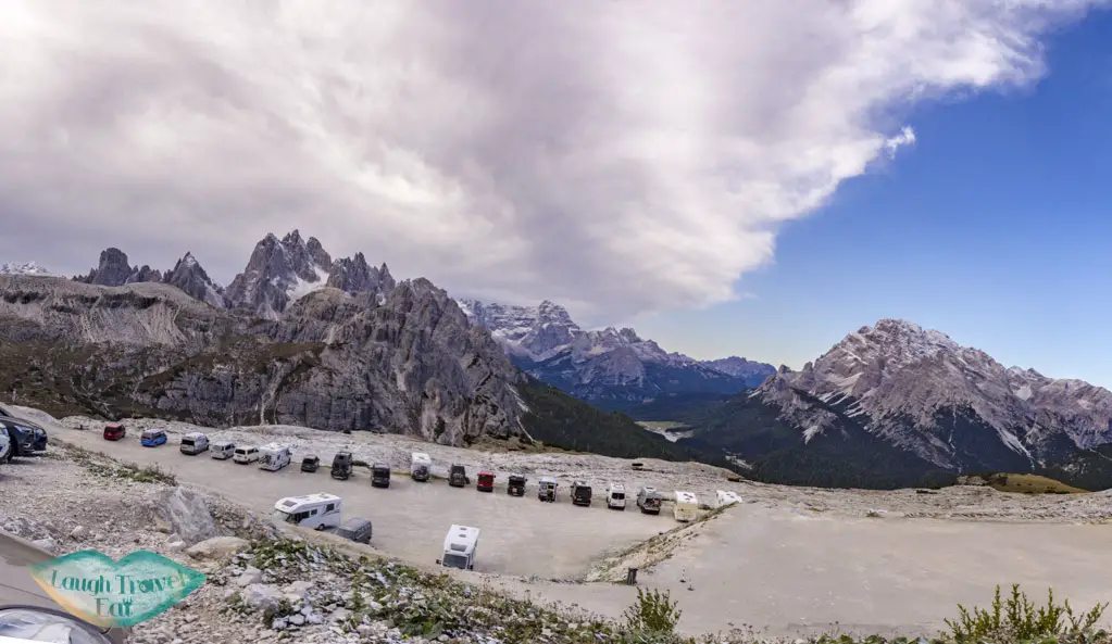
If you want to go all the way up to the car park where the trail starts, you need to be prepared to pay. Not long after passing Lago Antorno, there is a ticket barrier – you can either park your car before that or pay the fee to go up to the car park. Here’s the price list (photo taken Oct 2019):
For a car, it costs 30 Euros and I recommend paying it to go up. It’s worth it. It’s still about 20 minutes drive up up and up, so hiking up there will take at least 2 hours from my estimate.
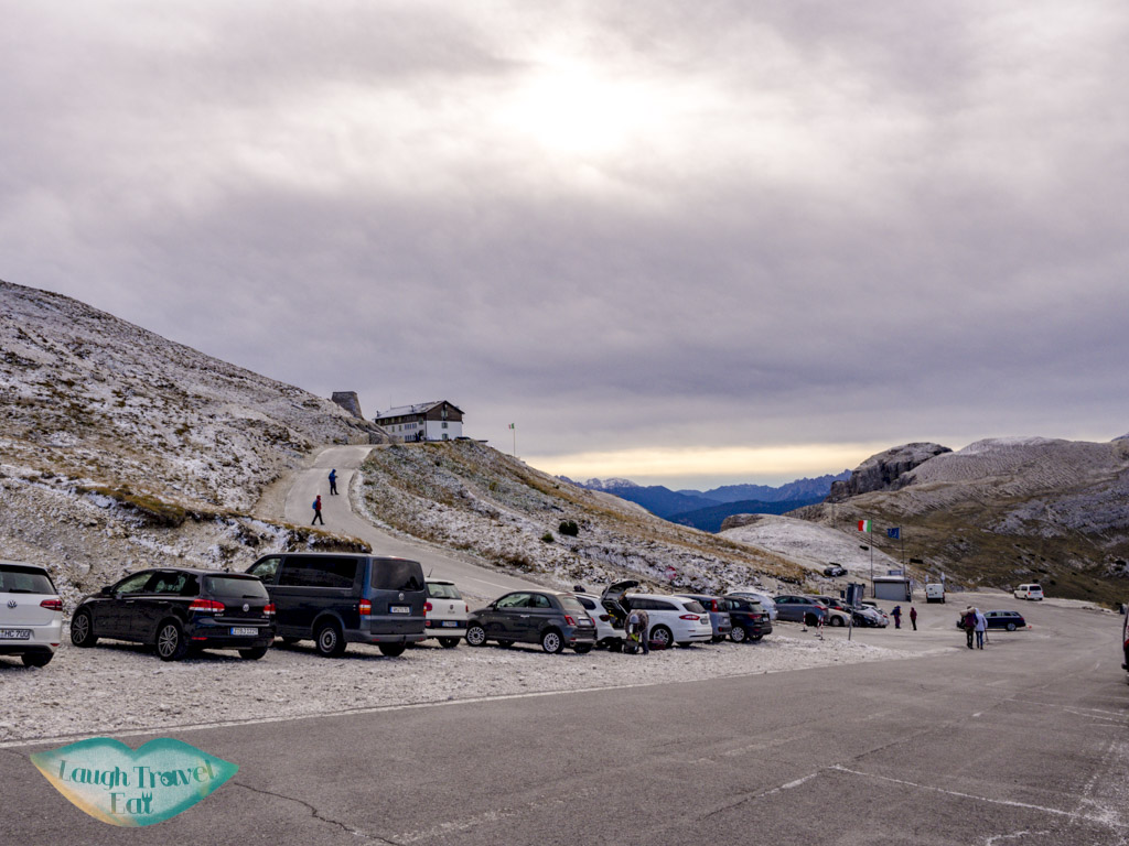
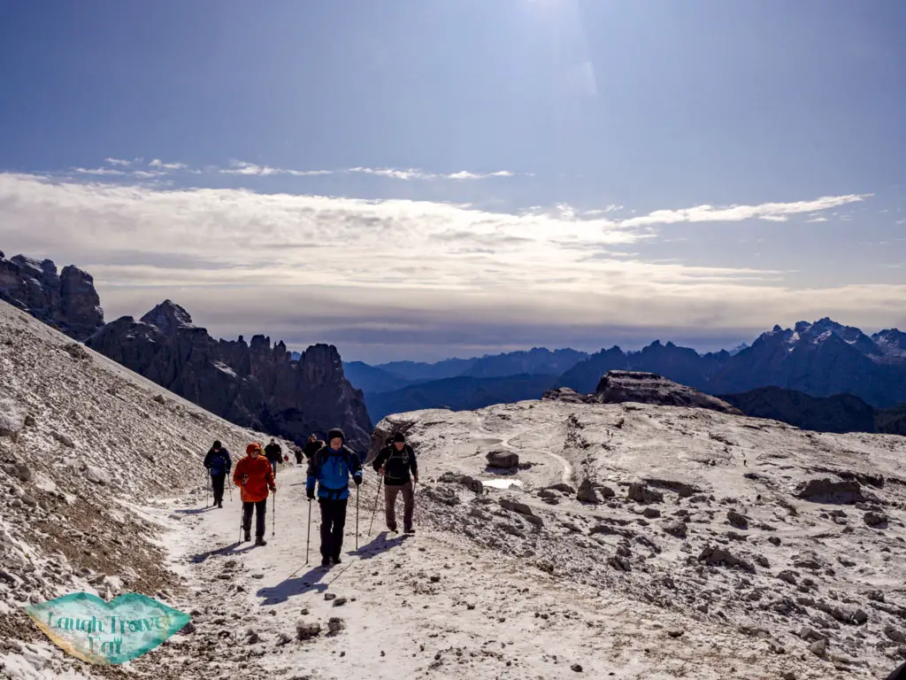
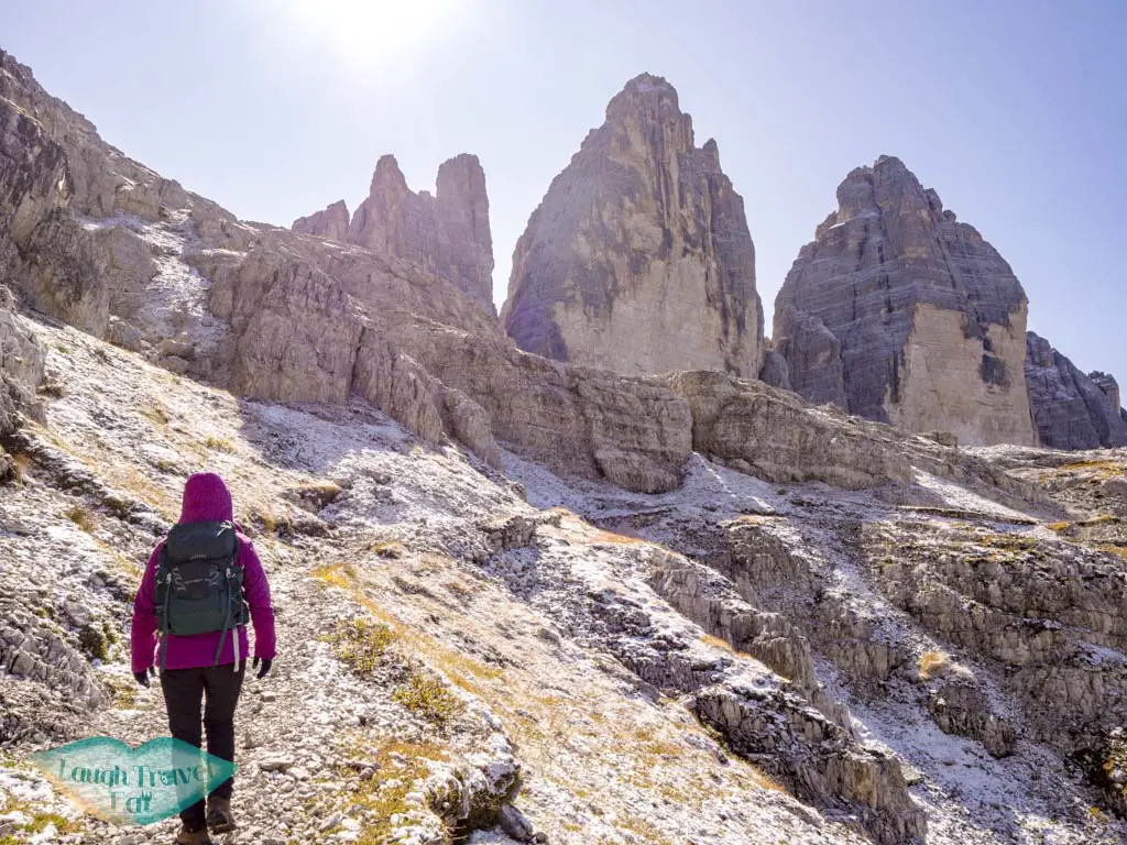
Hiking Tre Cime
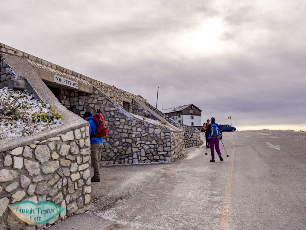
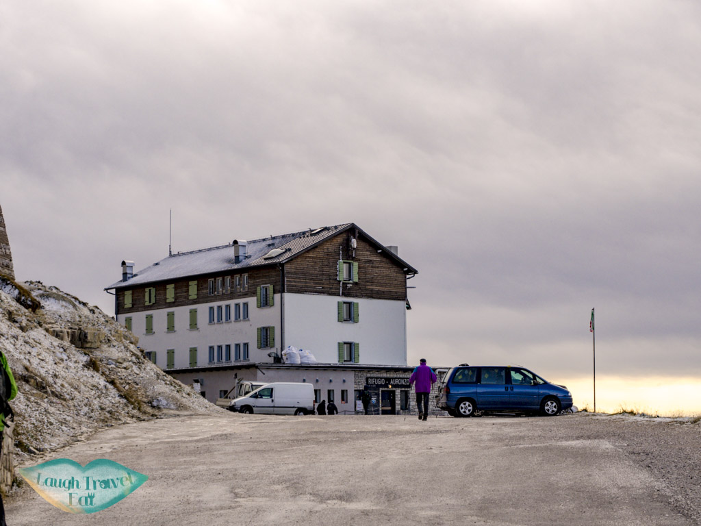
The best way to hike the Tre Cime is to do an anti-clockwise trek starting near the rifugio. The bathroom is down the slope from the rifugio – and it’s a free bathroom however it’s squat toilet
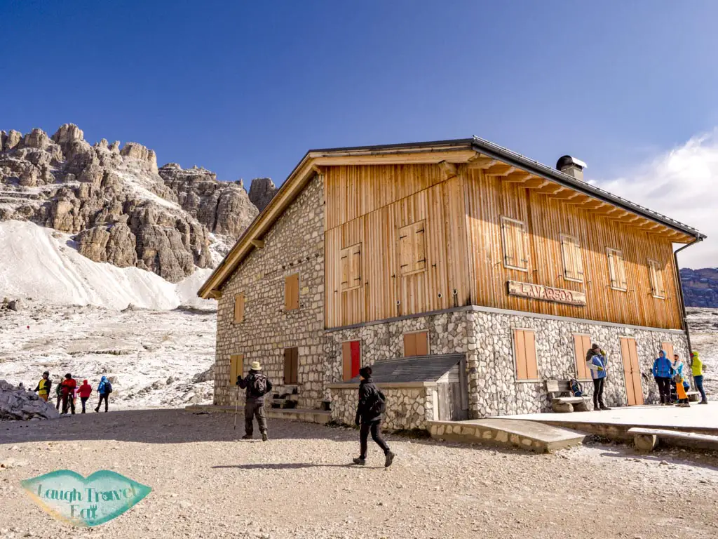
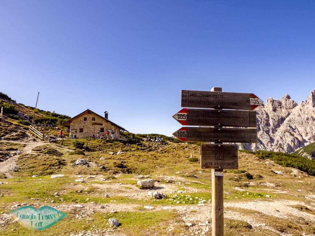
Start at Rifugio Auronzo (2326m)

The trek starts from the back of the rifugio, which also has a panoramic platform.
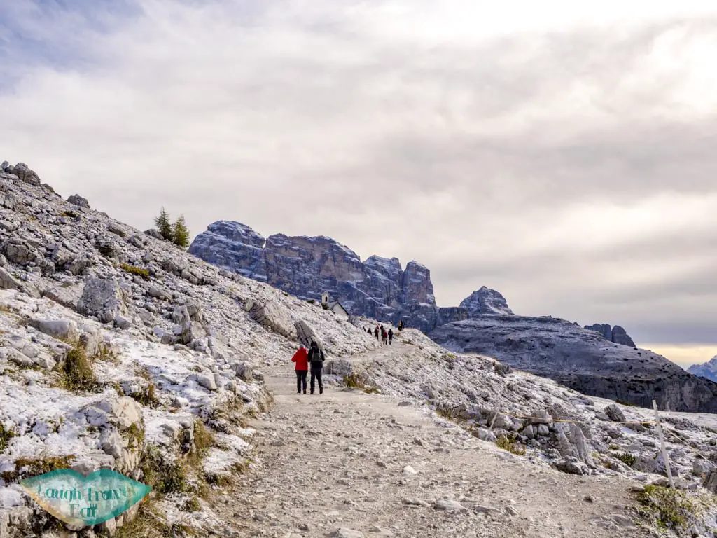
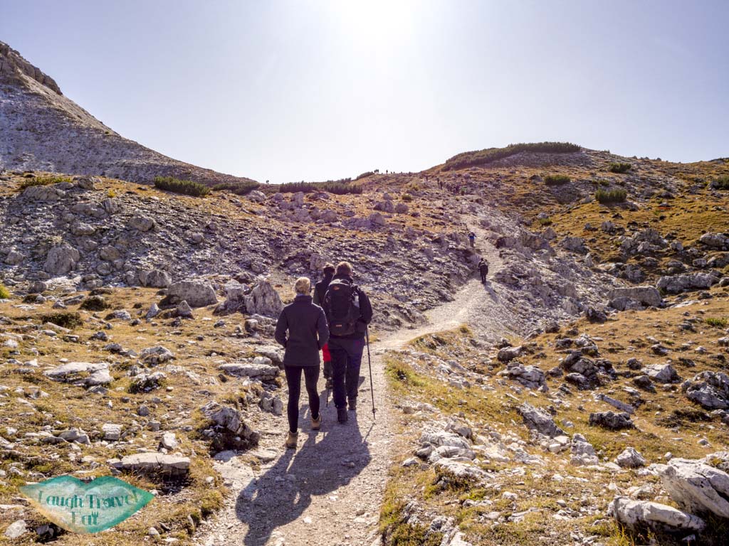
This first section of the trek is almost completely flat, and for those who are looking for just a short or less strenuous exercise you can trek to the end and head back the same way.
While it is an easy gravel path, in early October the temperature is already cold enough to cause frosting, which makes it slippery.
The view of the valley to the right is also gorgeous, and even if you don’t want to hike you can see a lot from the back of the hut.
Rifugio Lavaredo (2345 m)
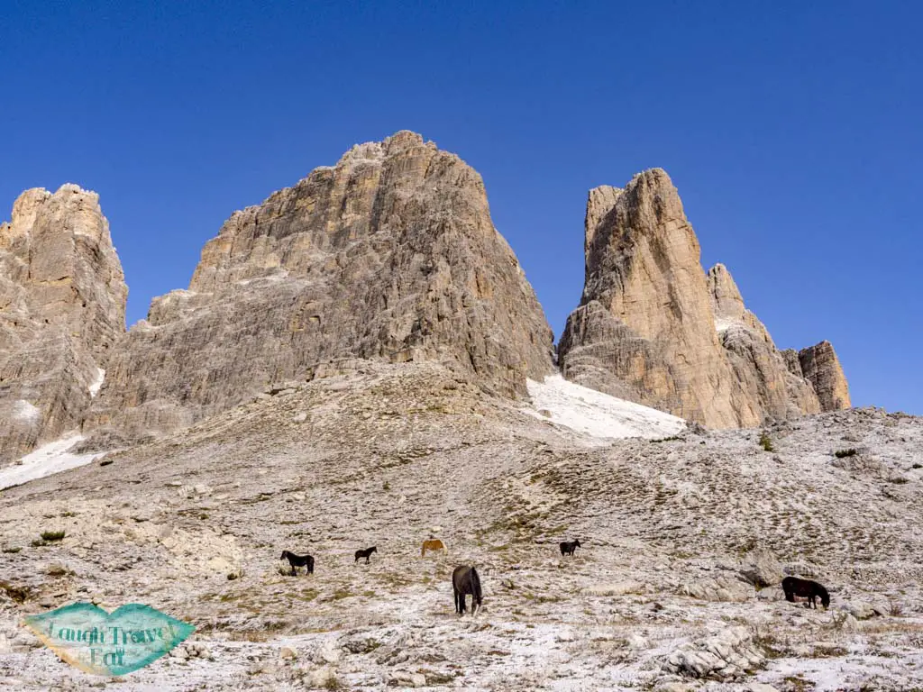
The first hut on the trek, it was already closed for the season in early October. Before that there is a chapel with horses grazing, making for a gorgeous photo against the mountain.
This part faces away from the mountain but remains relatively flat and wide.
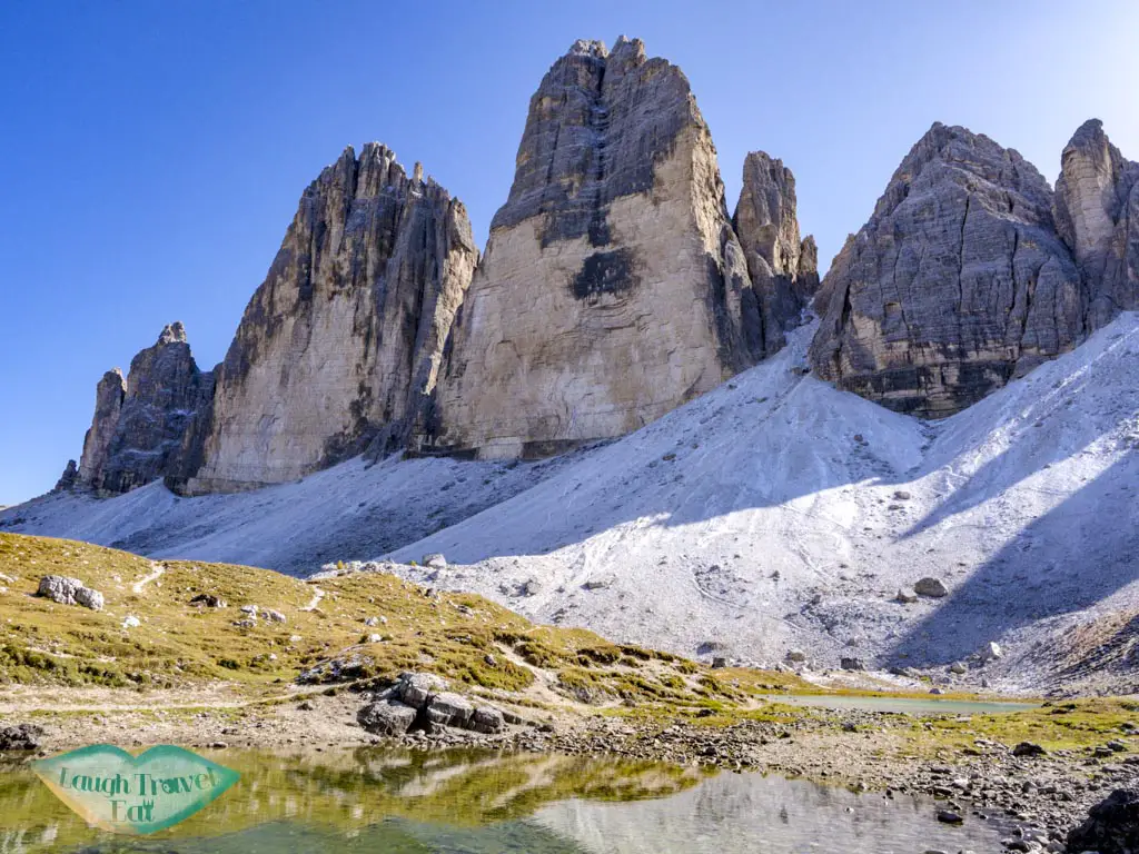
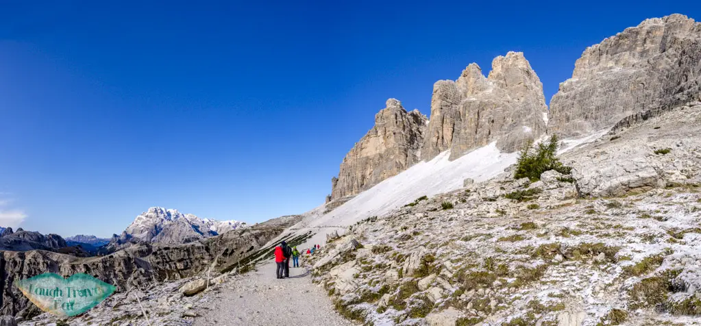
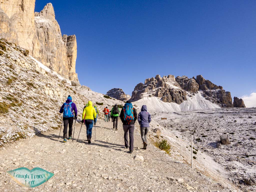
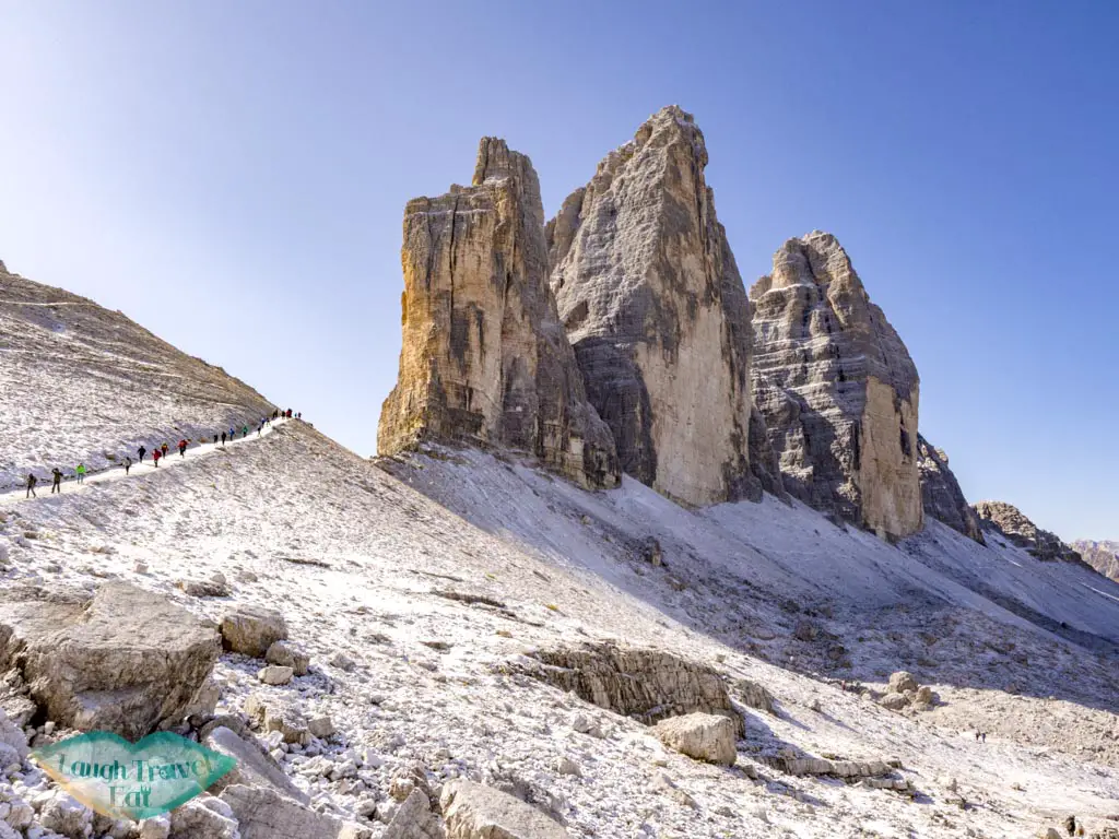
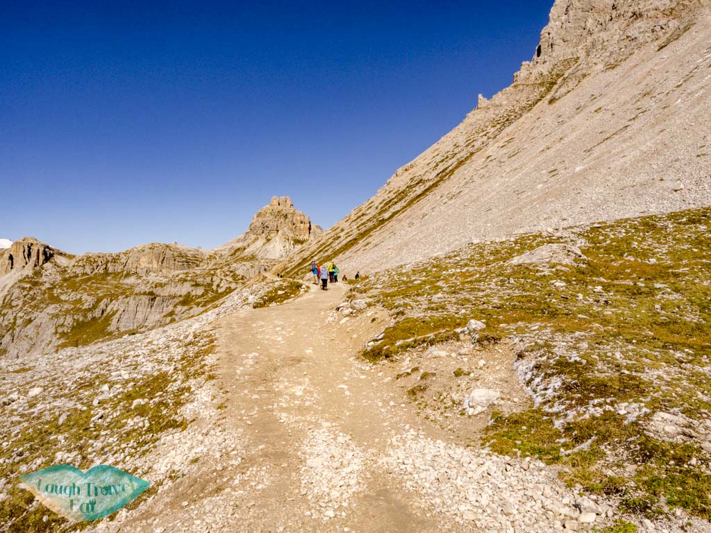
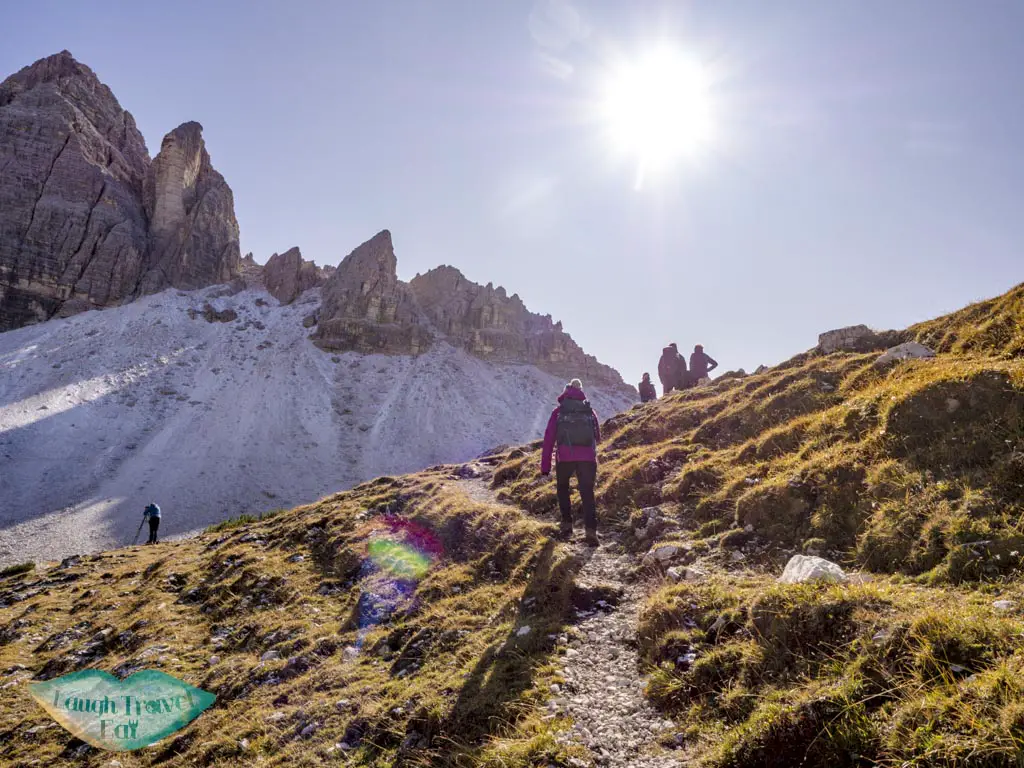
Rudere (second hut)
The second hut is also closed in early October but has a clearer view of the three peaks. The path that slopes upward, and we had to be careful going up because of the frost layer.
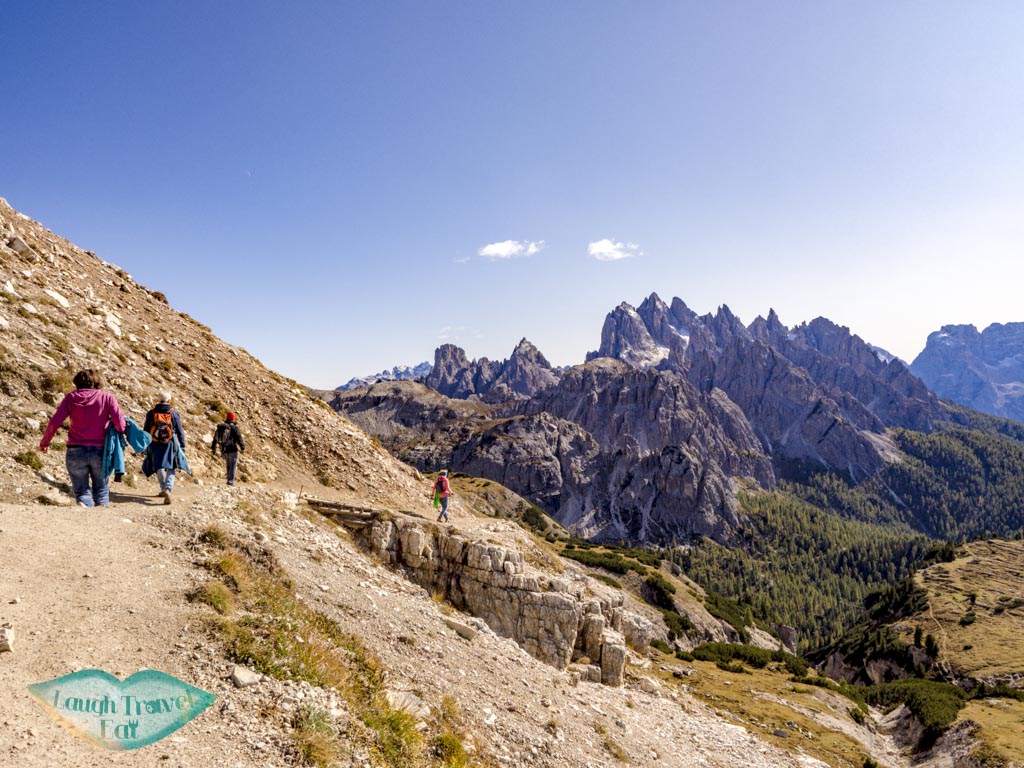
Don’t forget to look back now and then to admire the view. There are two ways up, we chose the route to the right because the uphill looks gentler.
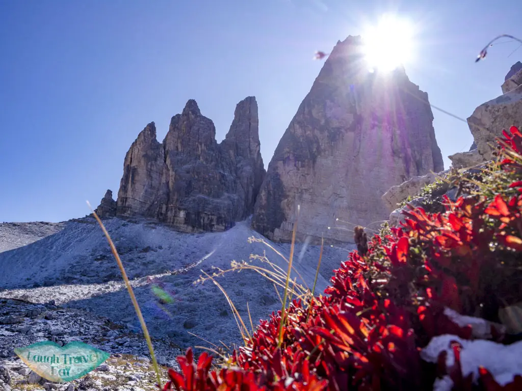
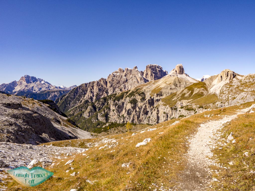
First split – a pass at 2454m
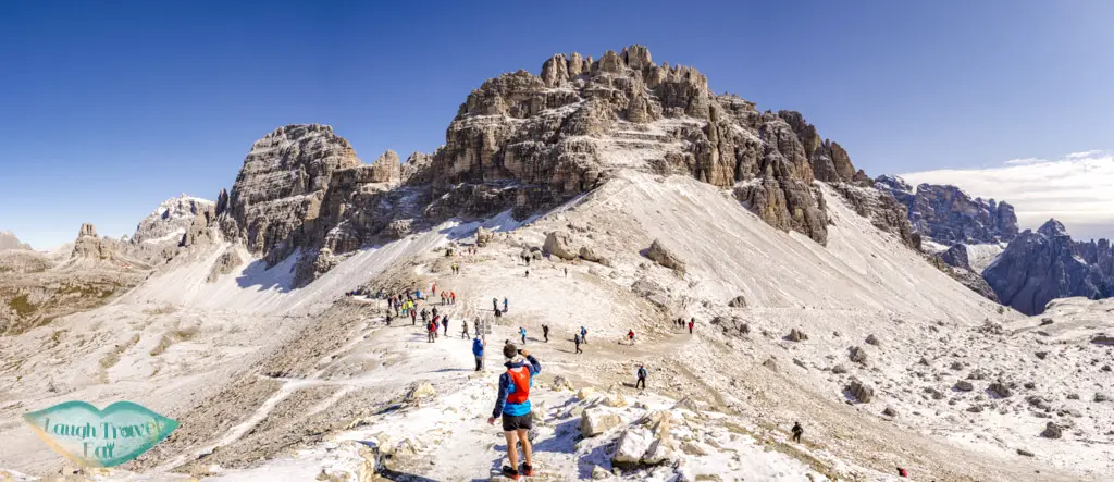
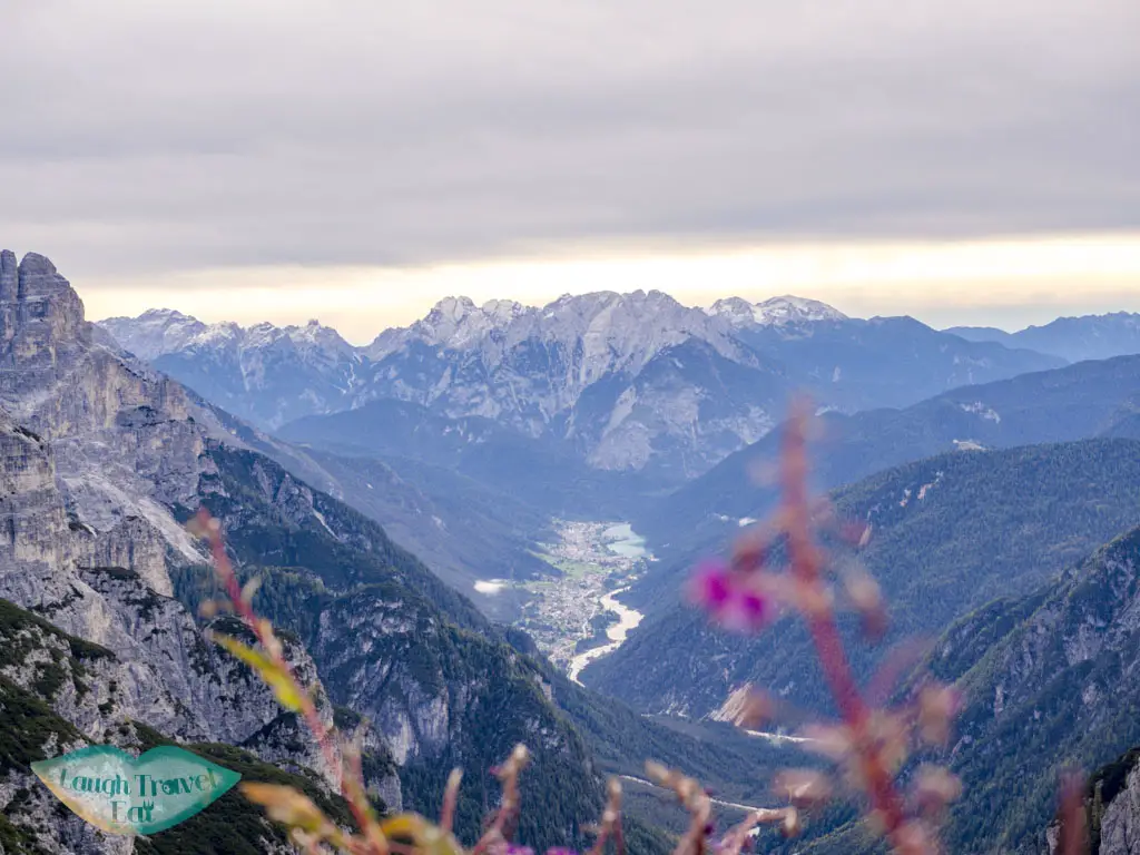
At the end of the uphill is a pass with no name at 2454m. It has a great view of the other side of the valley.
For the daring and experienced hiker, there is a trail along the steep gravelly slope that cut straight back.
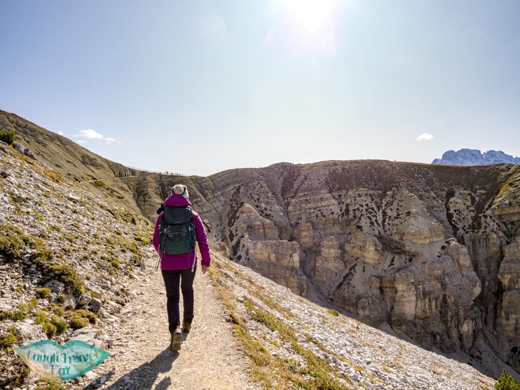
Heading west
However, I recommend heading north until the next junction. This part is a little confusing, since we couldn’t actually find the second trail and had to go further and loop back. Hence, it’s important to have an offline map (I use OSMAnd, which offers up to 10 free maps).
You can head further down the valley, but that route takes you down and then back up. Plus, this intermediate route offers a great view of the Tre Cime up close along a gorgeous rock plain.
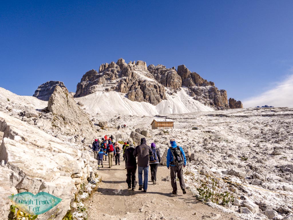
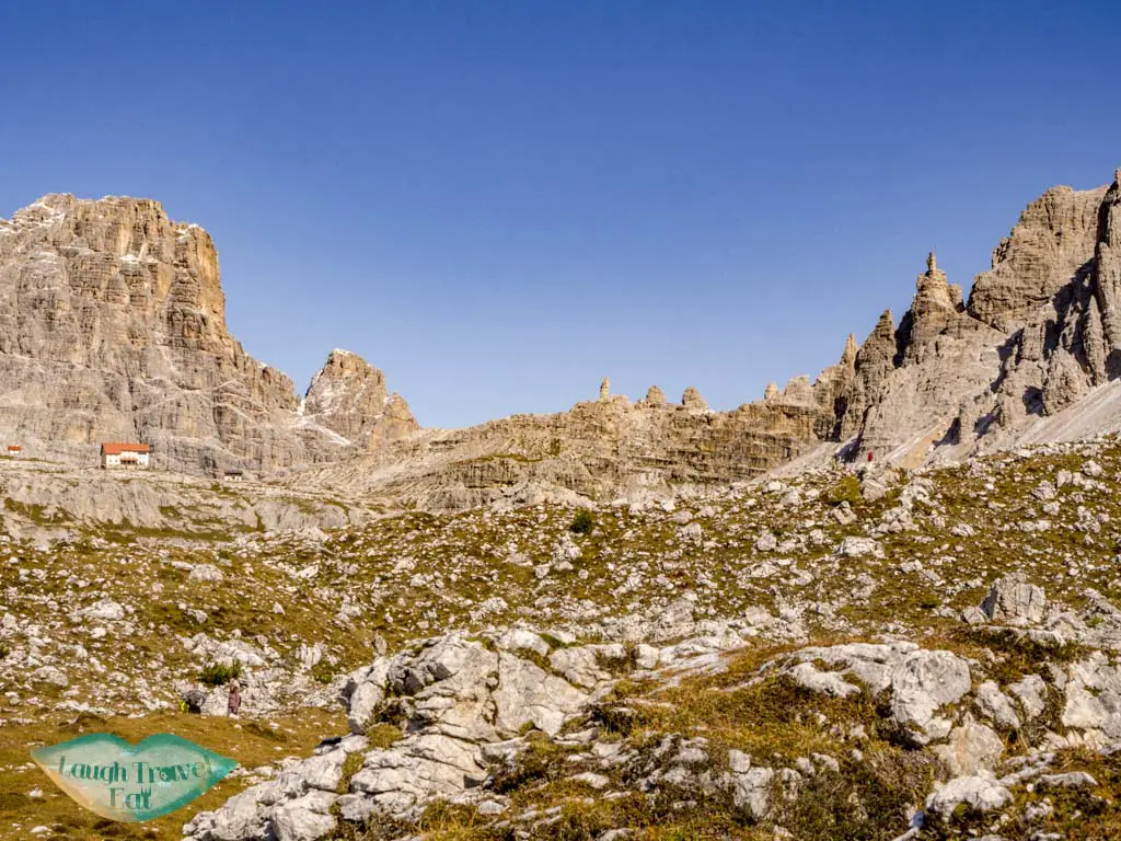
Col Forcellina (2232m)
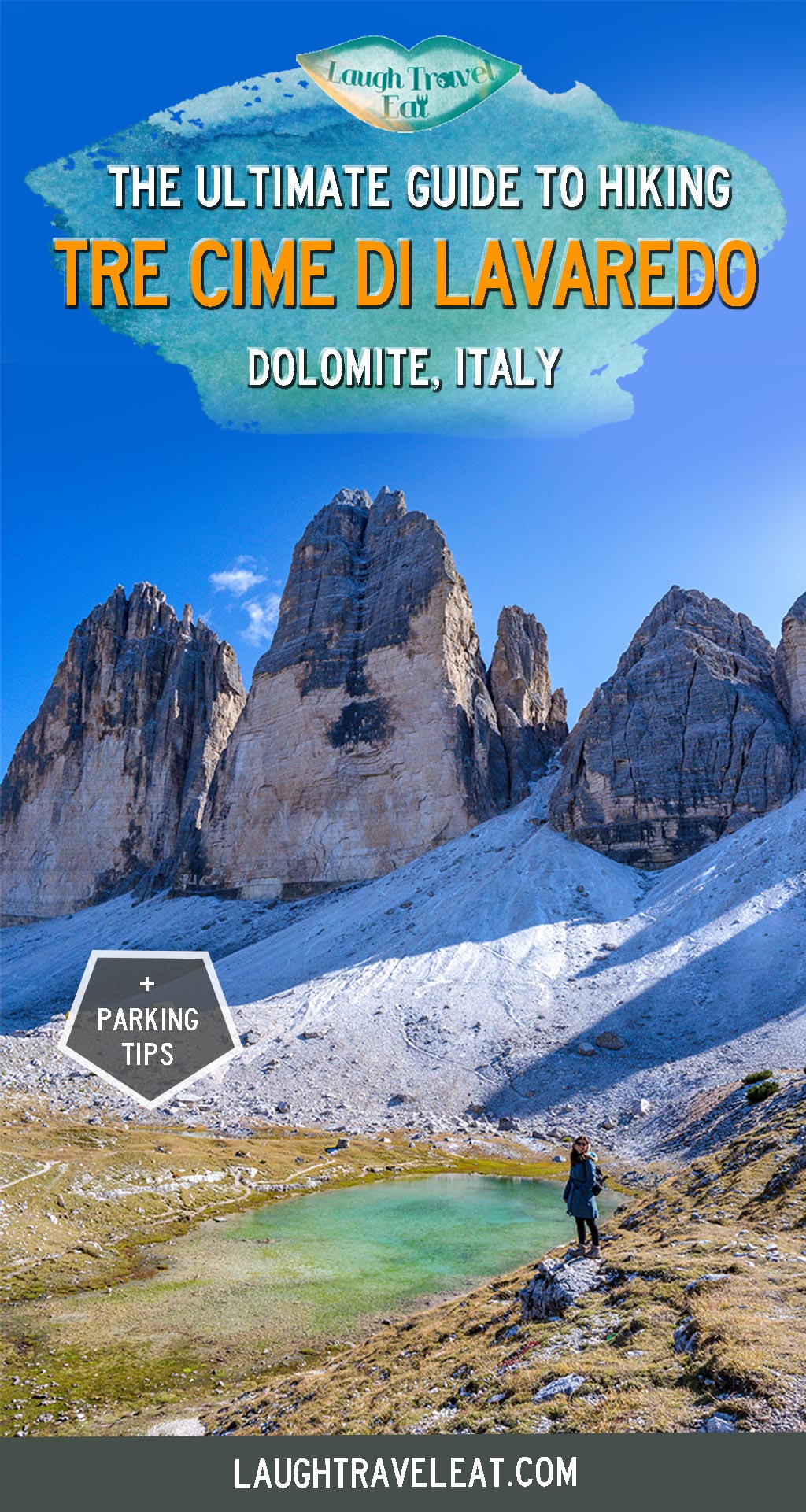
All the paths converge at Col Forcellina, where there’s a hut (that’s also closed at the beginning of October). On the side by the base of the peak is a pretty lake, but the low water level split it into two. The colour is still gorgeous.
Here, turns south and go around the peak. It takes you by the side of a valley on a relatively narrow path.
This isn’t a long stretch, but be careful of footing as you head up and out towards a fenced area.
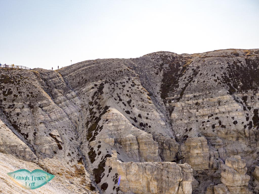
If you are interested in geology, the rock layers under the fence shows some faulting and folding.
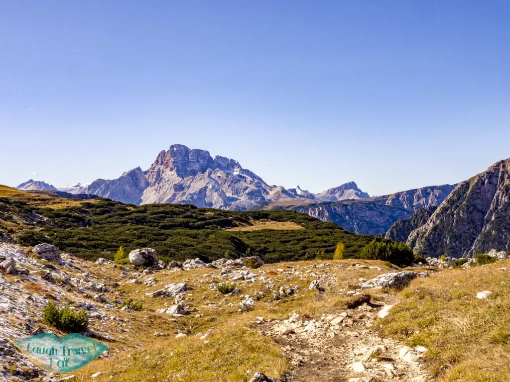
Col de Mezzo (2313m)
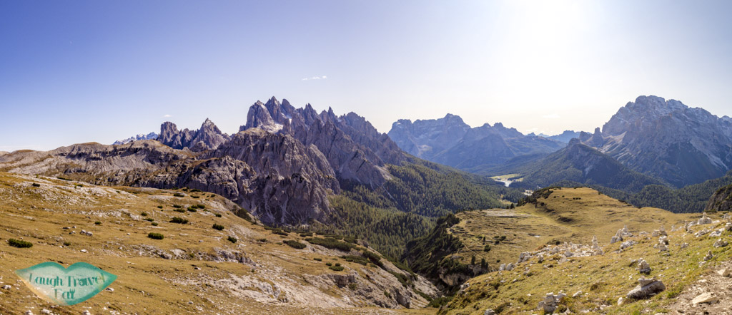
The view west from the pass at Col de Mezzo (which is the part by the fence) is amazing with views of snow-capped mountains in the distance.
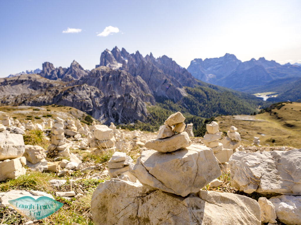
From here, turn left and continue the path east back to the car park. There is a stretch with stacked pebbles and rocks, too, which is popular with photographer. This part was longer than I anticipated but an easy walk back.