Asia, Hike and Nature, Hong Kong
Tai Mo Shan hike: 5 ways to go up the Highest peak in Hong Kong
Dec
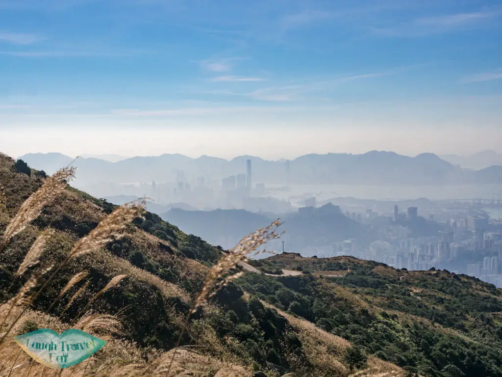
Tai Mo Shan is the highest mountain in Hong Kong and there are many ways to do a Tai Mo Shan hike. It stands at 957m, straddling Tsuen Wan, Tai Po, and Yuen Lo area with a spectacular view both north and southward. It literally translates as ‘big hat mountain’, but also phonetically close to ‘cloudy mountain’ which is a reference to the peak being shrouded by clouds.
There are many hikes in the whole of Tai Mo Shan country park, which means there are many ways of hiking Tai Mo Shan. I’m also going to cover how to go to Tai Mo Shan and five different Tai Mo Shan hiking trails in this Tai Mo Shan hiking guide.
Tai Mo Shan Hong Kong Essential Information
Tai Mo Shan itself refers to the mountain but Tai Mo Shan Country Park consists of 1440 hectares that include several sub-peaks, one of which is Wo Yang Shan which is a great hike itself that starts all the way back in Tsuen Wan. Tai Mo Shan was once a volcano in the Jurassic era and the geology of the park are all igneous rocks.
Here are some frequently asked questions:
How High is Tai Mo Shan?
The Tai Mo Shan height is 957m, making it the highest mountain in Hong Kong.
Where is Tai Mo Shan?
The Hong Kong Tai Mo Shan is in Tsuen Wan, but the whole country park extends to Tai Po, too.
Can you drive to Tai Mo Shan?
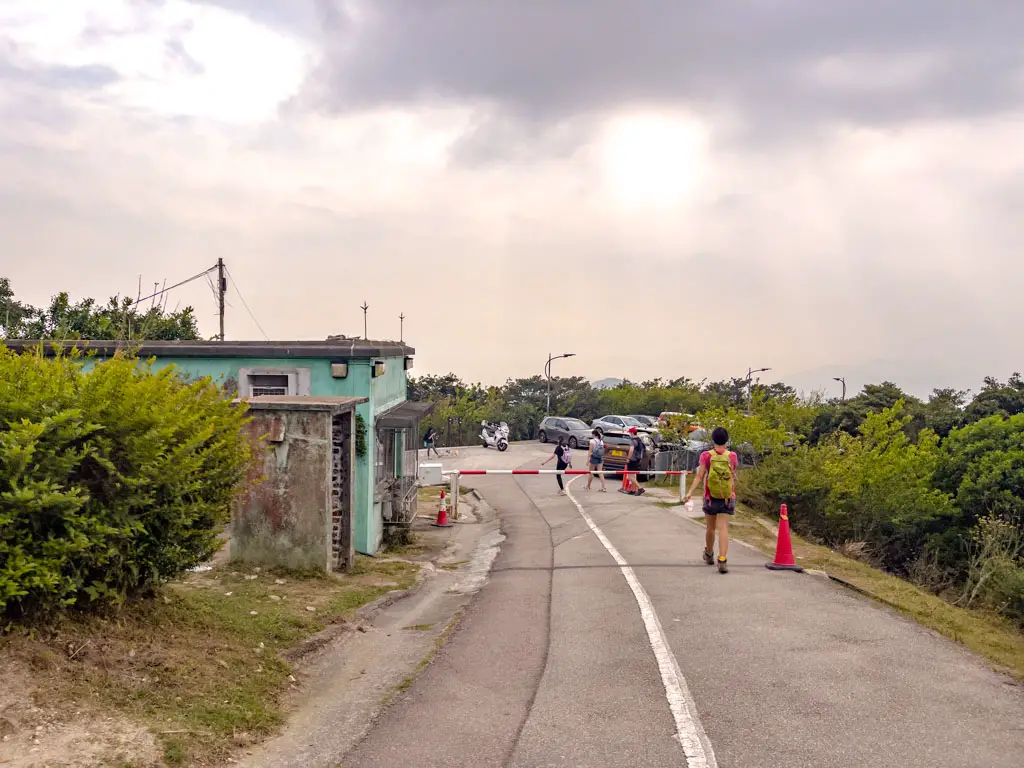
Yes, there is a Tai Mo Shan Road that links to Road Twist. Near the junction is a visitor center where you can learn more about the park’s history and ecology, and there’s a car park next to it. They also run guided tours, but you should check their website for information regarding it under COVID-19.
Opening times: Weds – Mon 9:30 – 16:30
Address: near the entrance of Tai Mo Shan Country Park by Route Twisk
Can I get food at Tai Mo Shan?
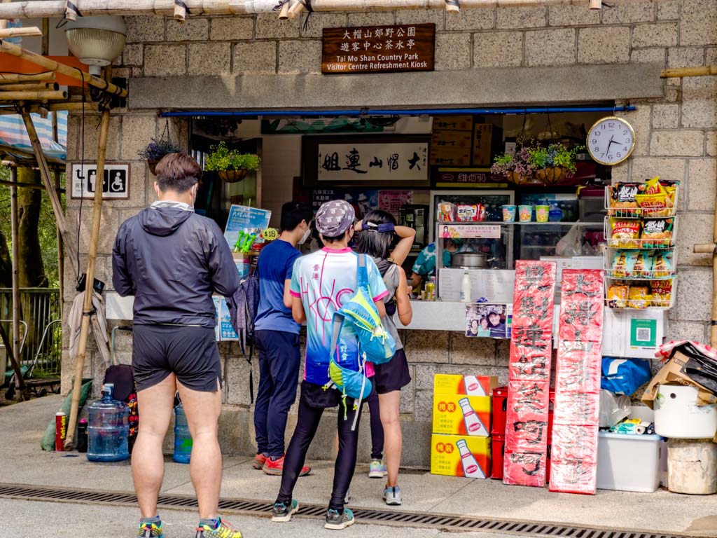
There is a snack stand run by Aunt Lin by the Tai Mo Shan visitor center. If you end the hike this side, you can eat a bowl of her famous Tofu Fa as a treat.
They also sell other standard snack stand fares like fish siu mai and various drinks. She also has her own Facebook page.
Opening times: daily 8:00 – 18:00 (though it might be different under COVID)
Address: Hong Kong, Tai Mo Shan, 香港大帽山荃錦公路大帽山道
How to go to Tai Mo Shan from Tsuen Wan
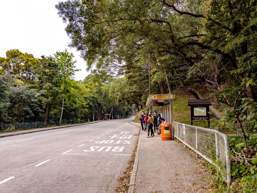
Take the bus 51 which stops by the Tai Mo Shan visitor center. More on how to get to Tai Mo Shan below.
Where is the Tai Mo Shan hike starting point?
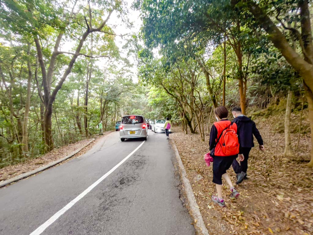
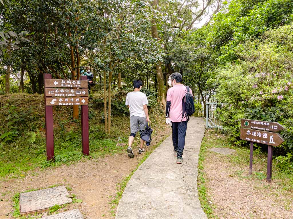
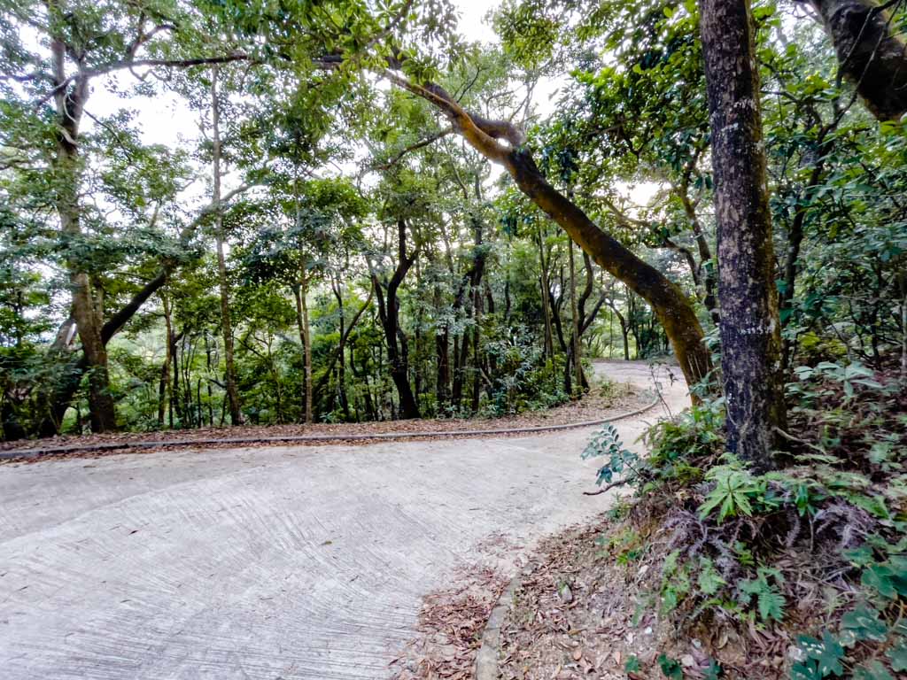
While there are many Tai Mon Shan hike route, a lot of them connects to McLehose Trail Stage 5, which is a concrete road. It leads to Road Twist, where there is a visitor center as well as the snack stand, and a bus stop. It’s a great place to start or end the hike – personally, I think it’s a better ending point.
Is hiking Tai Mo Shan difficult?
If you are looking for the Tai Mo Shan easy hike, 1 and 2 are both good choices, but it’s far easier to drive up there, park, and walk to the summit.
How to Get to Tai Mo Shan
The various Tai Mo Shan trails all have different starting and ending points, but since they converge on Tai Mo Shan, you can go up and down any of them as you like.
In general, you would start from either Tsuen Wan or Tai Po. The bus 51 that runs between Tsuen Wan and Sheung Tsuen going past the Tai Mo Shan Country Park bus stop on Route Twisk being the easiest way out.
The Tai Mo Shan hike difficulty depends on which route you take – I’m going to start from easy to hard. The first two is very suited for a Tai Mo Shan drive!
1. Hidden Tai Mo Shan Hike
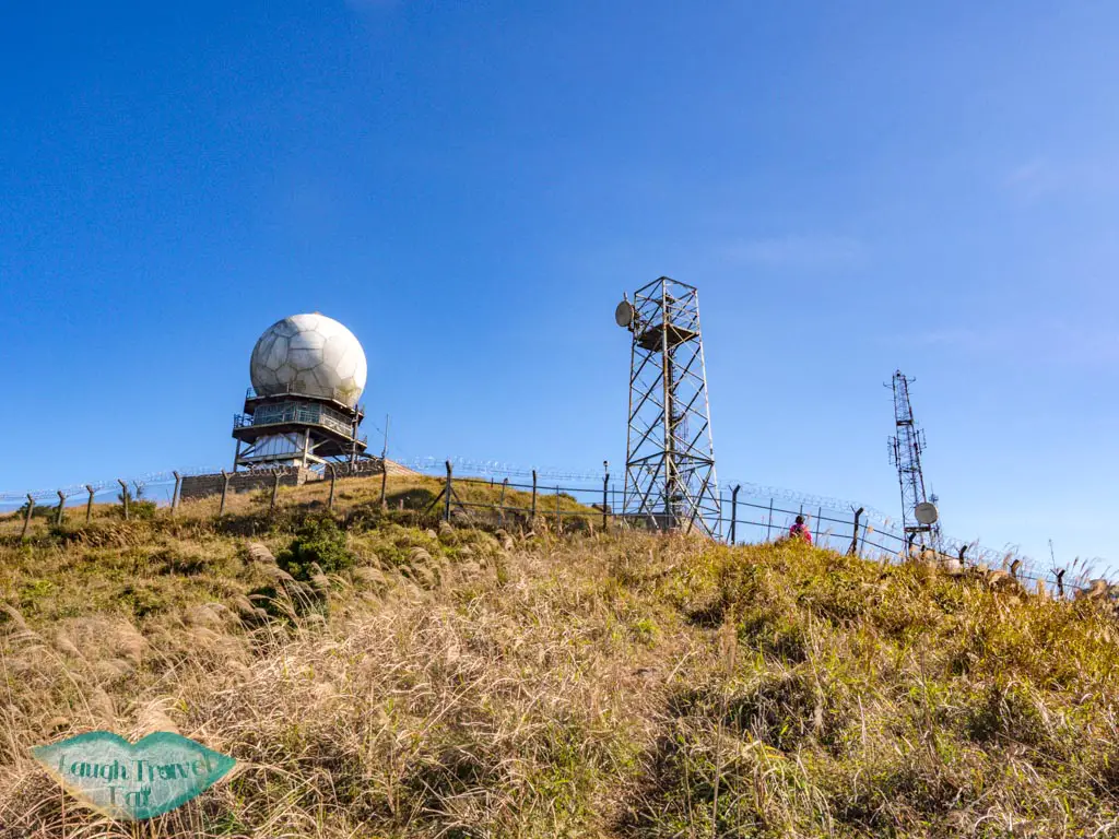
Note: you CAN’t go to the weather station at the top with this hike, but it’s gorgeous to hike between November – January.
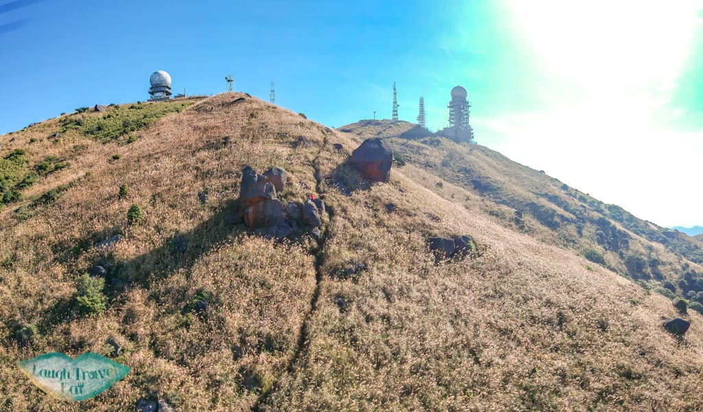
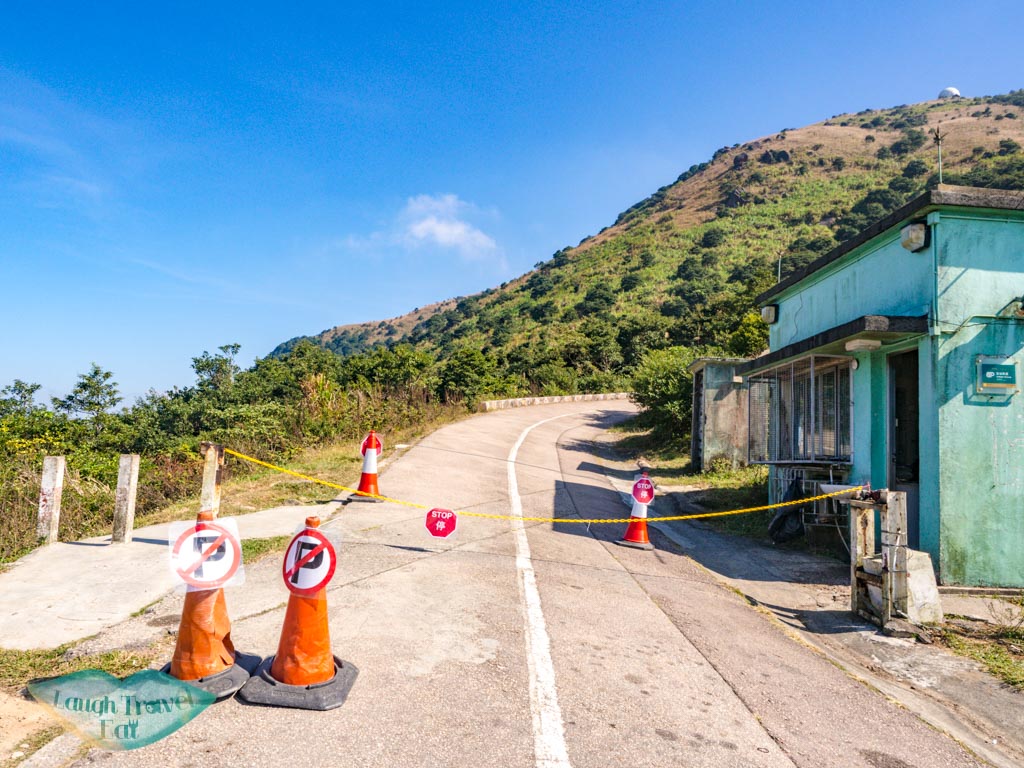
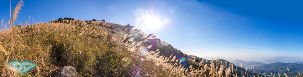
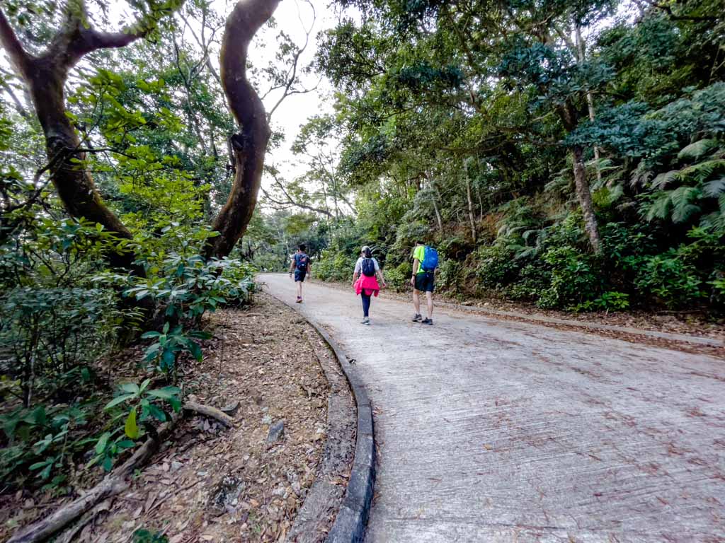
While most hikes to Tai Mo Shan aim to arrive on MacLeHose Trail stage 8, which is a concrete trail, there’s a hidden hike that’s perfect for silver grass lovers. To hike this route, it’s fastest to go up from Route Twisk until you reach Wo Tong Kong (702m).
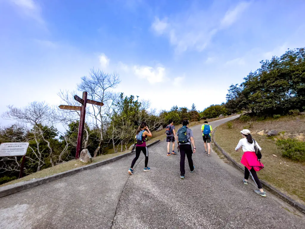
As you go past the bend from Wo Tong Kong, there’s a small hill that’s almost like a platform to the right where people can admire the view.
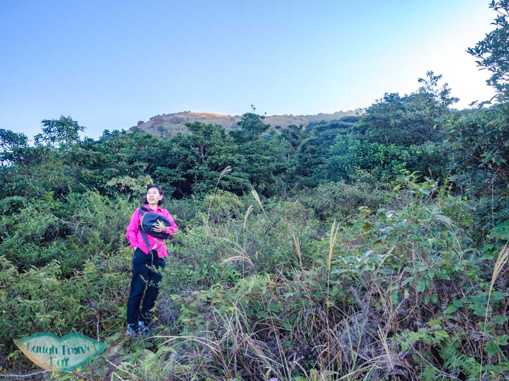
Right across from it is an obscure path that leads up to Tai Mo Shan on the western side. It’s a bit hidden and a silver grass heaven from November to almost January.
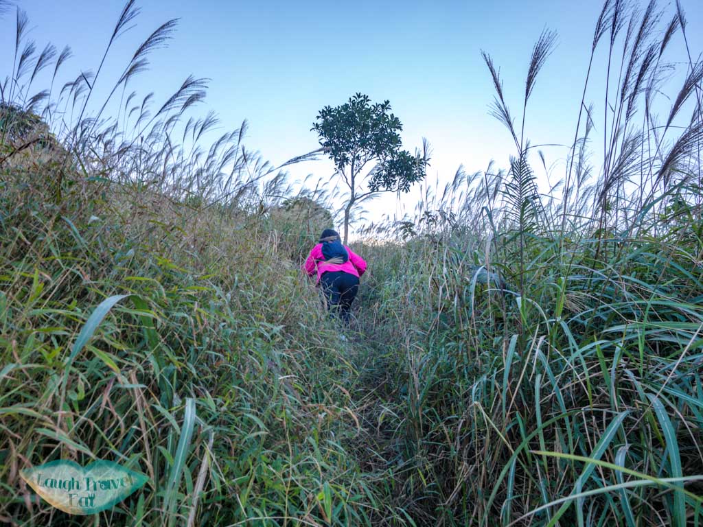
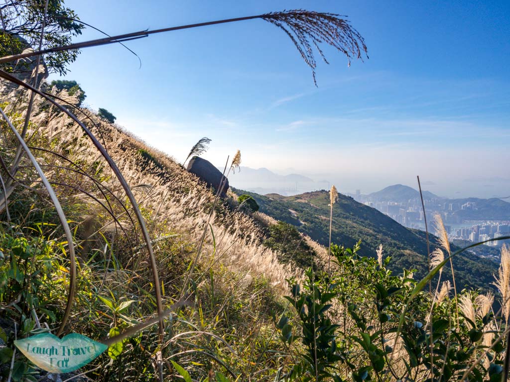
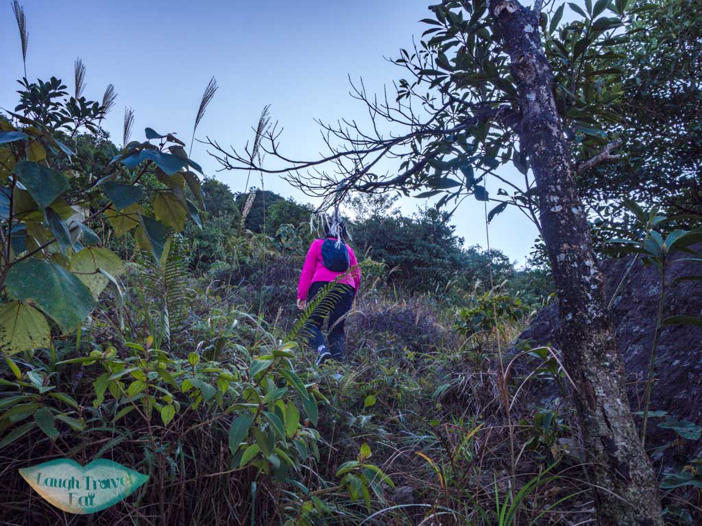
This trail is pretty steep, first going up in shrubbery then a narrow path marked by a few lone trees in the middle. There are ribbons to follow and pretty quickly it would emerge into a sea of silver grass.
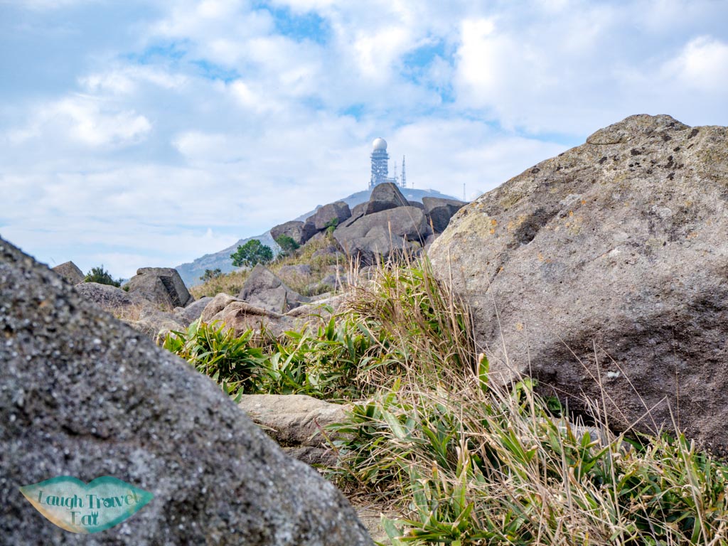
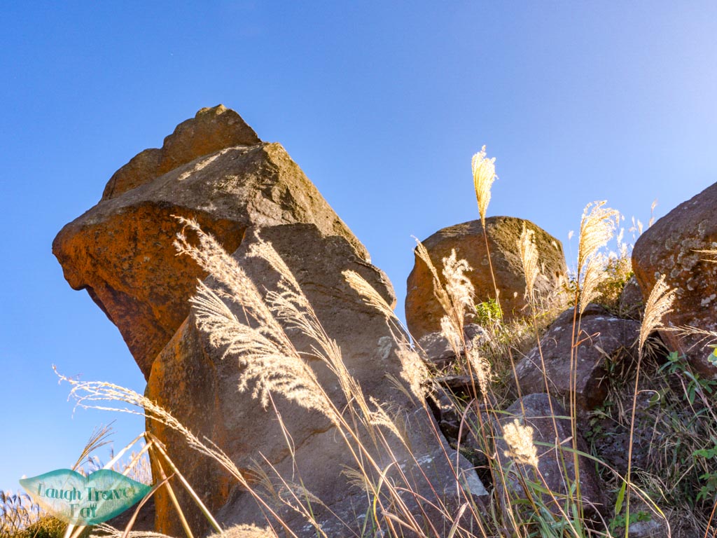
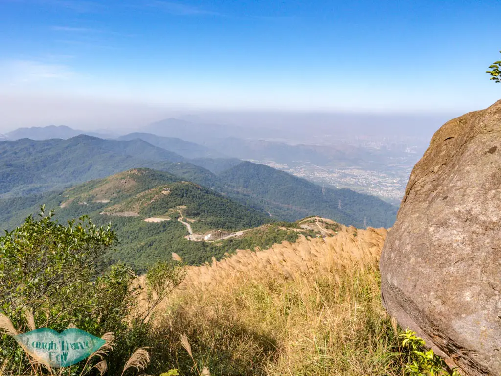
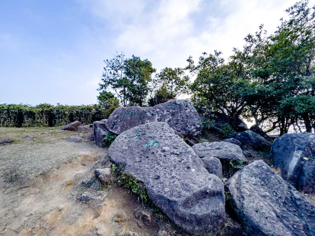
There are a few giant rocks that act as an interesting landmark and after the last one, the peak is in view and you can see towards the western part of Kowloon and Hong Kong Island clearly, as well as all the way to Shenzhen behind.
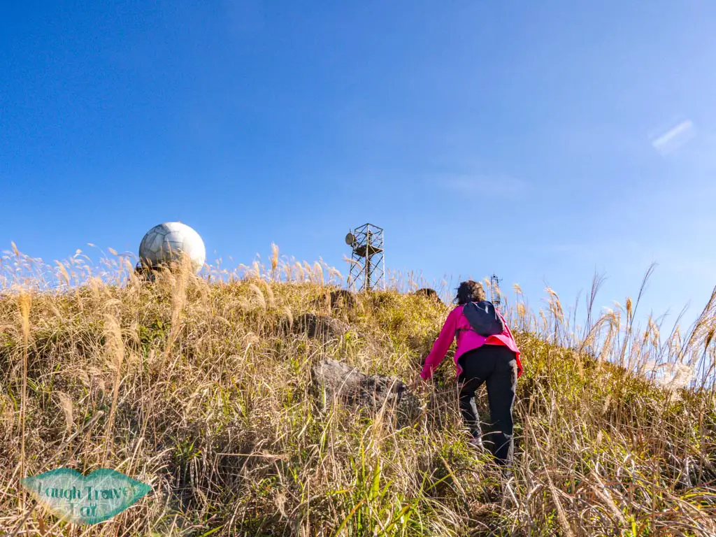
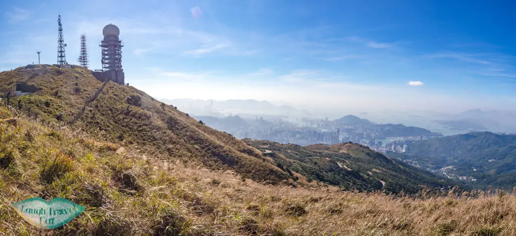
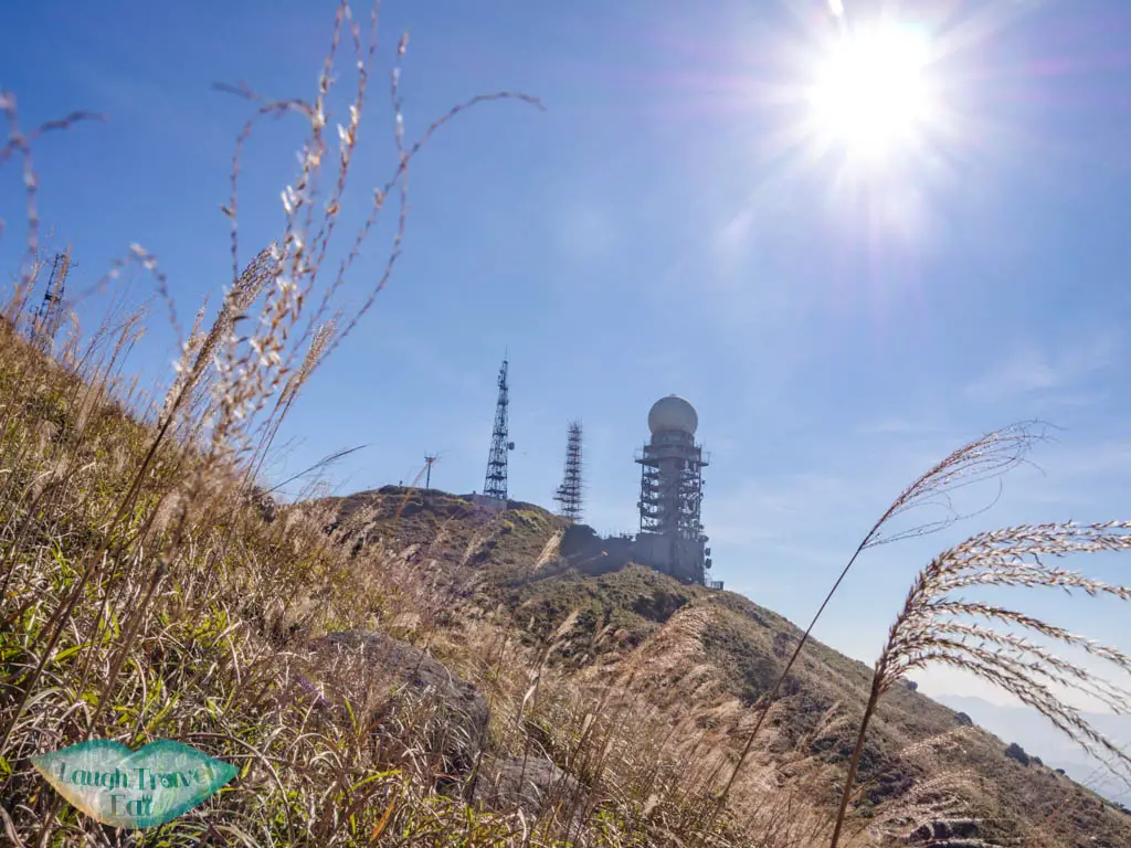
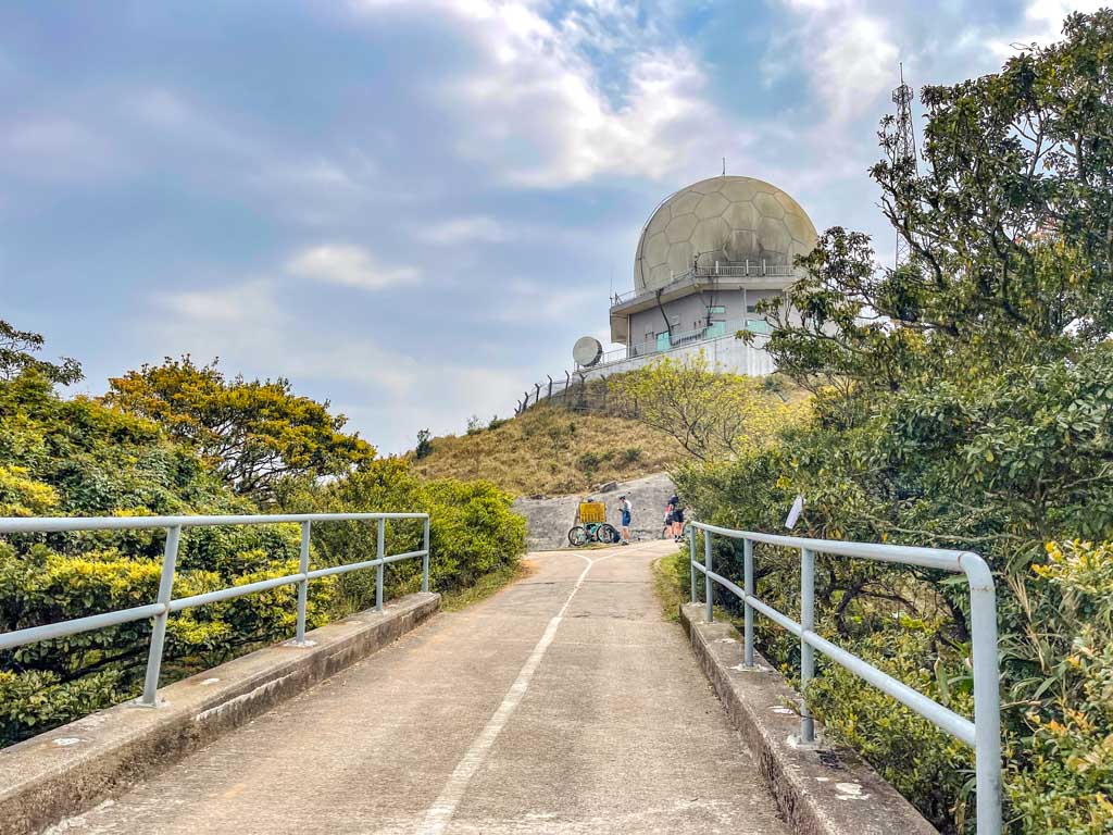
As mentioned before, the top of Tai Mo Shan is fenced off.
There seemed to be a trail that can loop back to the front, where you can probably join up to MacLehose Trail Stage 8, but we opted to go back down as it is faster and easier.
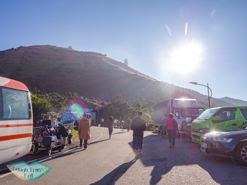
How to get there: you can take the bus 51 to Tai Mo Shan Country Park and hike up, or drive all the way up. Do note that parking space is limited, and it’s best to get there early. Alternatively, there’s also a parking lot just past the Tai Mo Shan Lookout entrance to the right as you drive in that’s easily missed.
Time taken: 2 hours to and from Wo Tong Kong, add 1.5-2 hours from the bus stop
Difficulty: 3/5 as long as you wear proper hiking shoes
Pros: exceptional density of silver grass and relatively crowd-free
Cons: the trail is overgrown and you have to retreat the same way
2. MacLehose Trail Stage 8 Tai Mo Shan hike
The MacLehose Trail Stage 8 refers to the stretch between Lead Mine Pass in the east to Route Twist on the west, and is another popular way to hike Tai Mo Shan. It’s also the Tai Mo Shan sunrise hike route since it’s easy to hike in semi darkness.
You can hike it in either direction, it actually starts with the Wilson Trail stage 7, going up from the Tai Po side to Lead Mine Pass.
The MacLehose Trail stage 8 starts from there, going past Sze Fong Shan to Sze Fong Shan Au and up Tai Mo Shan.
How to get there: take the minibus 23K from Tai Po Market station to end stop San Uk Ka, then hike south along Wun Yiu Road until you find W087 which marks the start of Wilson Trail that goes up to the Lead Mine Pass, where it joins the MacLehose Trail Stage 8.
3. Ng Tong Chai Waterfalls Tai Mo Shan Hike
The Ng Tung Chai Waterfalls starts at Tai Po and goes up to Tai Mo Shan via Sze Fong Shan Au, approaching the Tai Mo Shan from the east side.
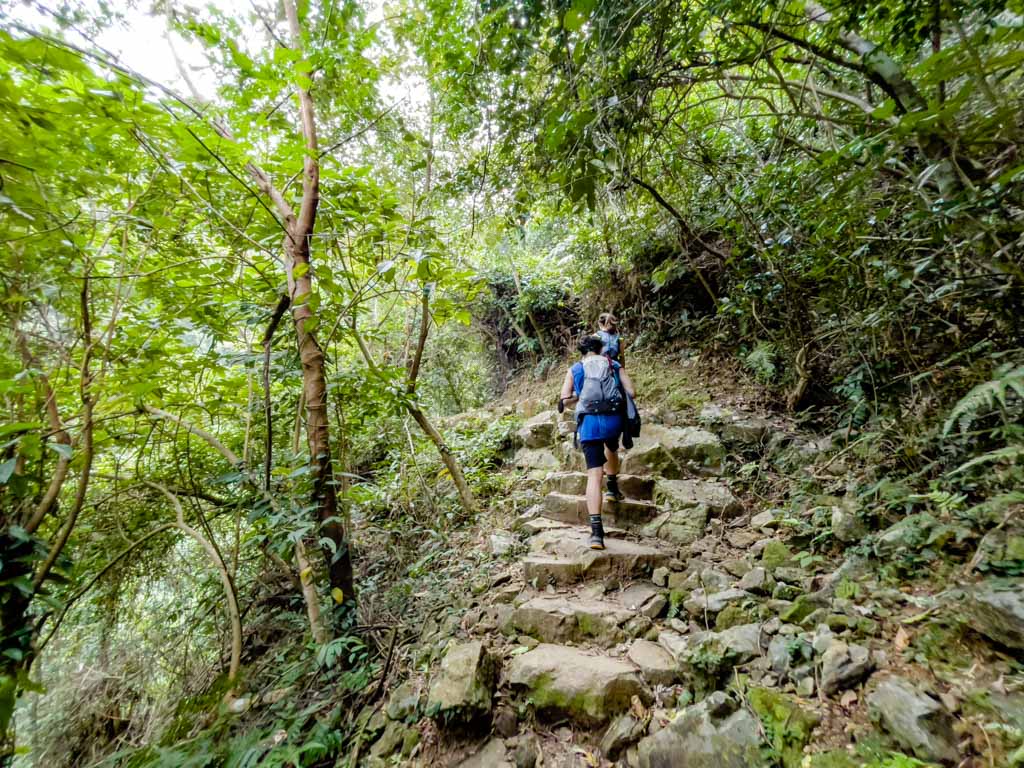
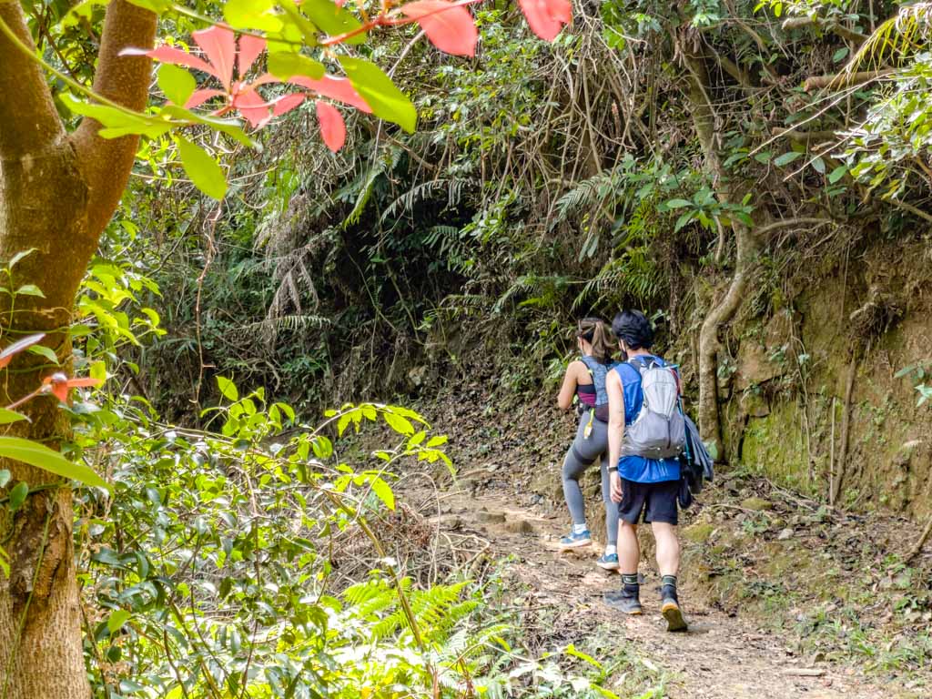
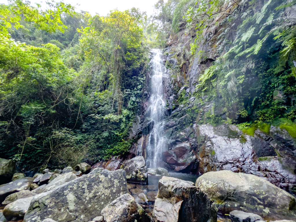
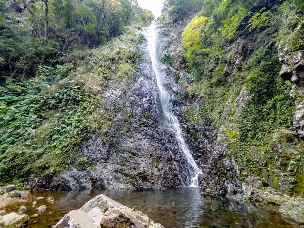
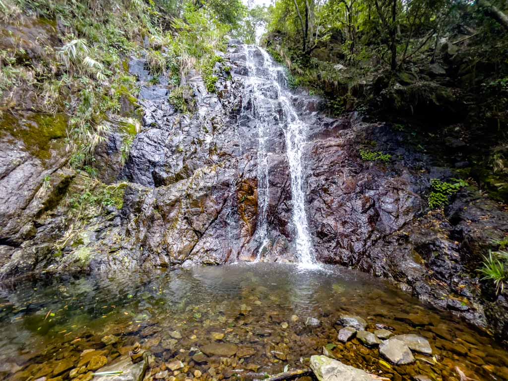
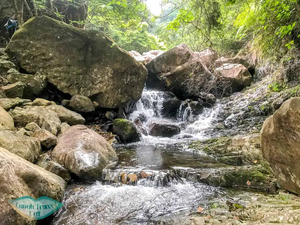
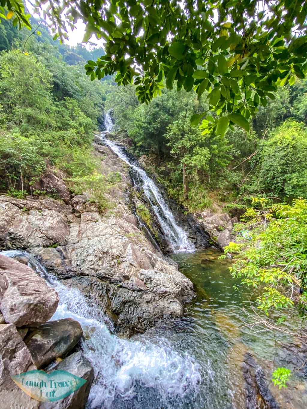
It’s a scenic hike that leads you past four waterfalls along a jungle-like trail with a stone-paved path mostly in the shade. The four waterfalls are Bottom, Middle, Main, and Scatter, although there are a few others along the stream, too.

Bottom Fall Middle Fall
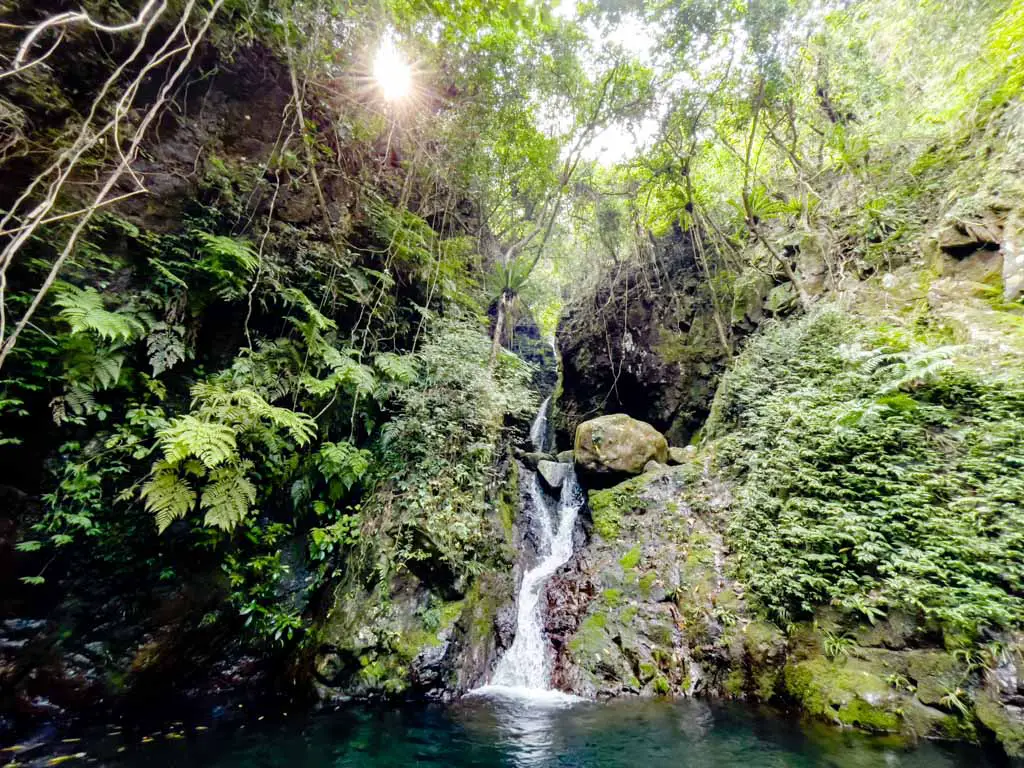
Main Fall Scatter Fall
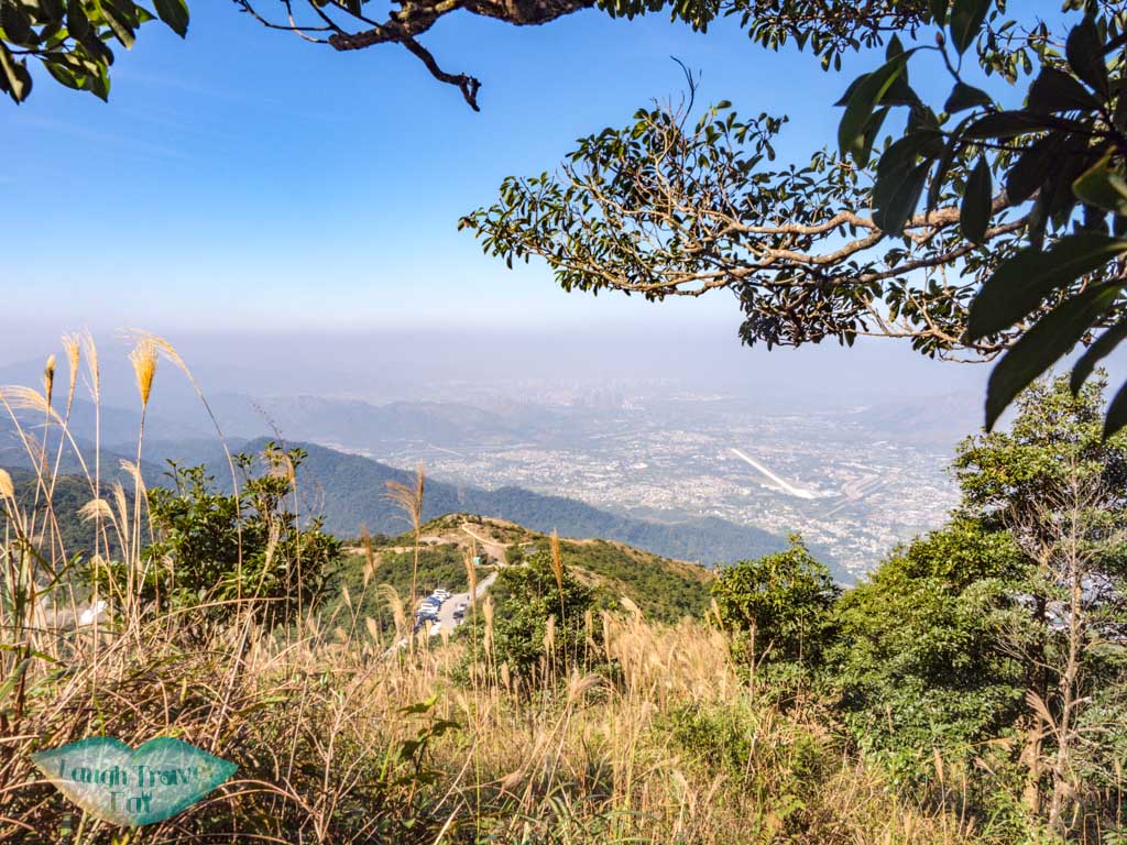
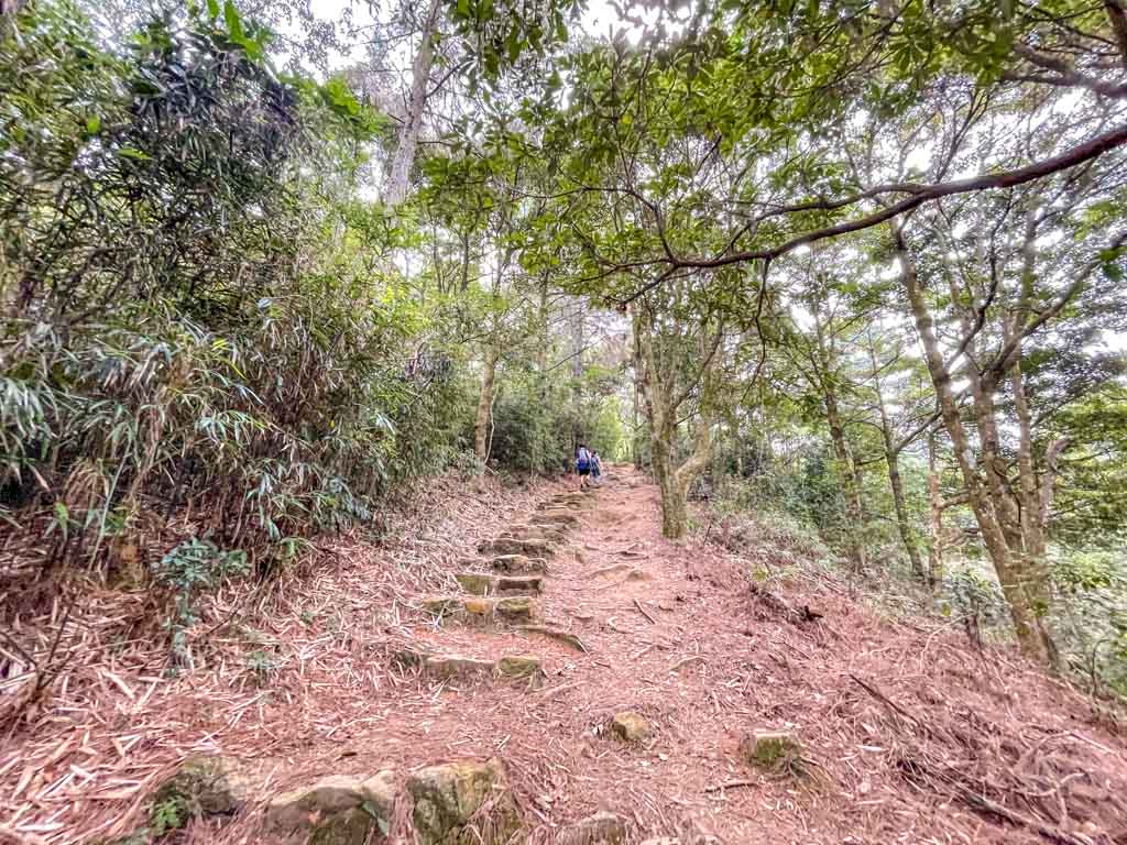
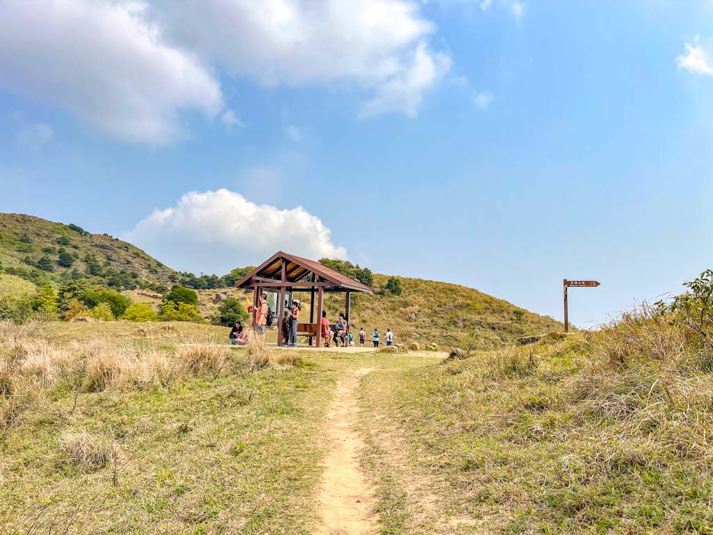
From the junction at the top of the hike, you can continue up to Tai Mo Shan. It’s a long hike up to the Sze Fong Shan Au, which joins the Tai Mo Shan Forest Track. You can take a break at the pavilion first before continuing up on the tarmac road.
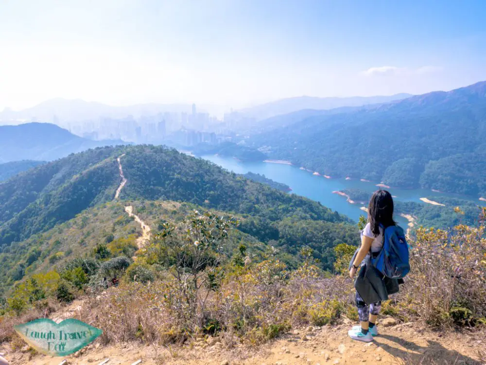
The Needle-Grass-Tai Mo Shan trail also comes up this side, and when you’re at Sze Fong Shan Au, you can see Needle Hill and the Shing Mun Reservoir.
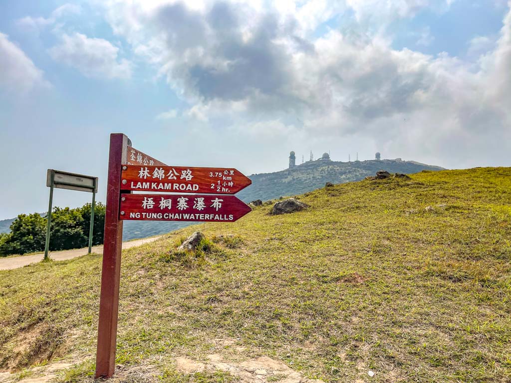
The fastest way to get out from Tai Mo Shan is to go down to the visitor’s center along the tarmac road which is also part of the MacLehose Trail.
It leads down to the Tai Mo Shan Country Park Visitor Center by Route Twisk, where there is a snack stand.
How to get to Ng Tong Chau Stream:
Take the 64K bus from Tai Po Market East Rail station to Ng Tung Chai Bus Stop. From the bus stop, go back the way you came on the Lam Kam Road until you see the second road to the right.
Time taken: this is a longer route and would take about 5 hours. I recommend going down to Route Twisk to get bus 51 out.
Difficulties: 3.5/5 mostly for the steepness. Stairs can be slippery during the wet season
Pros: hit two birds with one stone with waterfalls and Tai Mo Shan
Cons: longer than some of the other trails
4. Tai Shing Stream Tai Mo Shan hike
The Tai Shing Stream ends pretty close to Tai Mo Shan at Fat Mak Rock, where you can hike up to Sze Fong Shan Au that joins the MacLehose Trail Stage 8 route to Tai Mo Shan.
Our hike up Tai Shing Stream last time ended abruptly due to sudden rain, so we didn’t make it all the way up to see.
As always, I recommend downloading an offline map for your hikes – I use OSMAnd.
5. Needle-Grass-Mo Hike
This is the most challenging Tai Mo Shan hiking trail. It combines the MacLehose Trail Stage 7 and 8, starting at Shing Mun Reservoir and going up to Needle Hill, then to Grass Hill, before turning to Lead Mine Pass.
Instead of going down to Shatin, you can carry on the concrete trail and go up the Grass Hill path when you reach a junction. Most people tend to skip Grass Hill because it’s just a concrete trail up and not that fun.
The path to the left leads down to the Lead Mine Pass
You don’t have to go to Grass Peak to go down to Lead Mine Pass, which leads to Sze Fong Shan and then Tai Mo Shan. But it’s nice to hike up if you’ve never been before.
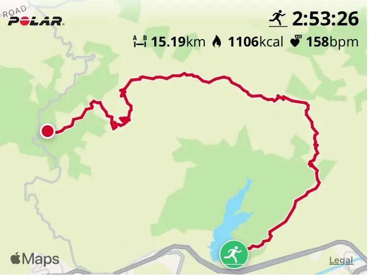
This is a popular trail for trail runners and it can be done in under four hours, if you run, that is. This is the Needle-Grass-Tai Mo Shan map from my sister’s hike. Although it usually takes a lot longer if you don’t run. So beginners shouldn’t attempt this together!


