One of the most famous hiking trails in Hong Kong is the MacLehose trail, and MacLehose trail stage 4 is my favourite. It’s is a stretch of 100 miles path that cut across New Territories and Kowloon, meandering roughly east-west. Because of its length, it’s separated into stages and Stage 4 is my favourite (not that I have been to every section of the trail). MacLehose Trail Stage 4 is located in Ma On Shan, straddling over the Ma On Shan and Sai Kung region. this also happens to be fairly close to where I live, which makes it a convenient trail for me to go!
Contents
Mmaclehose trail stage 4 Hike Summary
Difficulty: 3.5/5 – it does have a steep uphill climb
Time: 3-4 hours
Pros: a beautiful hike and the option to go up Pyramid Hill
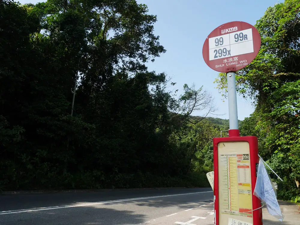
The bus stop to get off at – with the name Shui Long Wo.
The Maclehose trail stage 4 starts at either the Ma On Sha Country Park or Shui Long Wo, it is probably for the best if you start at the remote part (Shui Long Wo) first. There is only one way in: by bus.
Bus number 99, or 299X from Shatin and get off at the Shui Long Wo Stop. The buses all ends at Sai Kung, but you don’t want to go there this time.
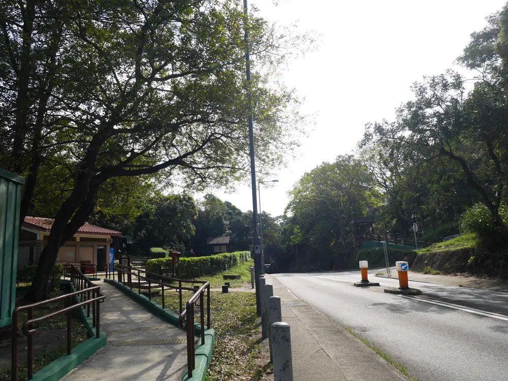
From the bus stop, continue walking along the same direction as the bus until you reach the public toilet – this is your last toilet stop.
The public toilet is on the left – your last loo stop, and the trail starts across the road!
The trail starts across the road.
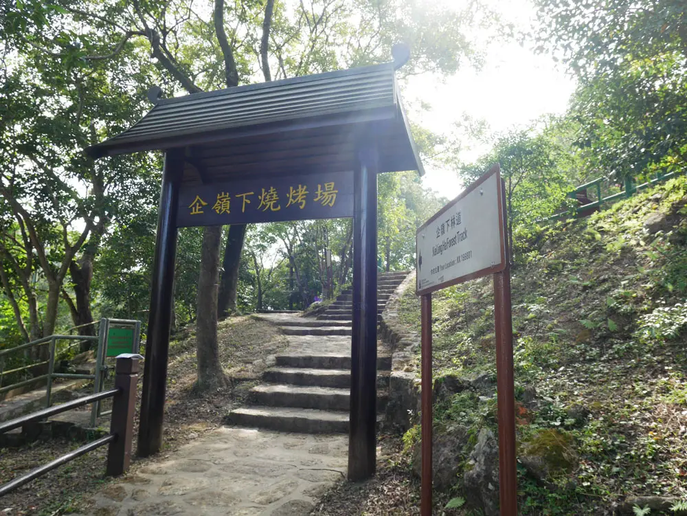
Maclehose trail stage 4 trail start
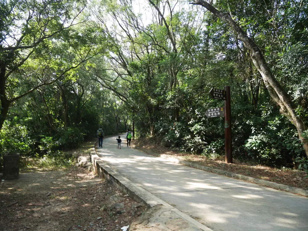
This is the trail you will start at towards the Shui Long Wo campsite pass the barbeque area!
The first part of the trail is on tarmac road. You’ll pass the Shui Long Wo Campsite. This part of the trail runs uphill and is relatively monotonous. The MacLehose Trail stage 4 is well marked with small signpost along the way, so there is little chance you’ll get lost.
The majority of the route looks like this in the beginning.
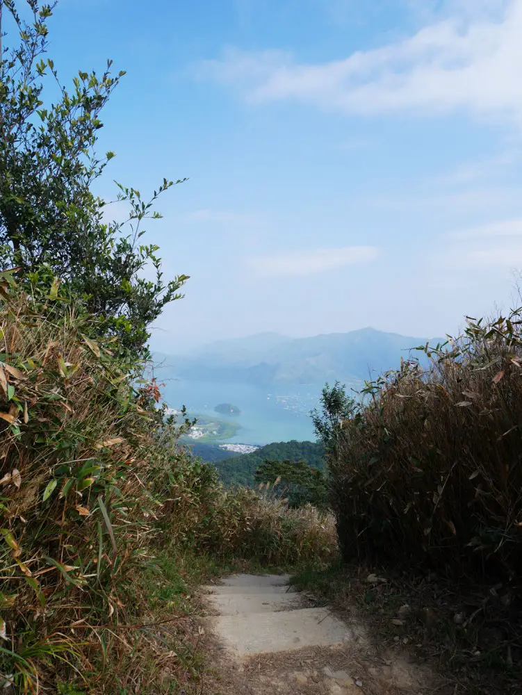
You start to catch a glimpse of the Sai Kung sea as you head up a long flight of concrete stairs!
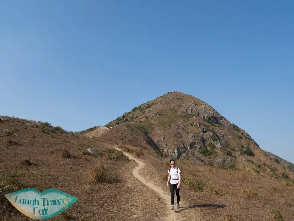
Once you reach a set of stairs, you can see the view of Sai Kung Bay behind and Ma On Shan in front. This marks the start of the scenic part.
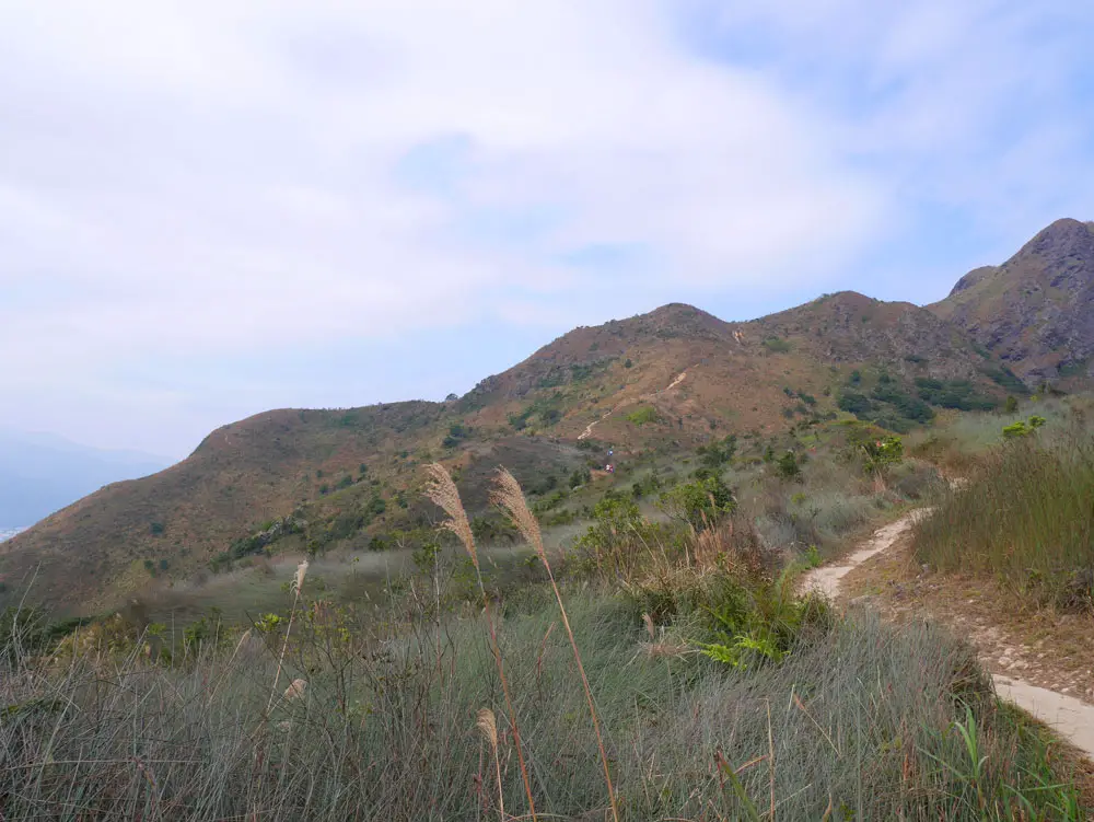
After the stairs, you’d quickly reach a more clear path along the top of the hills
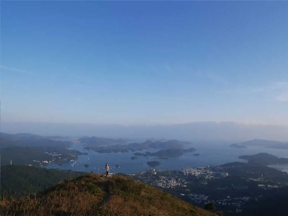
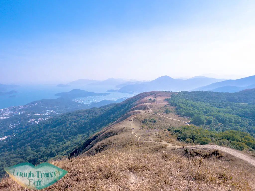
The glorious view from the ridge – can’t get enough of it! We’ve once seen a couple doing their wedding shoot here.
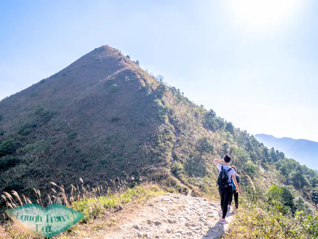
The ridge doesn’t have a name, save for the fact that it’s the section of MacLehose Trail Stage 4 that’s in front of the Tai Kam Chun aka Pyramid Hill.
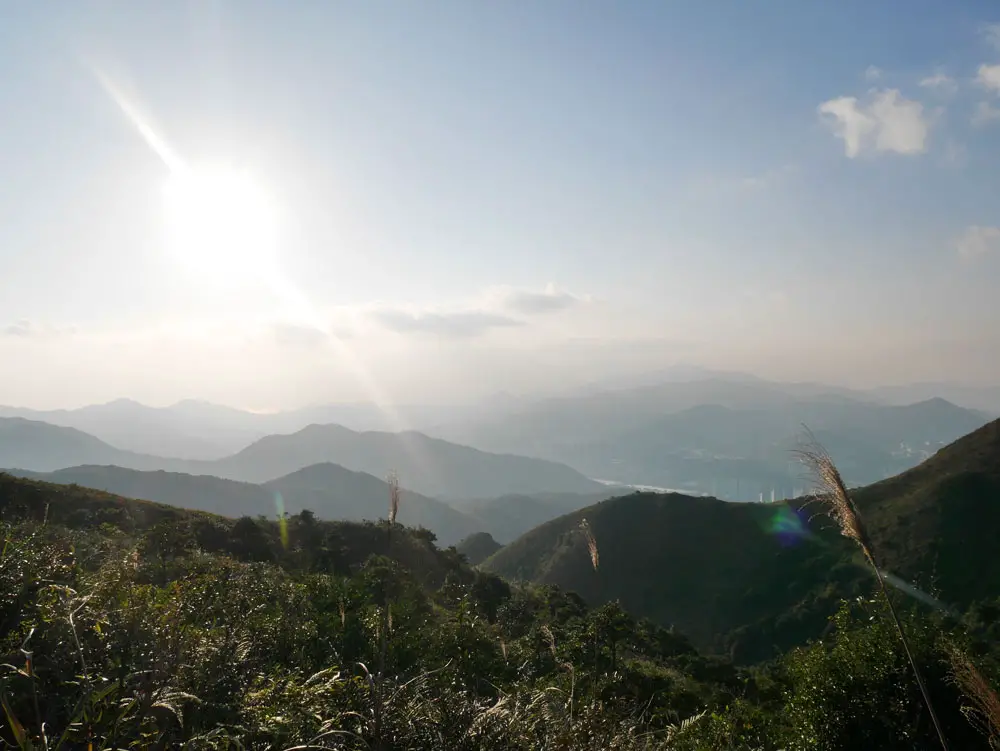
You can just make out Shatin on the other side!
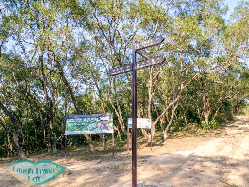
If you continue to follow the MacLehose Trail, you would be going down and eventually reach a small pavilion where five paths converge.
The intersection
Depending on where you want to end up, you can continue the hike or take the one heading north – the Ma On Shan Country Trail, which is the first one to the right.
Bonus: Pyramid Hill
(added 2/3/2018)
Would you?
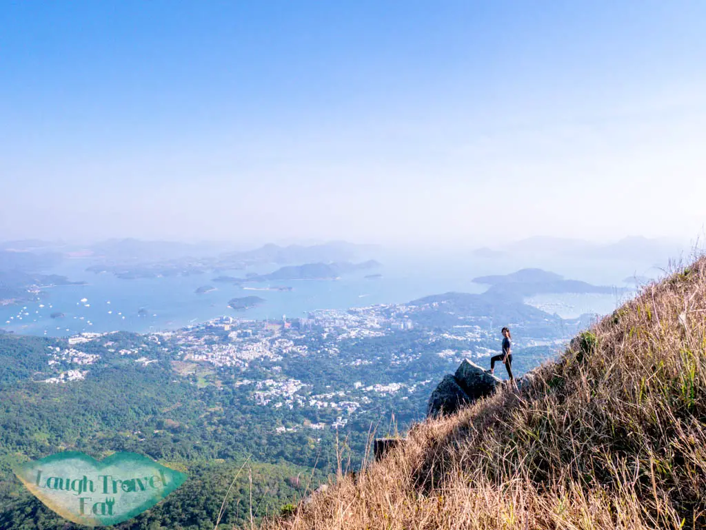
You can also hike up Pyramid Hill, also known as Tai Kam Chun, which offer a spectacular vista of the Ngong Ping (not the one on Lantau Island). The hike up was less difficult than I imagine, with the path being shorter and more solid than expected. once you reach the summit, don’t miss this little photo spot gem:
This was right along the last flat-ish stretch to the peak
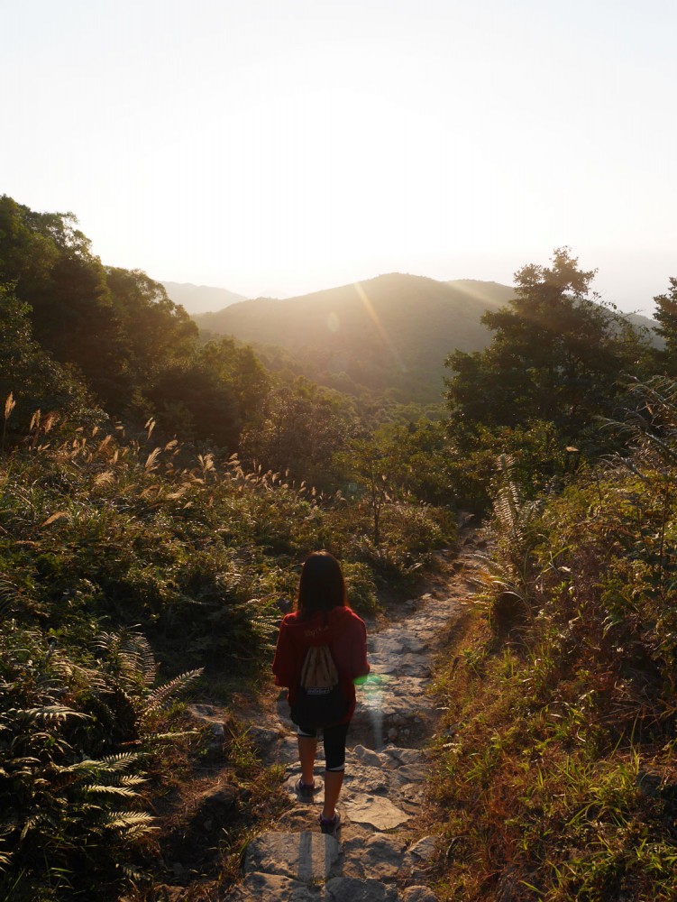
From there, I would thoroughly recommend turning back and going down the same path because the descent to Ngong Ping was extremely slippery and steep. It is much easier to go up there than to go down, and this path is also much longer.
The view of Ngong Ping
What it looked like from the other side
If you did indeed come down here, simply go forward and right to the main path and doubles back. You will join back up to the trail to Ma On Shan Village at the intersection.
Getting out of Maclehose trail stage 4 to Ma On Shan Village
It’s mostly stairs back towards the pavilion then to the Ma On Shan Country Park
This part of the trail is all downhill and easy, and you’ll pass a river then the Ma On Shan Village. The village is a remnant of the mining past and still inhabited. They have a museum and café if you are interested in learning more.
After passing the village, you’ll cross a bridge and be back at the Ma On Shan Country Park.
Getting out of Ma On Shan Country Park
There is a very sparse minibus service from Ma On Shan Village to go down, but otherwise, your best option is to walk down along the Ma On Shan Tsuen Road. There is no pavement and the road is not wide enough for two-way traffic, so you need to be careful. The road will take you back near the Ma On Shan city center.
Pin me!
Nam Cheah
Hi, my name is Nam. I am 24 and spent half my life in Hong Kong and the other half in UK. I believe there's endless experience and beauty in the world and this is me chronicling how to experience the best at the best price.
2 thoughts on “MacLehose Trail Stage 4 – Shui Long Wo”
It is amazing how many good hikes there are in Hong Kong. People think they are visiting an metropolis full of sky scrappers (which they are!) but don’t realise how green the place it.


It is amazing how many good hikes there are in Hong Kong. People think they are visiting an metropolis full of sky scrappers (which they are!) but don’t realise how green the place it.
You really do get the best of both worlds in Hong Kong! I still have a list of hikes I need to do even after a year back!