Asia, Hike and Nature, Hong Kong
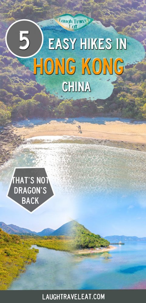
Easy hikes in Hong Kong that aren’t Dragon’s Back
Mar
Looking for easy hikes in Hong Kong? While many find it hard to believe that there beautiful hikes in Hong Kong, there are plenty of great easy hikes in Hong Kong that you shouldn’t miss.
Whether you are a die-hard Hong Kong islander or willing to go further afield and see the beauty of New Territories or just meeting friends in the middle of Kowloon, below are my top easy hiking trails in Hong Kong that isn’t Dragon’s Back. They are all pretty short hikes, too, generally under three hours.
Pssst: see a list of hikes I’ve been on in Hong Kong here.
Table of Contents
Easy Hikes Hong Kong FAQ
There are quite a few frequently asked questions regarding easy hiking trails in Hong Kong and about hiking in Hong Kong in general:
Is it safe to hike alone in Hong Kong?
Yes, Hong Kong is a perfectly safe city but I don’t recommend beginner hikers to venture out on their own. It is generally better to stick to popular or well-established trails when hiking solo, and most of the hikes on the list are fine.
Where can I hike alone in Hong Kong?
If you are going to hike alone, stick to the popular trails like MacLeohose, Wilson, Hong Kong Trail. If it’s not a paved trail with signs, then avoid going alone.
Is Hong Kong a good place for hiking?
Absolutely – there are so many hikes in Hong Kong spread out across the city that I haven’t hiked all the ones I want! We have the best of both worlds with city views and sea views –
What is the hardest hike in Hong Kong?
If you are looking for the hardest hike in Hong Kong (what are you doing here?) – the 134 hike in Sai Kung and the Devil’s Fist hike in Tai Po are the ones to tackle. Only for those prepared and have sufficient supplies, though!
> See more Hong Kong hikes here
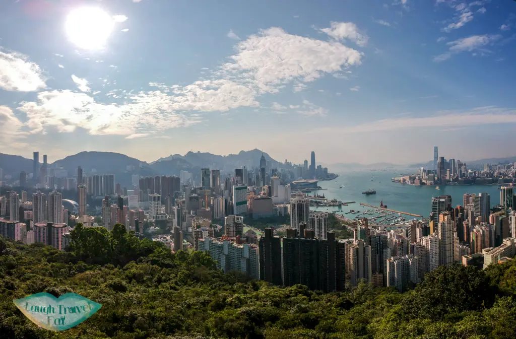
Easy hikes on Hong Kong Island
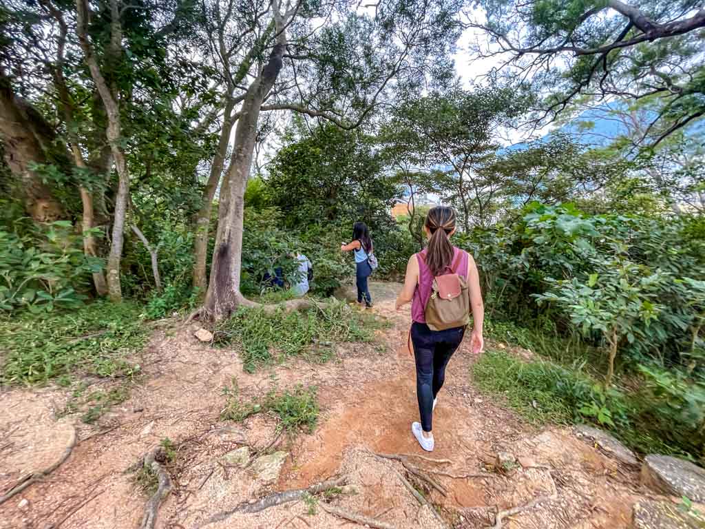
Hong Kong Island is built on the foot of the mountains which means there are plenty of trails – some of them the best easy hikes in Hong Kong in terms of accessibility – near the city center. A lot of them are paved and well-trafficked, making them suitable for solo hikers, too.
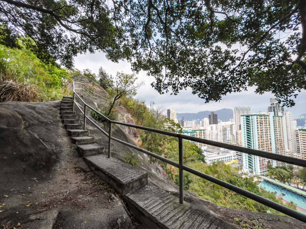
Red Incense Burner Summit
A popular spot on Hong Kong Island, the Red Incense Burner Summit is called Hung Heung Lo Fung or Braema Hill (although it technically isn’t Braema Hill, I don’t think). The shortest and sweetest of all the easy hiking trails in Hong Kong, it is only 10-20 minutes walk from the nearest minibus stop, making it ideal for a walk on a whim.
The hike is a combination of concrete stairs, wood trails, which is a little confusing so make sure you have a map or follow my full instructions. It is also popular for night views, but be careful around the summit which consists of boulders and can get crowded.
Difficulty: 1/5 but the ground can get slippery
Duration: the hike is short but budget around 1-2 hours, can be extended to a 3 hour hike.
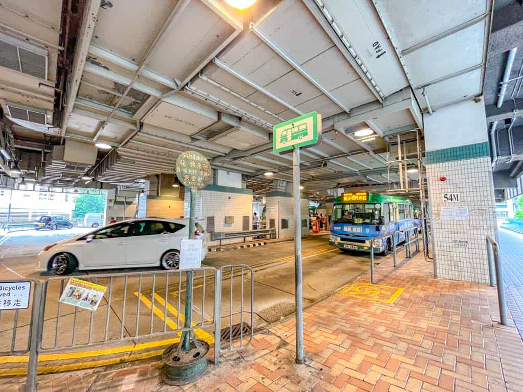
How to get there: Take the Minibus 25 from Causeway Bay to Braemar Hill. The minibus stop is across from Fashion Walk on Paterson Street, right outside MCL JP Causeway Bay Cinema. It runs regularly.
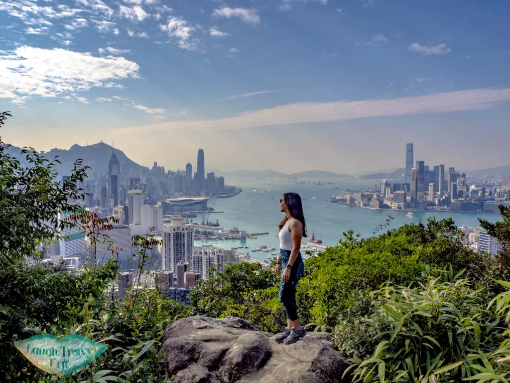
High West Hill hike (and Lugard Road)
While the Peak on Hong Kong island is famed for its view and reachable via the tram or a bus, you can go for a rewarding walk (yes, walk!) on Lugard Road. Seriously, it’s such an easy hike in Hong Kong that I added High West Hill because Lugard Road is way too easy.
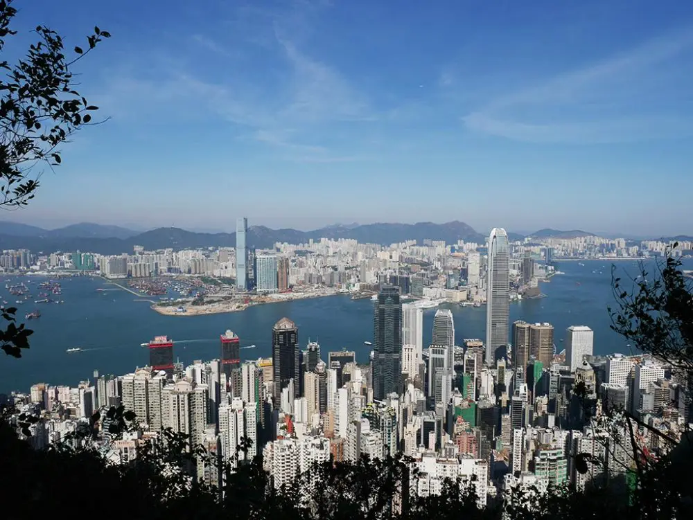
The trail starts on the edge of the Peak Tower and loops around the mountainside. A mere 15-20 minute walk gives you a full panorama of the Victoria Harbour, Kowloon Peninsula, and further west to Tsing Yi!
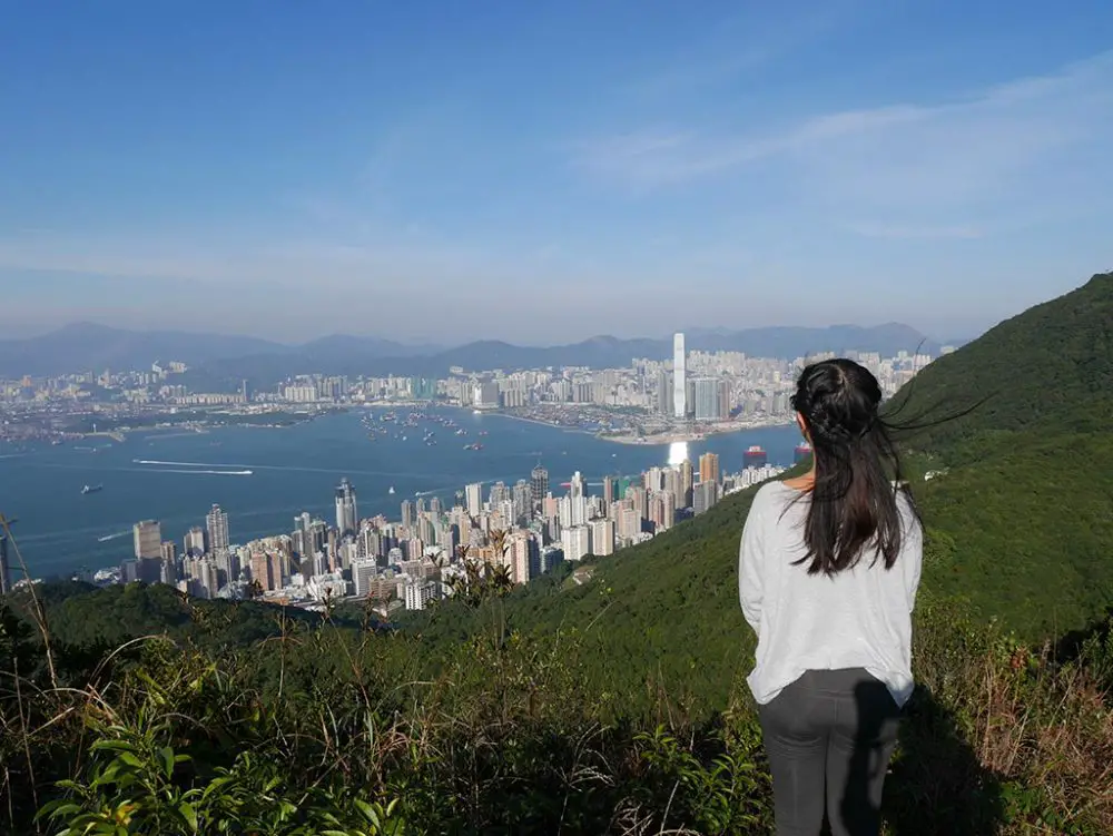
West High Hill is THE highest mountain on Hong Kong Island and while there is a lot of stairs going up, it’s a short journey from a junction reached by Lugard Road. Here is how to hike West High Hill.
Difficulty: 2/5 because of the stairs
Duration: 2 hours should suffice including going up from Lugard Road. You can go down to the Peak again or continue down to Hong Kong University
How to get there: head up to the Peak – bus 15 from Admiralty can take you up to the Peak. If you have 3+ people, getting a taxi up is the best way. Lugard Road is just past the Peak Tower and you can carry on from there.
Wanchai Gap Hike
If you are looking for a challenging hike with some historical and scenic interest, Wanchai Gap is a great option. Located on the northern slope of Hong Kong Island, Wanchai Gap is a pass that connects Wanchai and Aberdeen. The trail offers a stunning view of the city and the harbour, as well as the tranquil Aberdeen Reservoir.
The trail starts from Wanchai MTR station and takes you towards the Old Wanchai Post Office, a colonial-style building that was built in 1912 and is now a declared monument. The trailhead is behind the post office, where you can follow a path up to the Wanchai Gap Road.
The climb is steep but rewarding, and you will pass by some historical sites along the way, such as the Pinewood Battery, a former coastal defence site that was built in 1905 and was heavily damaged during the Battle of Hong Kong in 1941. You can also visit the Police Museum, which is housed in the former Wanchai Gap Police Station and displays exhibits on the history and development of the Hong Kong Police Force.
From the Wanchai Gap Road, you can continue along the Aberdeen Reservoir Road, which will take you to the Aberdeen Upper Reservoir and the Aberdeen Lower Reservoir. These reservoirs were built in 1931 and 1932 respectively, and the hike ends in Aberdeen where you can do some sightseeing before catching the bus out.
Difficulty: 3/5 because of the steepness
Duration: 3 hours should suffice including exploring the historical sites and the reservoirs. You can go back to Wanchai MTR station or continue to Aberdeen via Aberdeen Country Park.
How to get there: take the MTR to Wanchai station and exit at A3. Walk along Queen’s Road East and turn right at Wan Chai Road. You will see the Old Wanchai Post Office on your left. The trailhead is behind the post office.
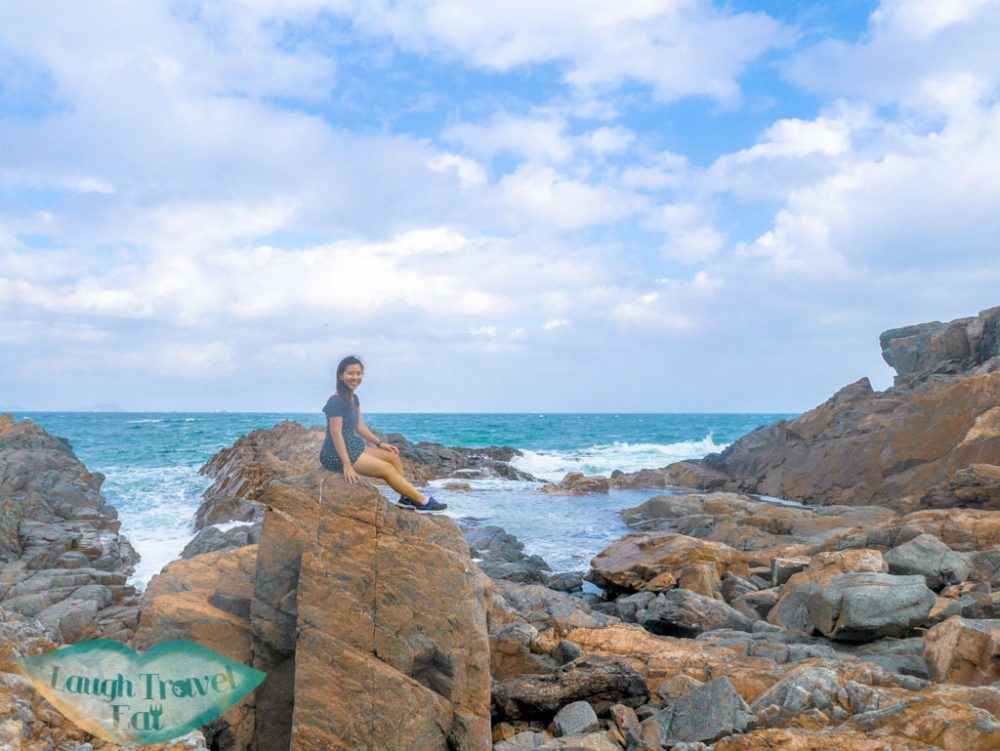
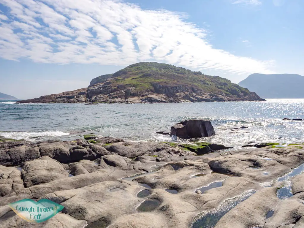
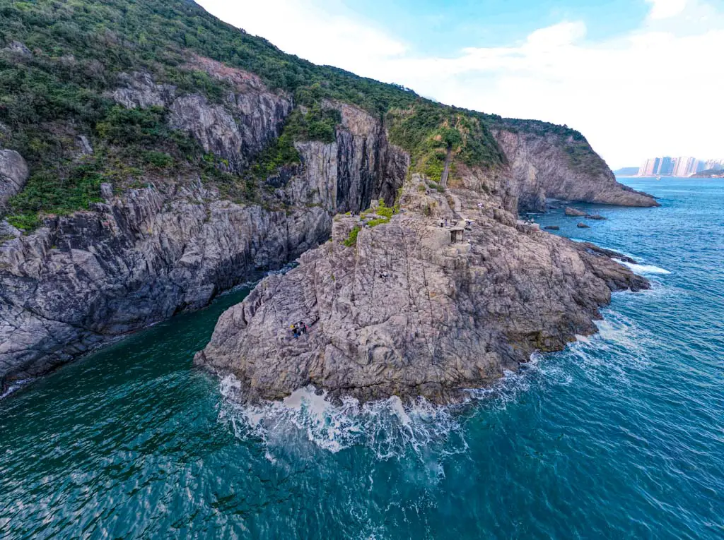
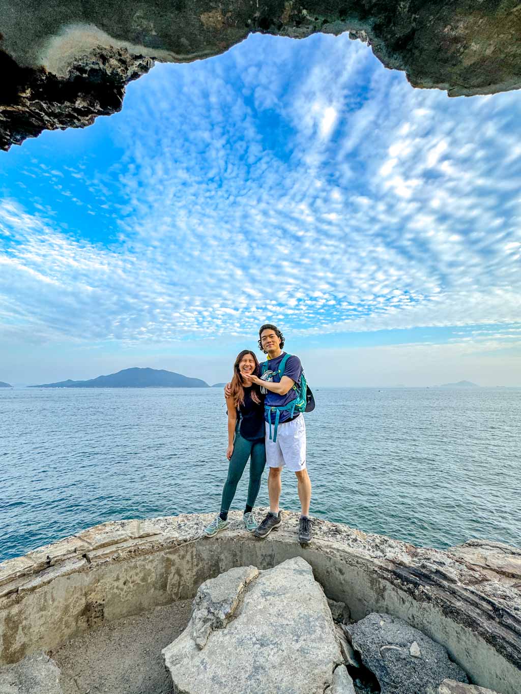
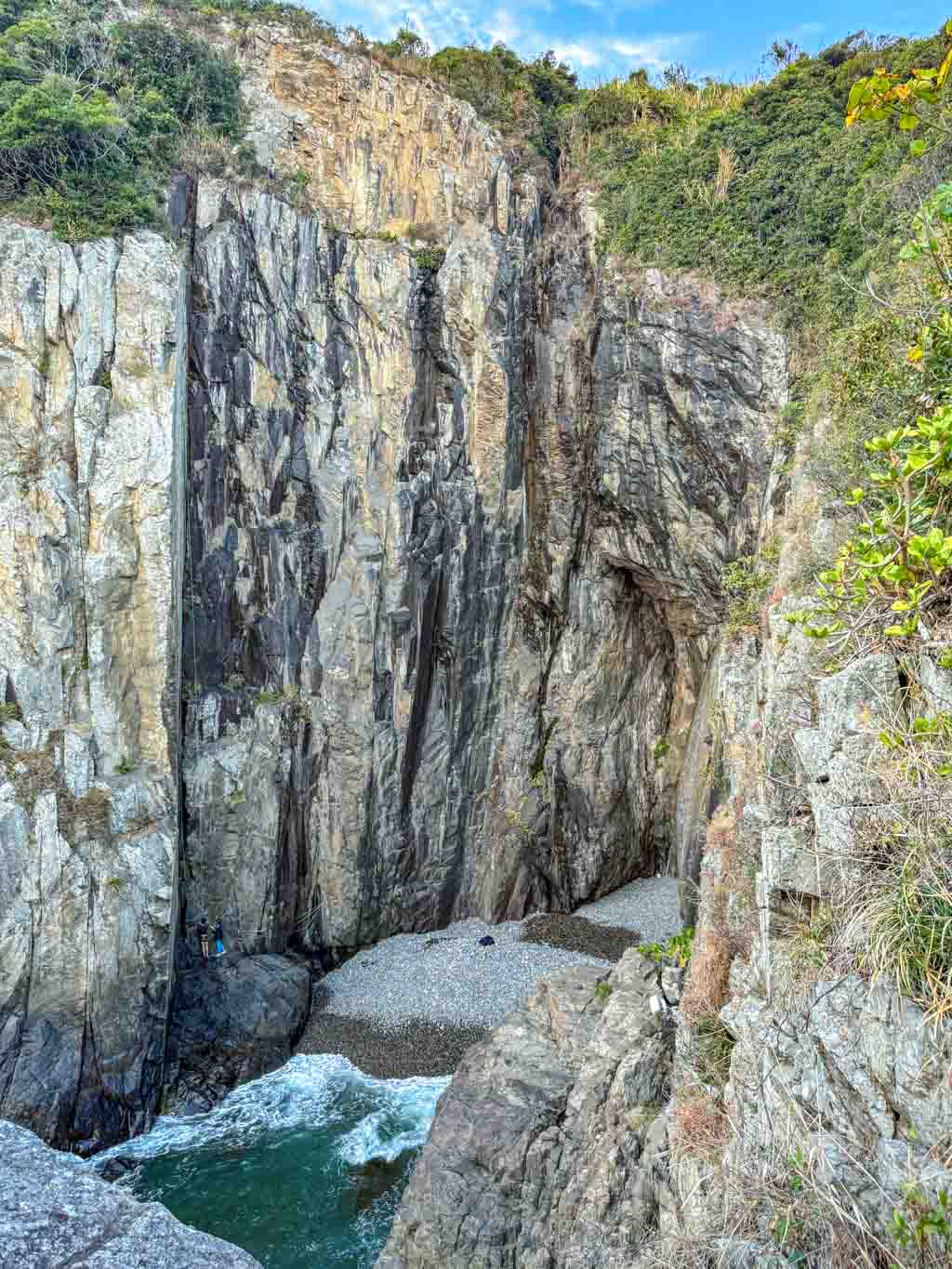
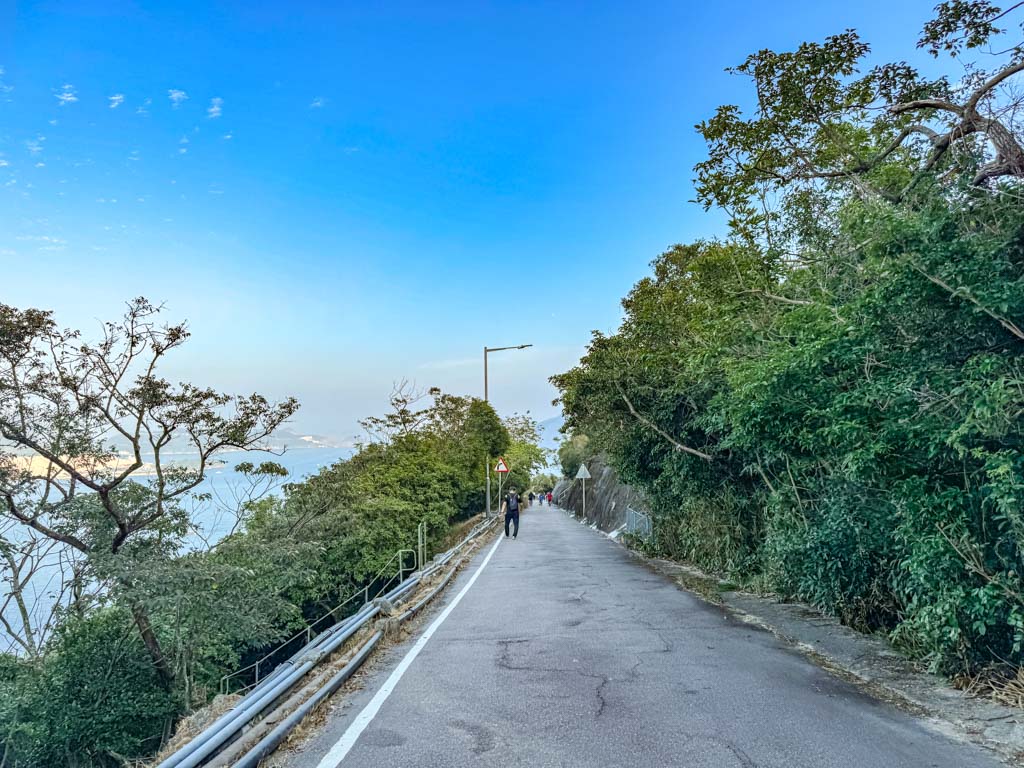
Cape D’Aguilar Hike

A popular alternative to the Dragon’s Back is Cape D’Aguilar. A family friendly trail that’s mostly flat, it’s arguably the second easiest. But getting in and out isn’t quite as easy, most of the hike consists of the road that leads in from the bus stop, with only a little dirt and rocky trail at the end.
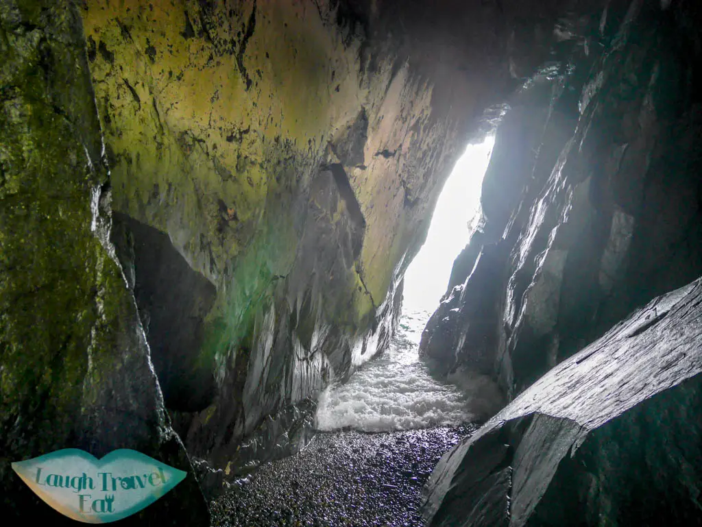
However, the Cape is known for its dramatic coastal landscape with the ‘thunder sound cave’ and arches a favourite. There are also several small local cafés along the route in one of the villages, making it a friendly beginner’s hike with good refreshment points.
Note: it can be a bit crowded as tourists from China also go there en massz
Difficulty: 1/5 – definitely on the top in terms of easy hikes in Hong Kong
Duration: about 2 hours roundtrip budgeting time for photos
How to get there: Take the number 9 bus from Shau Kei Wan and get off at Cape D’Aguilar (get out with the same bus – only 1 stop, make sure to note the end stop at the front of the bus)
Cape Collinson Battery hike
If you are looking for a coastal hike with some historical and cultural interest, Cape Collinson is a great option. Located on the eastern end of Hong Kong Island, Cape Collinson is named after a British surveyor who mapped Hong Kong in the 1840s.
The cape is most famous for its derelict battery on the coast with a stunning cove behind and ocean view in front.
If you want to walk there, then the nearest station is Chai Wan MTR where you can
You can continue down to the Cape Collinson Correctional Institution to see the white Cape Collinson Lighthouse. Built in 1875, it is the oldest surviving lighthouse in Hong Kong.
Difficulty: 2/5 because of how the trail start for the path down to the Battery is, and the steepness
Duration: 2 hours should be enough including exploring the lighthouse, the rock carving, and the climbing areas. You can go back to Cape Collinson Road or continue to Big Wave Bay via Pottinger Peak Country Trail.
How to get there: take the MTR to Chai Wan station and you can walk there or take a taxi. There is limited service from minibus 18M that goes down to the Correction Center, which would mean a significantly shorter hike to the Battery.
Note: I was able to get an Uber out eventually
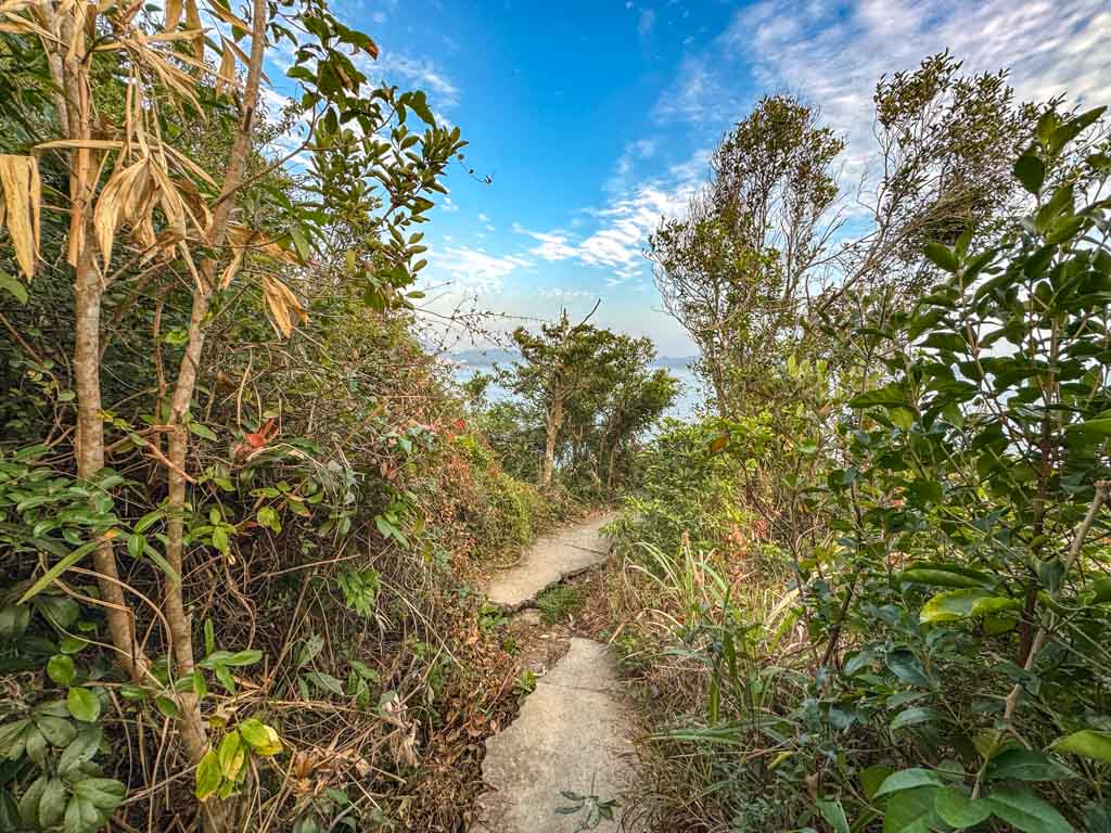
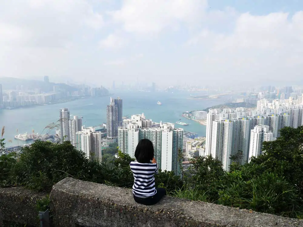
Rhino Rock Hike
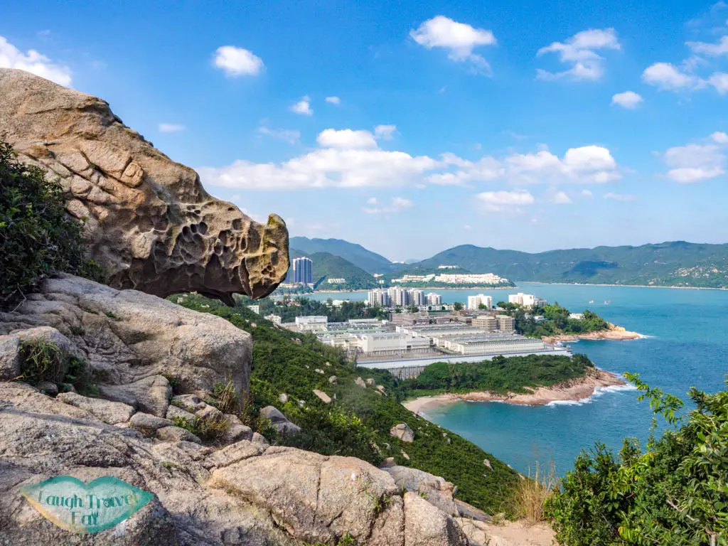
Nearby in Stanley, the Rhino Rock has attracted visitors with its unique and lifelike outcrop. It’s at the southern end of the peninsula facing east, although you will also get an eyeful of the Stanley Prison. The hike takes less than an hour round trip, making it one of the top short hikes in Hong Kong. Though you do need to wear good shoes and be sure-footed. If you’re planning to explore Stanley anyway, this makes for a good addition.
Difficulty: 2/5 mostly just for the sandy and slippery slope
Duration: you can get in and out within an hour but budget 2-3 for photo break
How to get there: Bus 14 to Stanley Fort. The bus starts at Sai Wan Ho MTR exit A, and it’s the best place to catch the bus. Stanley Fort is the end stop so you don’t have to worry about getting off.
Easy hikes in Kowloon
My personal favourites are the ones in Kowloon as it has the best panorama of Hong Kong easy hikes. They are all towards the northern edge and known as the Kowloon Ridge, but there are a few small hills that take less than an hour to reach.
Ping Shan

Ping Shan in Kowloon Bay is a hidden spot that is surrounded by housing estates. With a spectacular view of the surrounding area and the Kowloon mountain ridge, it lies in the shadow of Kowloon Peak itself.
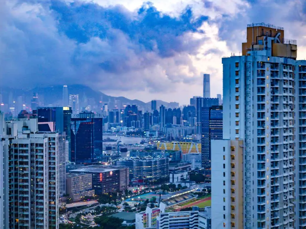
Not only do you see Lion Rock, but you can also see Hong Kong Island and even a glimpse of Victoria Harbour. While it is not as easy to reach as Garden Hill in Sham Shui Po, it is certainly a lot easier than most hiking trails in Hong Kong
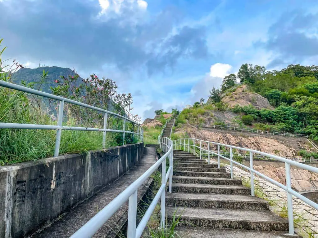
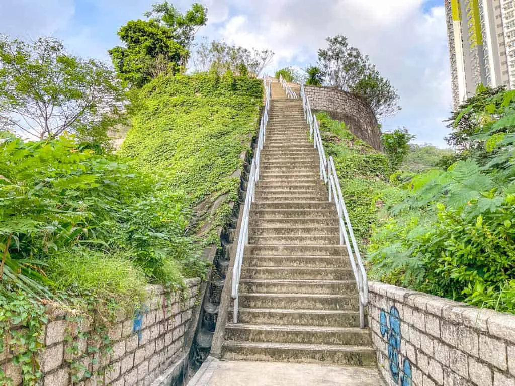
The way up to Ping Shan is on concrete stairs, and it takes around 10-20 minutes to go up, with a view of the Choi Fook Estate behind and Kowloon Peak in front. Do bring mosquito repellent, as this is a hot spot for mosquitos!
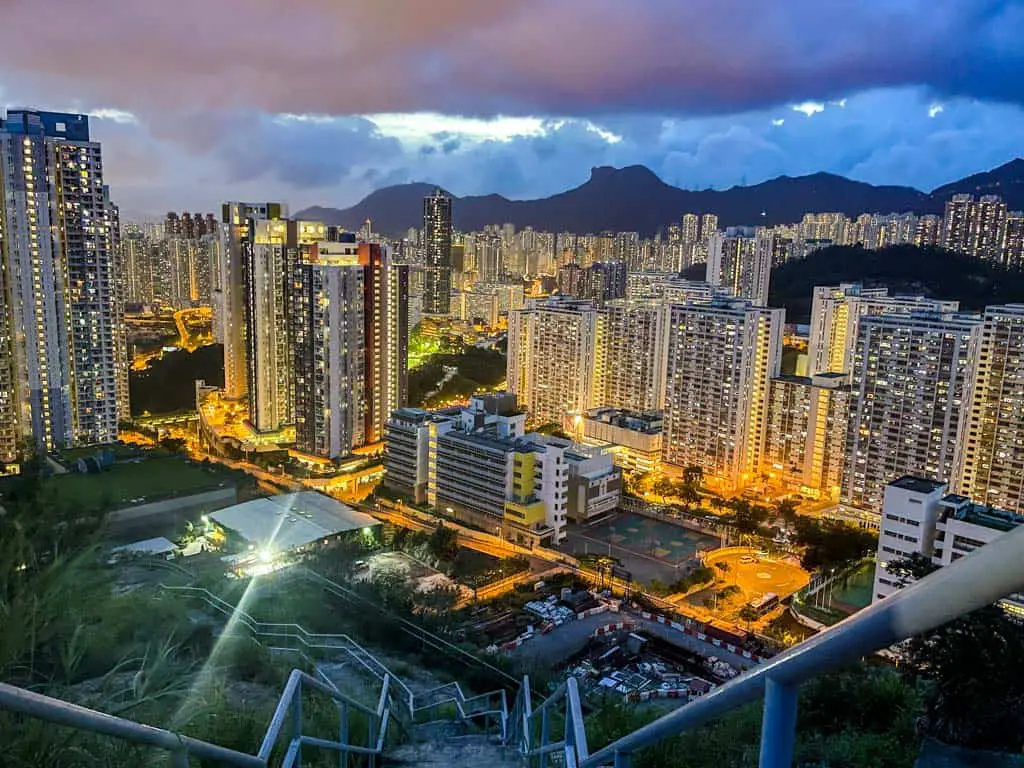
The best place to take photos is either the pink granite outcrop to the left as you go up or towards the end of the stairs where there’s a small turn. You should come here during sunset so you can get a great golden hour and blue light photo!
Difficulty: 1/5, it’s all paved but you will be attacked by mosquitoes.
Duration: 30 minutes – 1 hour, but if you’re going to go for sunset, budget to be there an hour beforehand to snag the best spot.
How to get there: There are two ways to go up Ping Shan, but since the scenic part is to the northwest, most people tend to take the staircase up from there.
You can actually walk up from Kowloon Bay or Choi Hung to the roundabout at the end of Choi Wing Lane. You can also take the 83A minibus and get off at Choi Ying House in Choi Fook Estate.
Note: if in doubt, search Choi Wan Road Salt Water Service Reservoir, which is right next to the roundabout.
Checkerboard Hill hike (and Kowloon Tsai Park)
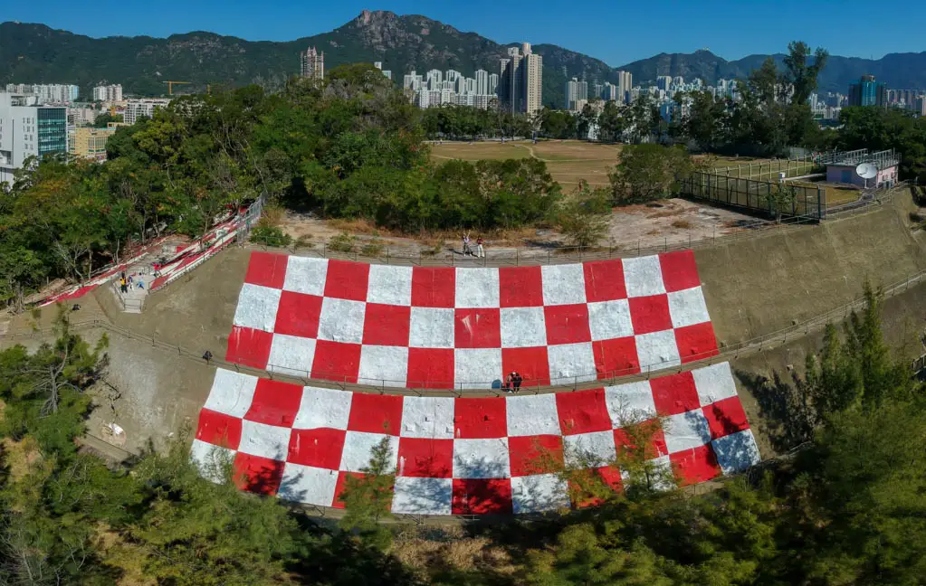
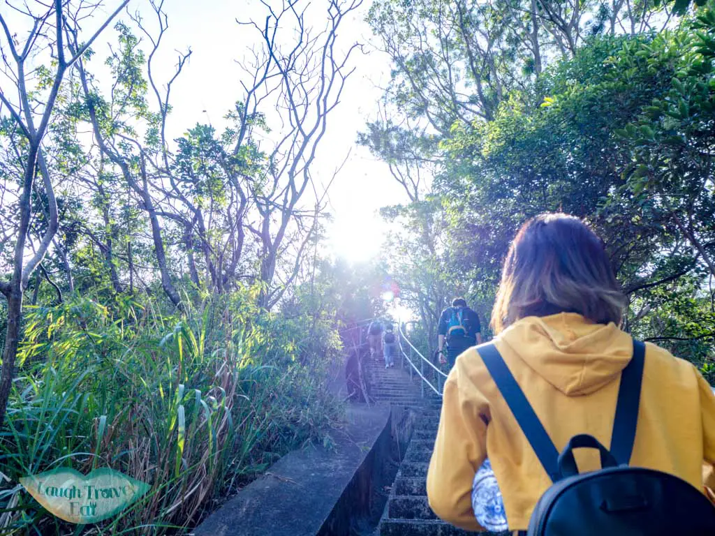
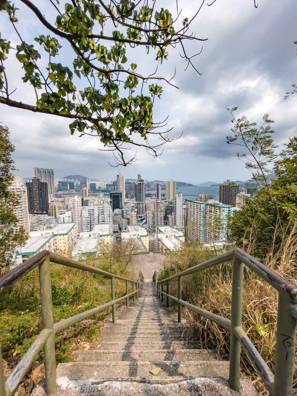
For an off-the-beaten-path unique hike that is short, Checkerboard Hill is the first to come to mind. This red-and-white checkered hillside was once used as a visual reference for pilots landing at the old Kai Tak Airport, and now it’s a quirky landmark that you can hike to.
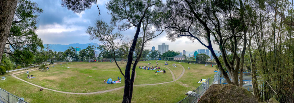
The trail starts from Lok Fu MTR station and takes you through Kowloon Tsai Park, a lovely green oasis with a pond, a playground, and a sports center.
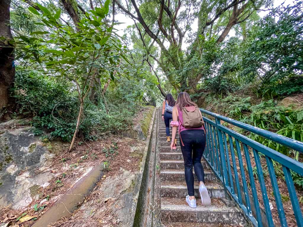
From the park, you can follow a path behind the hilltop pavilion and go around some fences to reach the base of Checkerboard Hill. The climb is steep but short, and you will be rewarded with a stunning view of the Kowloon Ridge and surrounding houses.
Difficulty: 1/5
Duration: 1 hour should suffice including exploring the park. You can go back to Lok Fu MTR station.
How to get there: take the MTR to Lok Fu station and exit at B – google map aobve
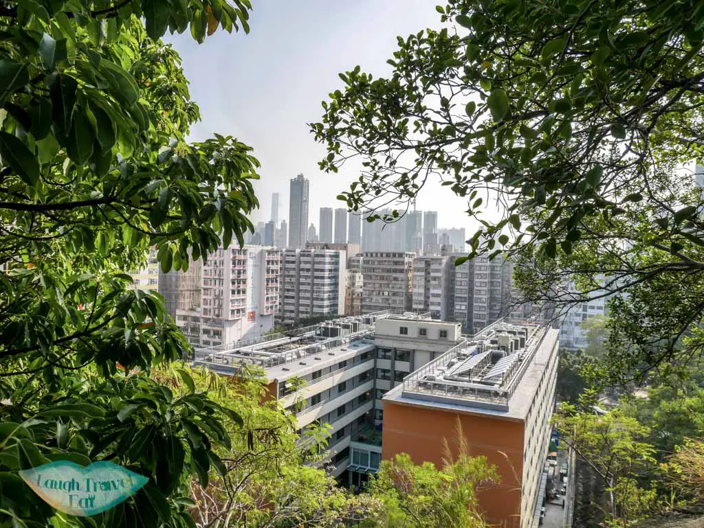
Red Signal Hill
Another unexpected viewpoint in the middle of the city, Red Signal Hill is a great choice if you want a relatively chill hike with friends. Located in Ho Man Tin, a residential area with a mix of old and new buildings. There is even a grass patch in the form of a less-used football pitch where you can picnic.
The trail starts from Ho Man Tin MTR station and takes you to the right and up the stairs. You will pass by Ho Man Tin Park on your way up.
From the park, you can follow a path to the right and up a slightly dodgy hill to reach the summit of Red Hill. The climb is steep but short, and you will be rewarded with a breathtaking view of the skyscrapers, the harbour, and even a small corner of the sea. You can also see the iconic Lion Rock and Beacon Hill in the distance.
Difficulty: 1.5/5 – the steep hill up is a bit scary
Duration: 1 hour should suffice including exploring the park. You can go back to Ho Man Tin MTR station or continue to Hung Hom MTR station.
How to get there: take the MTR to Ho Man Tin station and exit at A2
Garden Hill
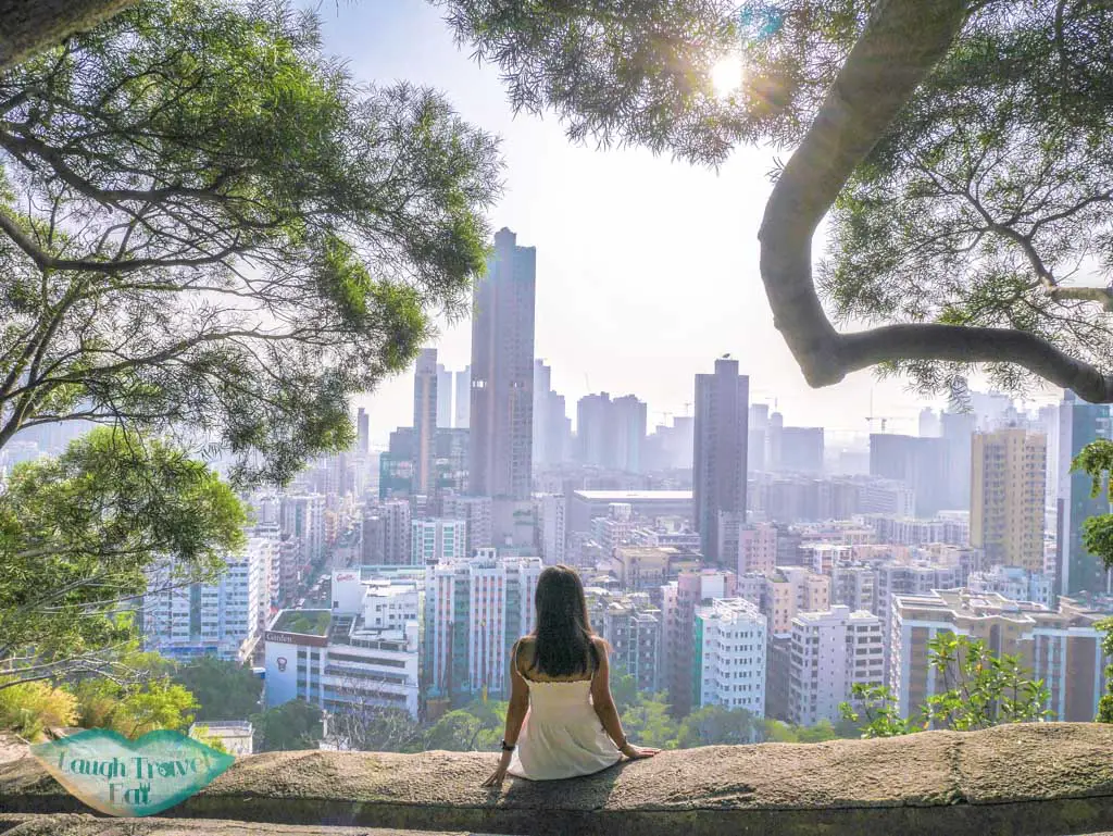
If you are looking for a quick and easy hike with a stunning view of the city, Garden Hill is a perfect choice. Located in Sham Shui Po, one of the oldest and most authentic districts in Hong Kong, Garden Hill is a 300-foot-tall (90.6-metre) hill that offers a panoramic view of the urban landscape, especially during sunset and evening hours.
It can be a great hike combined with seeing the district. The trail starts by Mei Ho House, a historic building that was once part of the first public housing estate in Hong Kong. You can visit the museum inside to learn more about the history and culture of the area.
From Mei Ho House, you can follow a path up to the summit of Garden Hill, which is a short but steep climb. You will be rewarded with a breathtaking view of the skyscrapers, the harbour, and even a small corner of the sea. You can also see the iconic neon signs and the bustling streets of Sham Shui Po below.
Difficulty: 1/5 because of the short distance
Duration: 20 minutes should suffice including exploring Mei Ho House. You can go back to Sham Shui Po MTR station or continue to Shek Kip Mei MTR station.
How to get there: take the MTR to Sham Shui Po station and exit at B2. Walk along Apliu Street and turn right at Pei Ho Street. You will see the Garden Bread factory and Mei Ho House on your left. The trailhead right behind Mei Ho House.
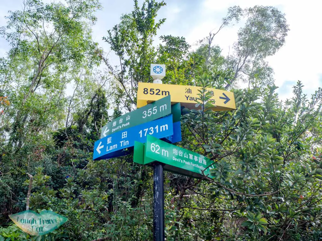
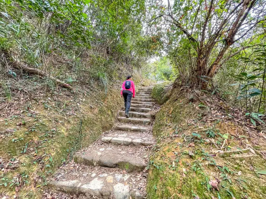
Devil’s Peak
Perhaps the least flat route on the list, Devil’s Peak makes for a short but interesting hike with a WWII fortress, great view of Tsuen Kwan O and east Hong Kong Island. What makes it an easy hike in Hong Kong is its well-paved paths and many exit points, and you can easily continue as well onto the Wilson Trail stage 3 and up Black Hill.
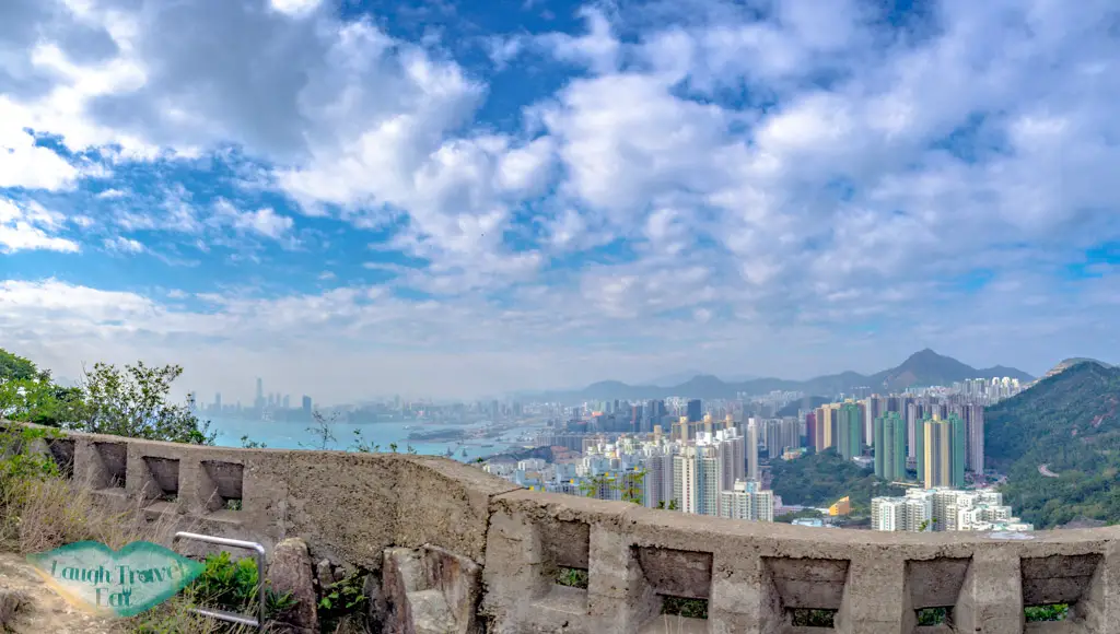
The hike takes you to the old battery that was used during WWII against the Japanese. It is very well sign-posted so you don’t have to worry about getting lost.
Difficulty: 2.5/5 for steep stairs
Duration: 1-2 hours depending on how long you continue down the route
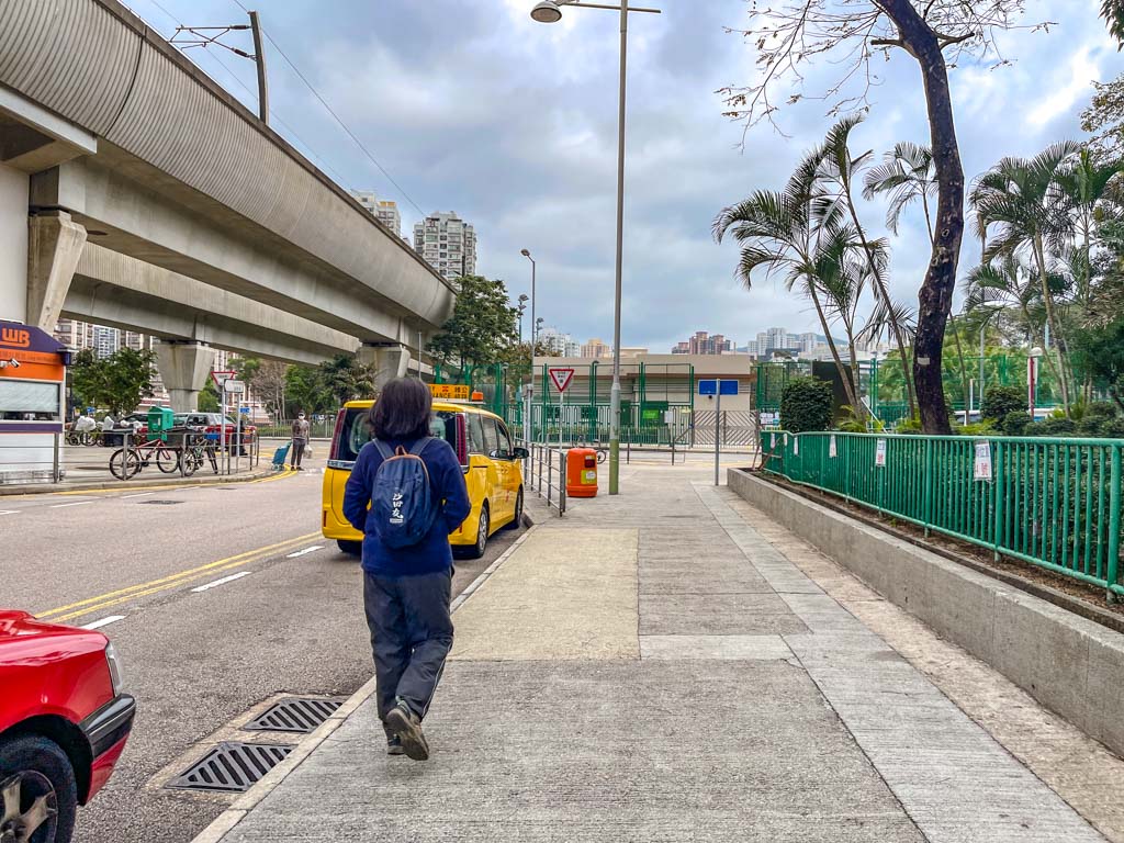
How to get there: the nearest MTR is Yau Tong. Take A2 exit and head towards the Junk Bay Chinese Permanent Cemetery. The Wilson Trail Stage 3 trail start is near the exit.
Easy hikes in New Territories
If you want to get a taste of nature, then New Territories are the best choice. There are many beautiful coastal and mountain trails, and I have a soft spot for those in Sai Kung in particular.
Tsz Sha Ancient Trail
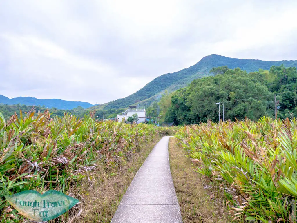
Tsz Sha Ancient Trail is a chill and historical hike. This trail was once a shortcut between Shatin and Kowloon, dating back to over 800 years ago. It’s a mostly flat hike on a paved trail that is perfect for a good day or a warm-up before Lion Rock.
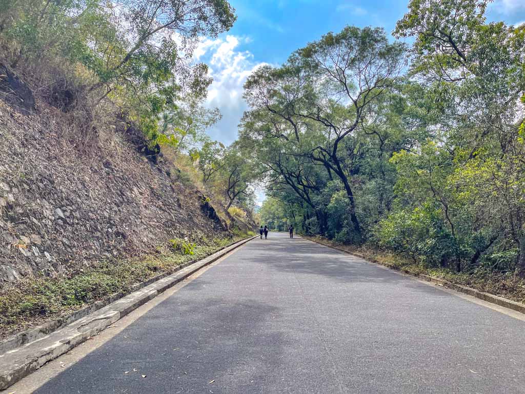
The trail start is a short walk from Shatin Wai MTR at the foot of the Shui Chuen O Estate. It’s mostly countryside scenery along the river, suitable for family and beginners. It intersects with Wilson Trail Stage 5 at the end near Lion Pavilion.
Difficulty: 1/5 because it is mostly flat and paved
Duration: 1 hour or so, depending on your pace and stops
How to get there: Shatin Wai MTR, ends at Lion Pavilion which is a 15-20 walk down to Wong Tai Sin Station
Ten Thousand Buddha Monastery
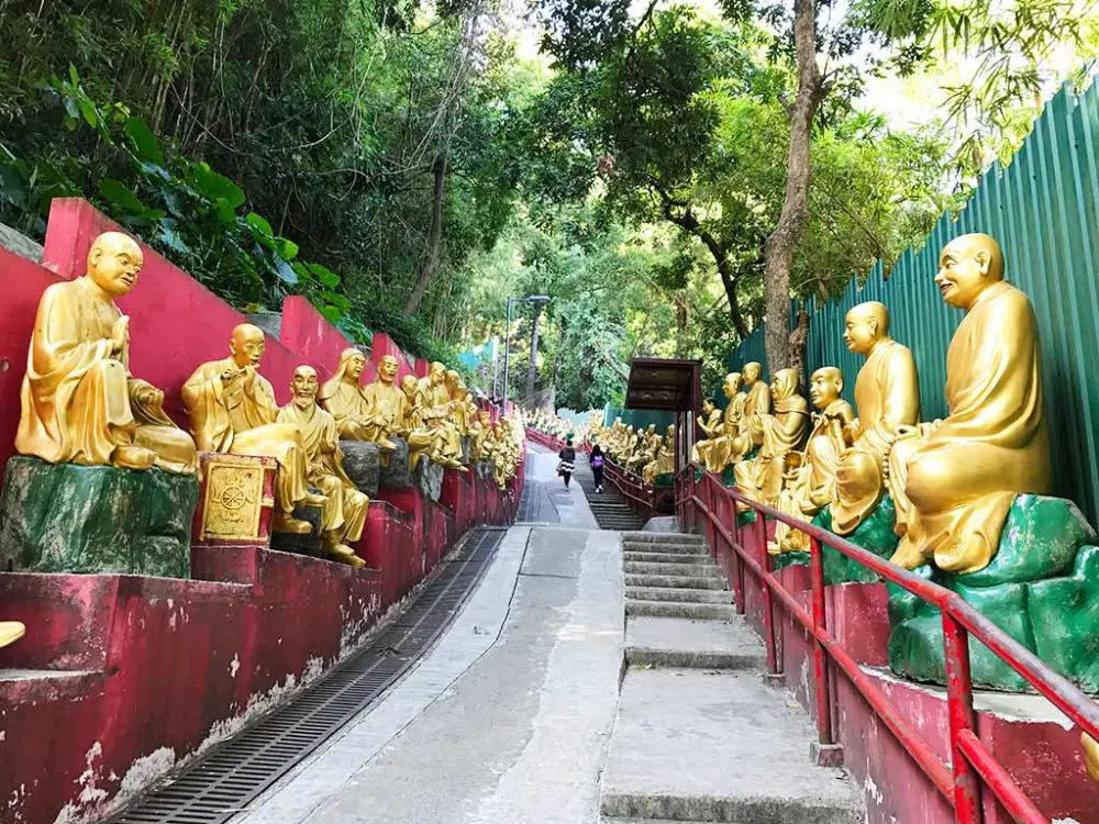
If you are looking for a cultural hike with some stunning views and a unique temple, Ten Thousand Buddhas Monastery is a great option. Located in Sha Tin, the Ten Thousand Buddhas Monastery is a Buddhist temple that was founded in the 1950s by a revered monk named Yuet Kai. The temple is named after the many Buddha statues that adorn the walls, halls, and gardens of the complex.
To get to the trail start, head over from Sha Tin MTR station and head towards Home Square, then turn to Shatin Government Complex. At the very end, you can find the trail going up to the monastery.
The climb is steep but short, and you will be accompanied by many of golden Buddha statues along the way. Each statue has a different pose and expression, making the hike more interesting and fun.
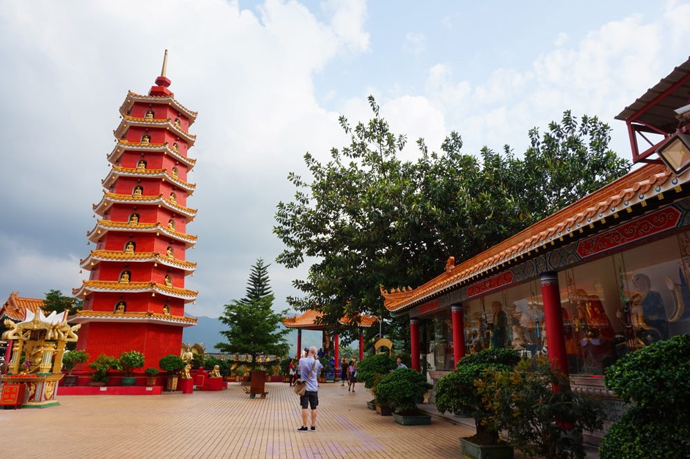
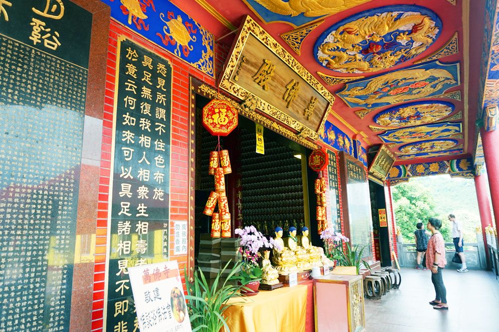
At the top, you will reach the main temple, where you can admire the architecture. You can also visit the nine-storey pagoda, the hall of Kwun Yam, and the pavilion of Avalokitesvara. The temple is a popular place of worship and a beautiful attraction, but there are no monks living there anymore.
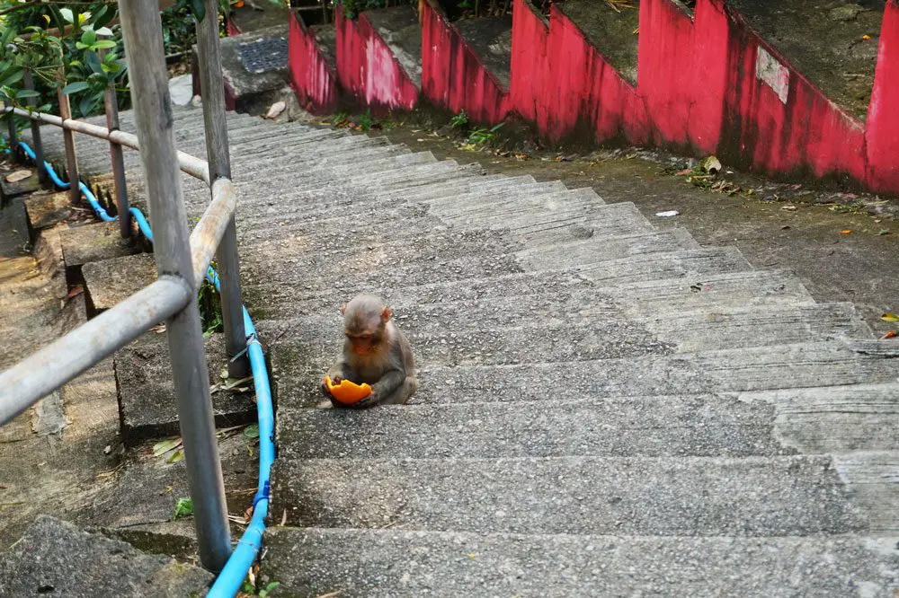
Tips: You might also see some wild monkeys in the area, so be careful with your belongings and do not feed them. Remember to bring your mosquito repellent and water as well. It has two levels so make sure you don’t miss the upper floor.
Difficulty: 1/5
Duration: 1 hour should suffice including exploring the temple. You can go back to Sha Tin MTR station or continue to Tai Wai MTR station.
How to get there: take the MTR to Sha Tin station and exit at B.
Tai Tan Country Trail
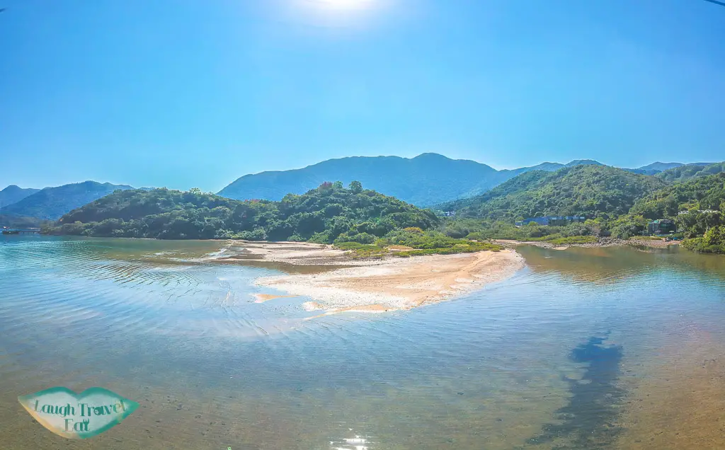
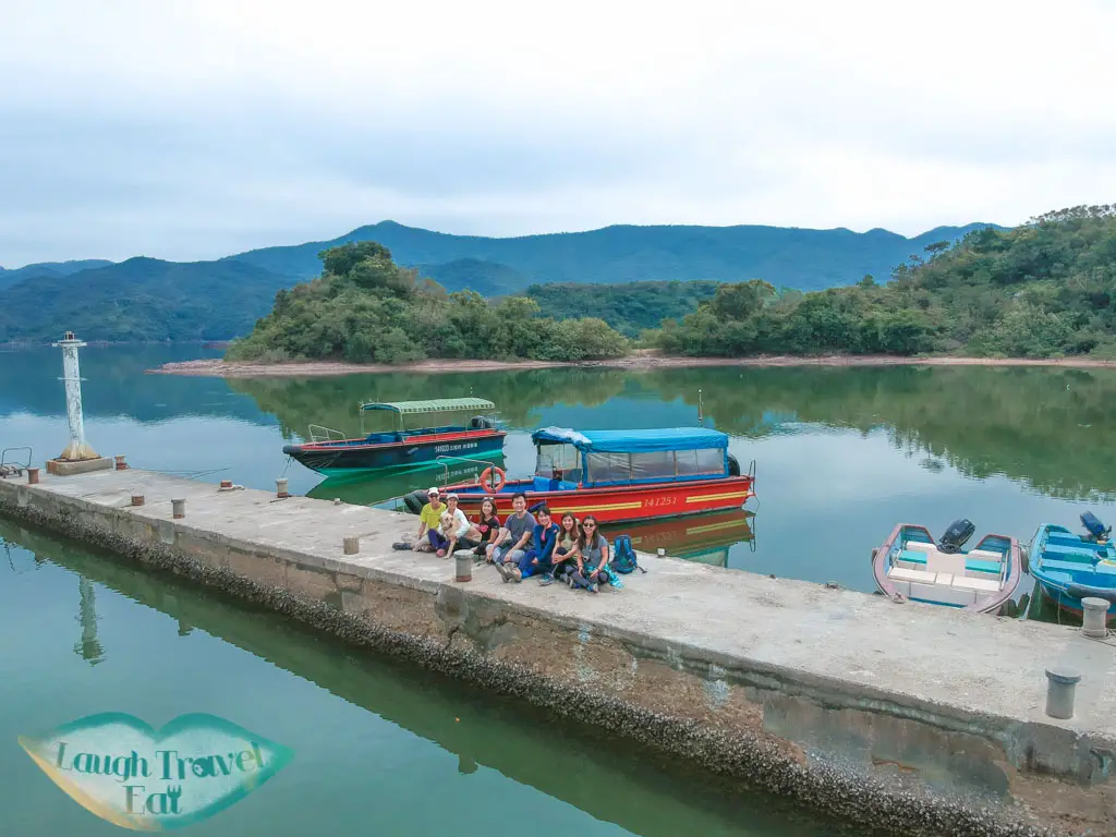
A new favourite of mine, Tai Tan Country trail features mostly flat trail that isn’t concrete and is a straightforward coastal hike with only a small hill. Starting from Tai Tan Village near Wong Shek Pier in Sai Kung, it takes you along the coastal route to Hoi Ha, passing by the Wan Chai campsite and many wonderful beaches. The hike takes around 3 hours to complete, and if you are feeling adventurous, there are snorkeling and kayaking rentals available at Hoi Ha, which also happens to be a protected marine area.
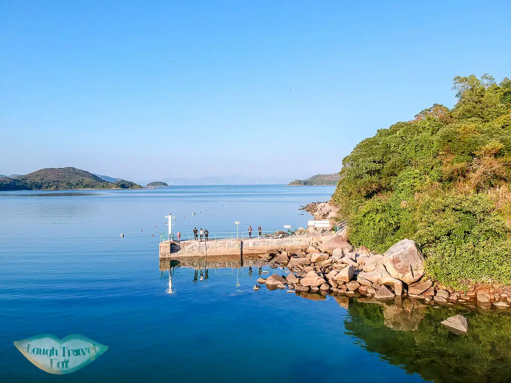
With easy transport in and out of the start and end points, it’s a great hike to do for a half day, though you might want to budget some time for photo taking etc.
Difficulty: 2/5 due to the path being a bit rocky
Duration: 3 hours hike, another hour to get in and out from Sai Kung town center
How to get there: get bus 94 (and 96R on weekends) from Sai Kung town center and get off at Tai Tan stop. From Hoi Ha, take the minibus 7 at the front of the village back to Sai Kung town center.
Note: you can check the bus schedule with the KMB app, the minibus has a tentative schedule of 30 minutes per ride
Wu Gau Tong
One of the best routes to take your pets (or unfit human friends) on, Wu Gau Tong is perhaps the best nature trail for someone who wants to feel the wilderness of Hong Kong without committing into too big or too crowded a hike. Completely away from the city, you will be walking through green vegetation, ending in Sam A village for some refreshment.
This is, however, a circular route, with the option to really up the difficulty by going up Tiu Tan Lung.
Difficulty: 1.5/5 – mostly for getting in and out
Duration: 3 hours for the hike, though budget more time for eating, photo break, and getting in and out
How to get there: take the minibus 20R from Tai Po. Alternatively, there is a car park there where you can park your car for free.
See the full hike in the Wu Gau Tong and Tiu Tan Lung hike post.
Lai Chi Chong
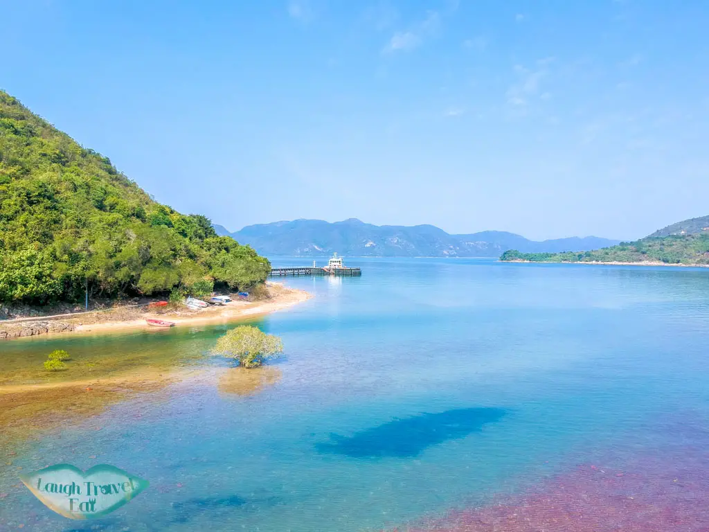
A favourite for family, Lai Chi Chong is a geopark that makes for another easy round-trip hike with a good educational twist. Being a geopark, the coastal area of Lai Chi Chong is home to unique geology and you can find the information on the education board!
Again, you can add to this trip by carrying on to Sham Chung and Yung Shue O, or even just get out by ferry to Ma Liu Shui.
Difficulty: 1/5 – just for the stretch to Lai Chi Chong
Duration: 2 hours >
How to get in: take the Minibus 7 from Sai Kung town center (don’t forget to buy something to eat) to Hoi Ha, get off at Yung Shue O village after the youth hostel. You can also get in (or out) by ferry from Ma Liu Shui Pier.
See the full hike along with two other places at Lai Chi Chong + Sham Chung + Yung Shue O hike
Tsing Tam and Ho Pui Reservoir
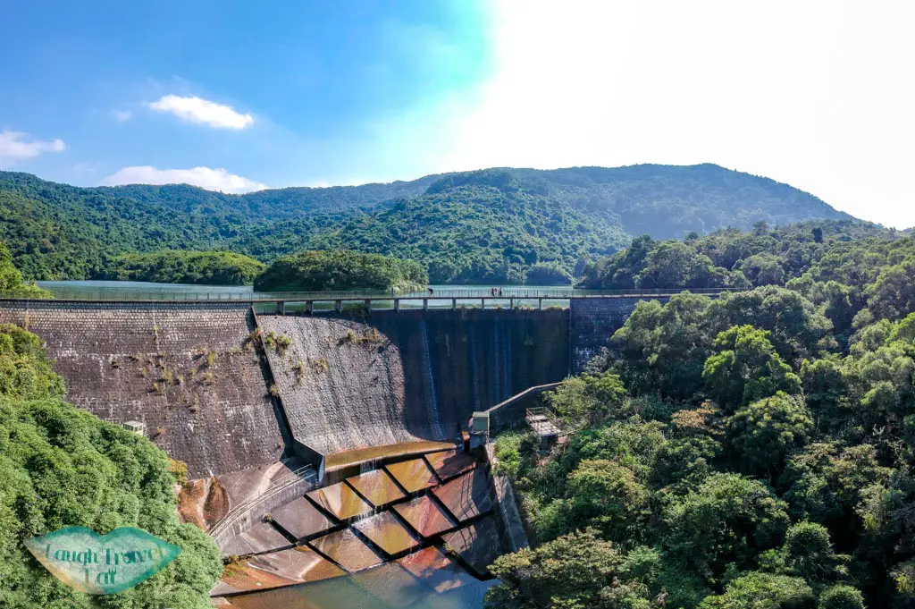
A great trail for the family, the reservoirs are along a concrete trail that stretches between Tai Po and Yuen Long. Not only is it stroller friendly, the 3 hour trail also takes you past some refreshment points and an Eco Garden.

If you don’t want to hike for so long, starts at Yuen Long and turn back once you have reached the Upper Tsing Tam Reservoir, as they are all closer to the Yuen Long side.
Difficulty: 1.5/5 – just because it takes some time to get in and out
Duration: 3 hours, but budget more time to get in and out
How to get there: Take the bus 64K from Tai Po to Sheung Tsuen playground. You can also take bus 51 to Shek Kong from Tsuen Wan.
Easy hikes in Hong Kong – what to look out for
If you are a hiking beginner, I’m excited for you to embark on one of these easy hiking trails in Hong Kong! But here are some essential information for hiking in Hong Kong:
- Make sure you have enough water – in general, brings 800 ml in the summer for short hikes. If it’s 3 hours, bring 1 L.
- Octopus card – make sure you have at least 50 HKD as transportation fees can go as high as 20 HKD per journey depending on where you go.
- Transport apps/option: you can use the KMB app for Kowloon and New Territories buses. You can also use google map to get an estimate for the arrival.
- Best time to hike: while you can hike anytime in Hong Kong, the best time to do so is between October to March before the weather gets too hot. It is also possible until May or June, but one should avoid hiking between July to October as it is the typhoon season.
- Hiking boots – for hikes with slippery trail, wearing proper hiking boots with proper grip otherwise it’d be more difficult.
- Hiking bag: a backpack is ideal, something that wouldn’t swing around too much!
- Hiking gear: the only thing I’d say is to avoid jeans!