Tai Tun Shan is one of the many mountains and hills that dotted the Sai Kung countryside. It is not to be confused with Tai Tung Shan, also known as Sunset Peak, on Lantau Island. Despite not being a particularly long hike, it is ranked 4/5 stars of difficulties by a local hiking website. It is relatively easy to reach, with the starting and end point possible at Pak Tam Chung, lasting on average of 2.5 – 3 hours. However, it is very steep in places so make sure you wear shoes with good grip.
toc
Let’s see how to get here!
Getting to Pak Tam Chung
Drive to Pak Tam Chung
Pak Tam Chung is a country park perched at the edge of the restricted area of Sai Kung Geopark. The good news is that you can drive there, the bad news is that you will probably be hard-pressed to find a parking spot if you get there late.
Bus to Pak Tam Chung
There are two buses that stop there:
The 94 operates from Sai Kung to Wong Shek Pier, the whole ride costs HKD6.8. It’s best to take this one in Sai Kung Town Center and you can also find a bite or have brunch/lunch beforehand.
The 96R operates from Diamond Hill in Kowloon to Wong Shek Pier but only operates during Sunday and public holidays and the entire journey costs HKD16.8 (13.6 if you get on in Sai Kung).
Minibus to Pak Tam Chung
Alternatively, there are also two mini-buses that also stops there. The number 7 from Sai Kung to Hoi Ha stops there and the journey costs HKD12.1. Number 9 operates between Sai Kung and the Lady MacLehose Holiday Village and costs HKD6.8.
Personally, I usually get the number 94 bus from Sai Kung. Of course, there is always the option of taxing in!
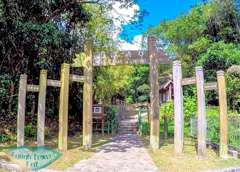
Tai Tun Shan hike starting + ending point
The shortest hiking route to Tai Tun Shan starts and ends at Pak Tam Chung, though not on the same route hence it can be considered a loop. Although if you choose starting point #1 mention below, you can extend it as you wish. If you are intending to do the loop, then it doesn’t matter which way you start.
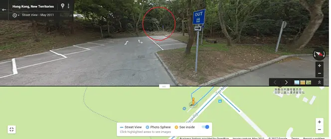
The path is just behind those bushes, go in and look for the steps and ribbon!
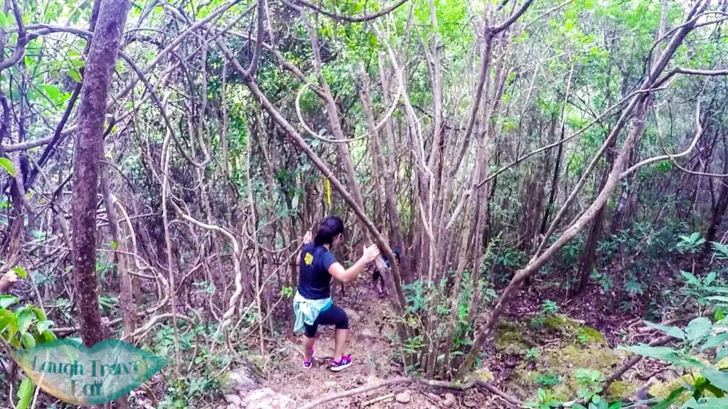
The secret passage that starts at the far end of the carpark of Pak Tam Chung is the fastest option but it is hidden among the foliage. The perk to hiking up from here is that it’s less easy to get lost on the path back to Pak Tam Chung Country Park, however, the hike up is continuous and long.
We went down it on the first time we hiked – sorry for the blurry shot from my gopro (And HI KELLY IF YOU ARE READING THIS)
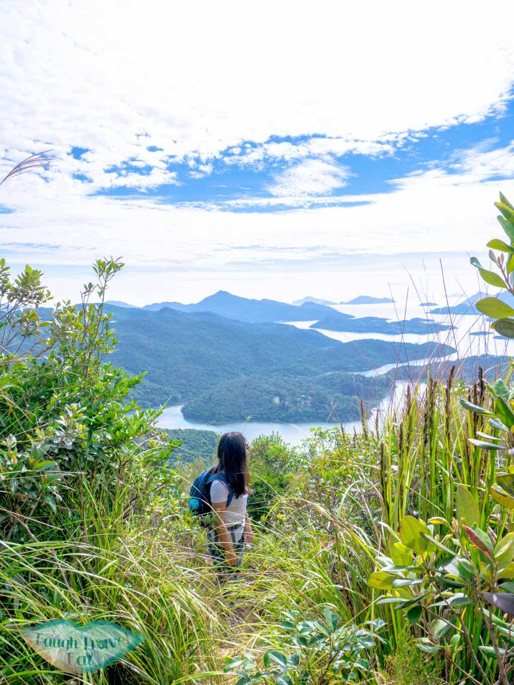
The view is beautiful so remember to look back!
But it also brings you up to the viewpoint faster.
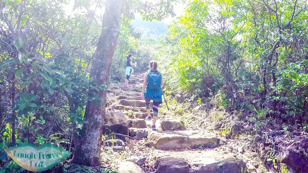
Going up from the Country Park path
The country path starts at the BBQ area
Otherwise, you can go via the main route that starts at the Pak Tam Chung Country Park – which passes through the BBQ area. The path goes up gentler but it’s easier to lose your way and the hike down is long and continuous from the peak.
I prefer the other direction as you also have the option to go up Lui Ta Shek as well if you’re not tired and have time.
Note: on google map they make it out like you can cross over to the first path from the country path BUT we have tried to find it the first time and couldn’t – I recommend you to stick to the loop!
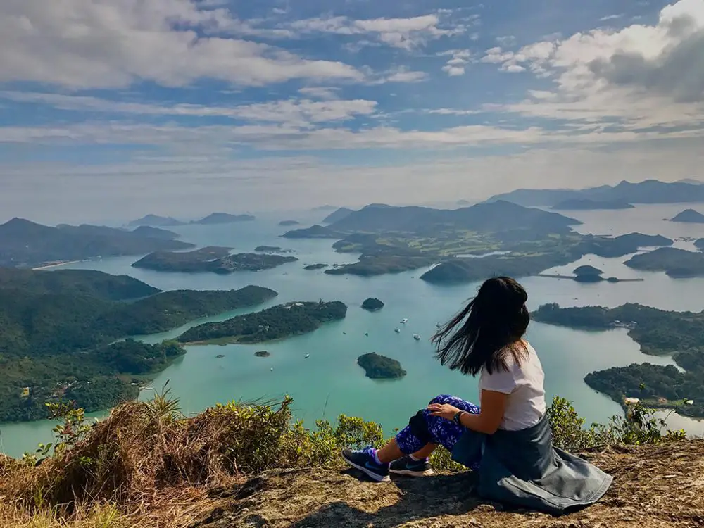
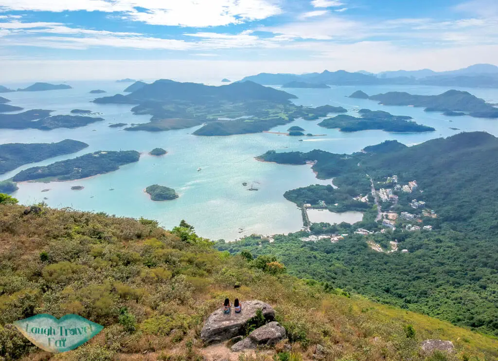
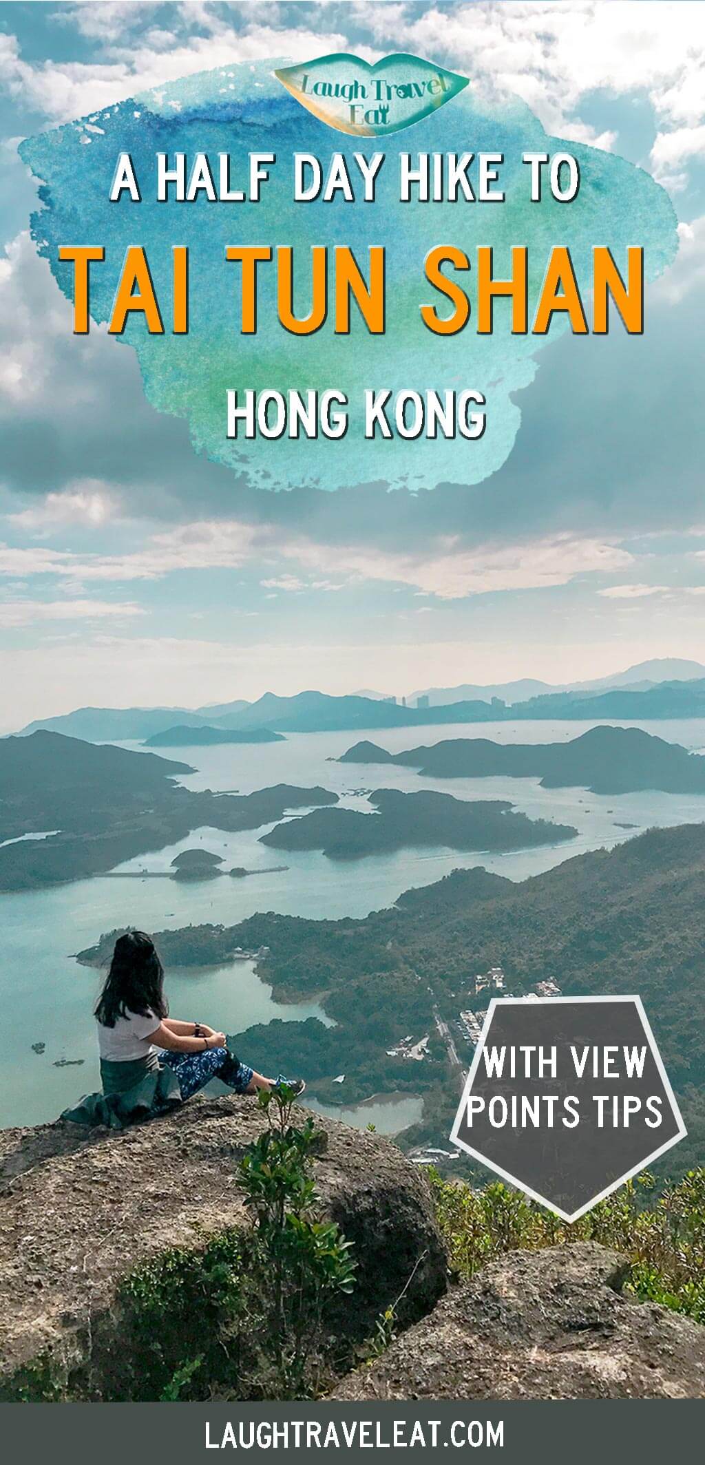
Tai Tun Shan Photospot:
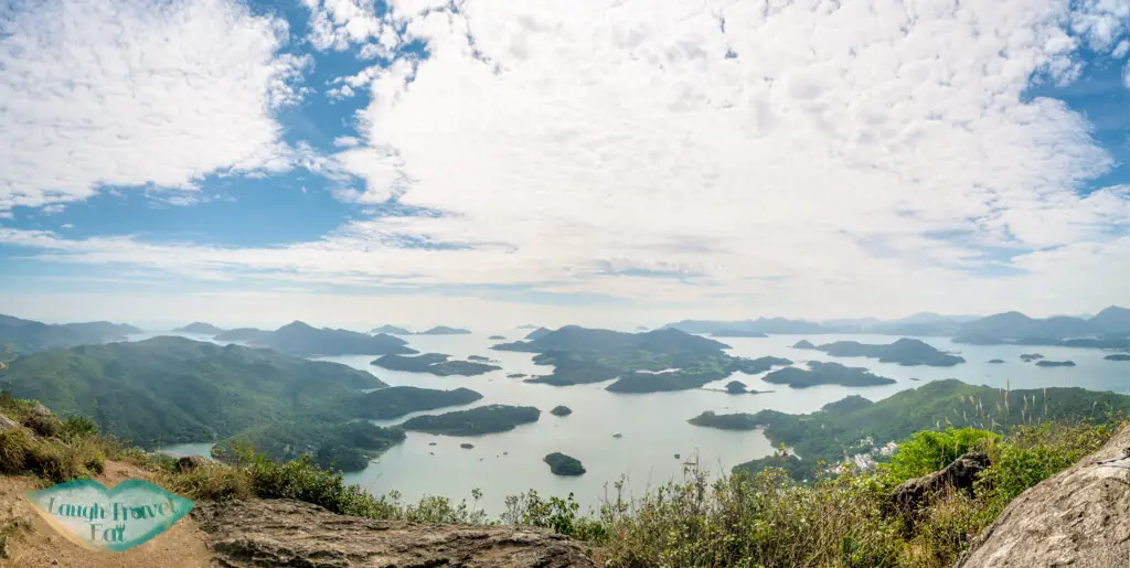
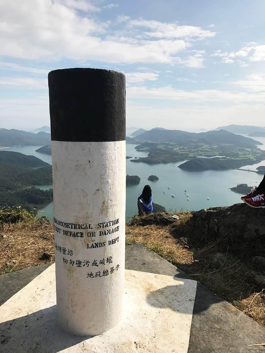
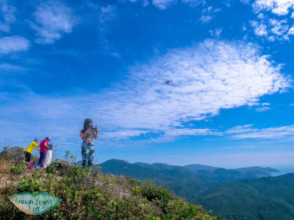
There are two main places for photos on Tai Tun Shan. The first is the area around the pillar that marks the Tai Tun Shan Peak.
The pillar that marks the highest point of Tai Tun Shan
Me flying the drone out! you can see a couple behind taking photos
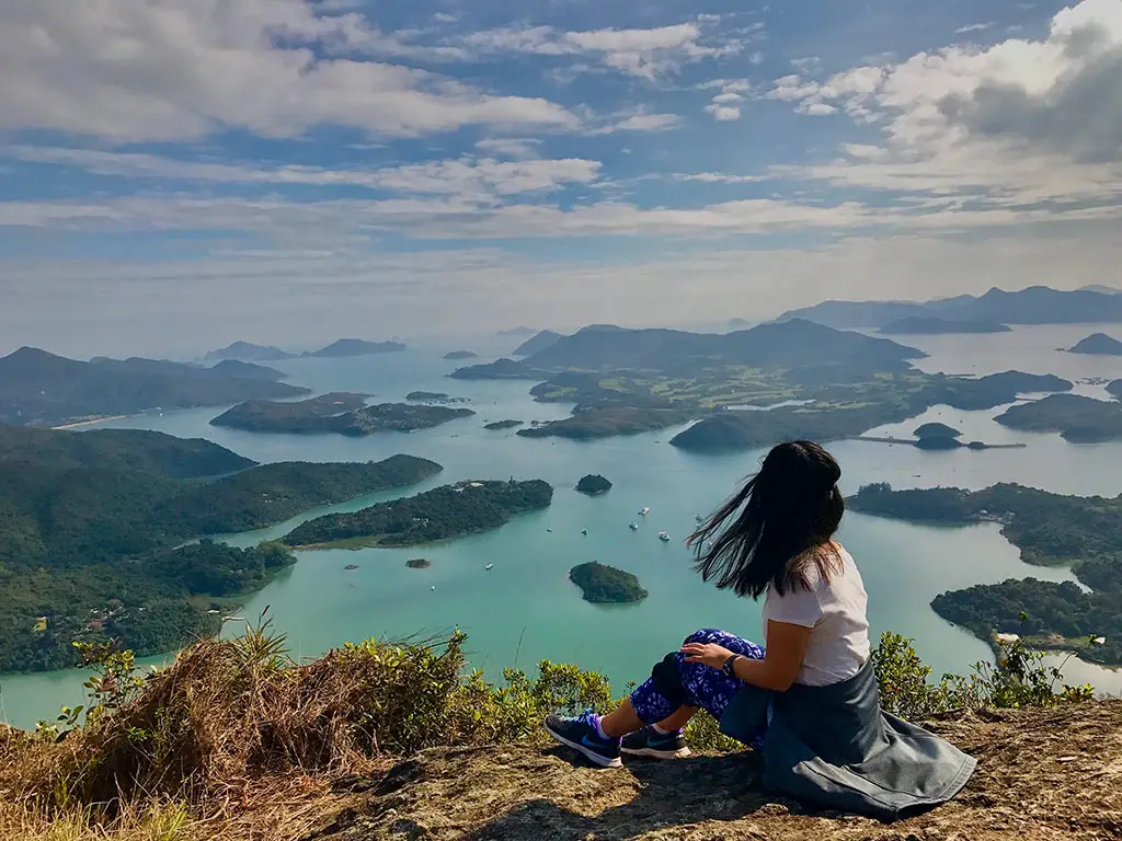
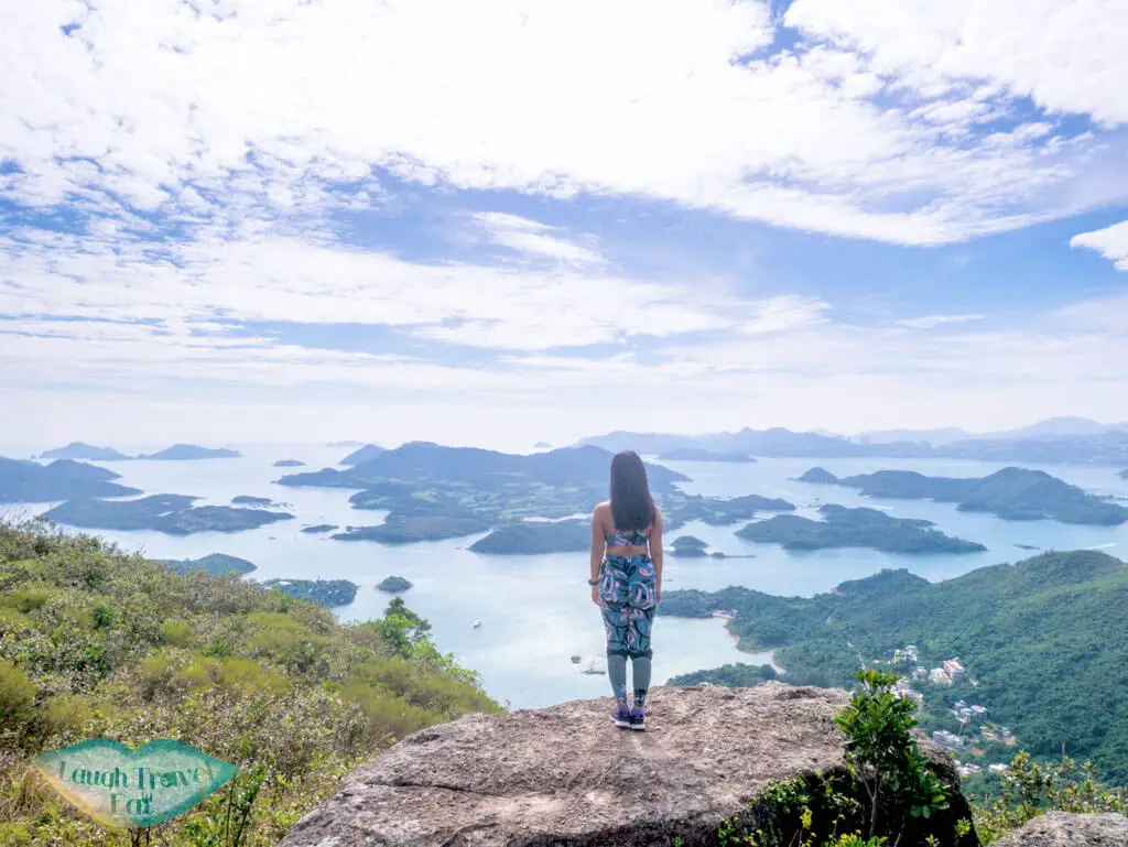
The other one is a rock that juts out to the left of the aforementioned area (facing the sea).
The view is glorious here too!
The obligatory drone shot from me!
Tai Tun Shan Hike Vlog
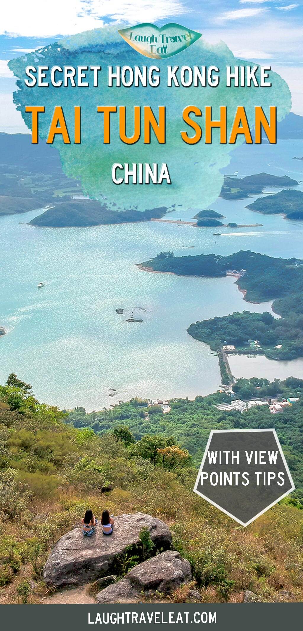
Pin me!
Pin me!
Nam Cheah
Hi, my name is Nam. I am 24 and spent half my life in Hong Kong and the other half in UK. I believe there's endless experience and beauty in the world and this is me chronicling how to experience the best at the best price.
One thought on “Tai Tun Shan – the thousand islands view of Sai Kung”
Ricky says:
Hi Nam,
Thank you for the awesome blog!
Question on this hiking route: for #1 and #2 how would you rate the difficulty, respectively? is it too difficult for generally-healthy middle-aged people that don’t exercise (aka my parents)?
Where can I find more detailed info on the Country Park path mentioned above? Like how do we get to the peak from there? and also what’s the exit route? Are we supposed to come back down the same way after we have reached the peak?
Many thanks,
Ricky